
 United Kingdom
 France
 Germany
 Netherlands
 Sweden
 USA
USA
 Italy
Italy
 Spain
Spain
More From Contributor
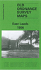


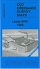


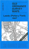
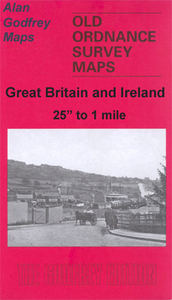
Leeds North West 1908
Leeds North West in 1908 in a fascinating series of reproductions of old Ordnance Survey plans in the Alan Godfrey Editions, ideal for anyone interested in the history of their neighbourhood or family. Selected towns in Great Britain and Ireland are covered by maps showing the extent of urban development in the last decades of the 19th and early 20th century.In this title: two versions have been published for this area. The maps covers the west and north-west of Leeds, encompassing a portion of the city centre, industry along the River Aire, the area now covered by the University, and residential areas of Burley and Woodhouse. Coverage stretches from Salisbury Road and Burley Grange eastward to Park Square and Vernon Road, and from Wellington Street and York Place northward to
Brudenell Street and Royal Park Road. Kirkstall Road, Burley Road and Belle Vue Road run through the map. Features include the River Aire with many industries nearby, Armley Mills, Leeds & Liverpool Canal, Albion ammunition works, Wellington Foundry, Leeds Forge, Scotch Foundry, Oak Tannery, Joppa tannery, stretches of the Midland and Leeds Northern railway approaches, portion of Armley (bottom left corner), Burley Lawn, Little Woodhouse, General Infirmary, Catholic College, Yorkshire College (later Leeds University), Trinity church, St George's church, General Cemetery. On the reverse are extracts from street directories. The 1889 version is in full colour.About the Alan Godfrey Editions of the 25
Brudenell Street and Royal Park Road. Kirkstall Road, Burley Road and Belle Vue Road run through the map. Features include the River Aire with many industries nearby, Armley Mills, Leeds & Liverpool Canal, Albion ammunition works, Wellington Foundry, Leeds Forge, Scotch Foundry, Oak Tannery, Joppa tannery, stretches of the Midland and Leeds Northern railway approaches, portion of Armley (bottom left corner), Burley Lawn, Little Woodhouse, General Infirmary, Catholic College, Yorkshire College (later Leeds University), Trinity church, St George's church, General Cemetery. On the reverse are extracts from street directories. The 1889 version is in full colour.About the Alan Godfrey Editions of the 25
Product Description
Reviews/Comments
Add New
Intelligent Comparison
Archived Product
Leicester North West 1902 Stanfords
£3.50
Archived Product
St Helens North West 1906 Stanfords
£2.95
Archived Product

St Helens North West 1906 Stanfords
£3.50
Archived Product

Bury North West 1908 Stanfords
£3.50
Archived Product
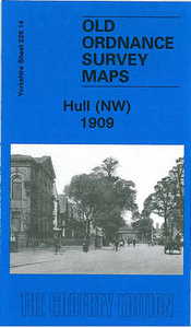
Hull North West 1909 Stanfords
£3.50
Archived Product
Burnley North West 1909 Stanfords
£2.95
Archived Product
Walsall North West 1902 Stanfords
£2.95
Archived Product
Burnley North West 1909 Stanfords
£3.50
Vouchers
No voucher codes found.
Do you know a voucher code for this product or supplier? Add it to Insights for others to use.
Do you know a voucher code for this product or supplier? Add it to Insights for others to use.
 Denmark