More From Contributor

£3.50
St Helens Blackbrook & Parr in 1906 in a fascinating series of reproductions of old Ordnance Survey plans in the Alan Godfrey Editions, ideal for anyone interested in the history of their neighbourhood or family. The map covers an area to the east of St Helens & west of Haydock. Coverage stretches from St Peter`s church, Broad Oak, eastward to Heyes Green & northward to Blackbrook. The network of railways & canals is especially interesting. Features include Baxter Works, Navigation Chemical Works, Ashton`s Green Farm, LNWR Havannah Branch, Parr Colliery South Pits & Havannah Pits, Haydock Wood, Parr Mineral Branch, Sankey Brook, Black Brook, St Helens Canal & Blackbrook Branch, LNWR Blackbrook Branch, LNWR Haydock Branch, GCR St Helens Branch, Old Fold Railway, Blackbrook village with tramway, Stanley House, Blackbrook House Industrial School, Broad Oak with tramway, etc. On the reverse are extracts from a 1918 directory listing St Helens churches & schools. About the Alan Godfrey Editions of the 25” OS Series: Selected towns in Great Britain & Ireland are covered by maps showing the extent of urban development in the last decades of the 19th & early 20th century. The plans have been taken from the Ordnance Survey mapping & reprinted at about 15 inches to one mile (1:4, 340). On the reverse most maps have historical notes & many also include extracts from contemporary directories. Most maps cover about one mile (1.6kms) north/south, one & a half miles (2.4kms) across; adjoining sheets can be combined to provide wider coverage.FOR MORE INFORMATION & A COMPLETE LIST OF ALL AVAILABLE TITLES PLEASE CLICK ON THE SERIES LINK. ...
Archived Product
£3.50
St Helens North East in 1892 in a fascinating series of reproductions of old Ordnance Survey plans in the Alan Godfrey Editions, ideal for anyone interested in the history of their neighbourhood or family. Two versions have been published for this area. Each covers the north-eastern part of the town in detail & extends eastward to Parr Hall Farm, northward to Stubbrook Farm, & southwards to Bickerstaffe Street. Features include St Mary`s RC church, tramways & depot, Providence Free Hospital, Hardshaw Hill, Union Chemical Works, Convent of Notre Dame, Victoria Park, Gerard`s Bridge Chemical Works, St Helen`s Plate Glass Works, Union Plate Glass Works, St Helen`s Canal, LNWR St Helen`s Line including Gerards Bridge station & northern approaches to St Helens station, Pocket Nook, Globe Alkali Works, Star Inn Race Ground, Islands Brow Tallow Works, Bromiloe`s Delph, etc. About the Alan Godfrey Editions of the 25” OS Series: Selected towns in Great Britain & Ireland are covered by maps showing the extent of urban development in the last decades of the 19th & early 20th century. The plans have been taken from the Ordnance Survey mapping & reprinted at about 15 inches to one mile (1:4, 340). On the reverse most maps have historical notes & many also include extracts from contemporary directories. Most maps cover about one mile (1.6kms) north/south, one & a half miles (2.4kms) across; adjoining sheets can be combined to provide wider coverage.FOR MORE INFORMATION & A COMPLETE LIST OF ALL AVAILABLE TITLES PLEASE CLICK ON THE SERIES LINK. ...
Archived Product
£2.95
St Helens North East in 1906 in a fascinating series of reproductions of old Ordnance Survey plans in the Alan Godfrey Editions, ideal for anyone interested in the history of their neighbourhood or family. Selected towns in Great Britain & Ireland are covered by maps showing the extent of urban development in the last decades of the 19th & early 20th century. In this title: two versions have been published for this area. Each covers the north-eastern part of the town in detail & extends eastward to Parr Hall Farm, northward to Stubbrook Farm, southwards to Bickerstaffe Street. Features include St Mary's RC church, tramways & depot, Providence Free Hospital, Hardshaw Hill, Union Chemical Works, Convent of Notre Dame, Victoria Park, Gerard's Bridge Chemical Works, St Helen's Plate Glass Works, Union Plate Glass Works, St Helen's Canal, LNWR St Helen's Line including Gerards Bridge station & northern approaches to St Helens station, Pocket Nook, Globe Alkali Works, Star Inn Race Ground, Islands Brow Tallow Works, Bromiloe's Delph, etc. About the Alan Godfrey Editions of the 25 ...
Archived Product
£3.50
St Helens North East in 1892 in a fascinating series of reproductions of old Ordnance Survey plans in the Alan Godfrey Editions, ideal for anyone interested in the history of their neighbourhood or family. Two versions have been published for this area. Each covers the north-eastern part of the town in detail & extends eastward to Parr Hall Farm, northward to Stubbrook Farm, & southwards to Bickerstaffe Street. Features include St Mary`s RC church, tramways & depot, Providence Free Hospital, Hardshaw Hill, Union Chemical Works, Convent of Notre Dame, Victoria Park, Gerard`s Bridge Chemical Works, St Helen`s Plate Glass Works, Union Plate Glass Works, St Helen`s Canal, LNWR St Helen`s Line including Gerards Bridge station & northern approaches to St Helens station, Pocket Nook, Globe Alkali Works, Star Inn Race Ground, Islands Brow Tallow Works, Bromiloe`s Delph, etc. About the Alan Godfrey Editions of the 25” OS Series: Selected towns in Great Britain & Ireland are covered by maps showing the extent of urban development in the last decades of the 19th & early 20th century. The plans have been taken from the Ordnance Survey mapping & reprinted at about 15 inches to one mile (1:4, 340). On the reverse most maps have historical notes & many also include extracts from contemporary directories. Most maps cover about one mile (1.6kms) north/south, one & a half miles (2.4kms) across; adjoining sheets can be combined to provide wider coverage.FOR MORE INFORMATION & A COMPLETE LIST OF ALL AVAILABLE TITLES PLEASE CLICK ON THE SERIES LINK. ...
Archived Product
£2.95
St Helens North West in 1906 in a fascinating series of reproductions of old Ordnance Survey plans in the Alan Godfrey Editions, ideal for anyone interested in the history of their neighbourhood or family. Selected towns in Great Britain & Ireland are covered by maps showing the extent of urban development in the last decades of the 19th & early 20th century. In this title: the map covers the north-western part of St Helens, Denton's Green & part of Eccleston. Coverage runs from Albion Street westward to Christ Church, Eccleston, & northward to Windlehurst house. Features include Queen's Recreation Ground, Windle House, Public Baths, tramway, Denton's Green, Cremona House, Millbrook House, St Thomas Cemetery, Windleshaw Cemetery (at top of map), Bleak Hill Brow etc. About the Alan Godfrey Editions of the 25 ...
Archived Product
£3.50
St Helens South East in 1906 in a fascinating series of reproductions of old Ordnance Survey plans in the Alan Godfrey Editions, ideal for anyone interested in the history of their neighbourhood or family. The map covers the south-eastern area of St Helens, including part of the town centre; coverage extends eastward to Parr Stocks, & southward to Burtonhead Farm & Sherdley Colliery. Numerous large glass works are shown with their many railway sidings. Features include Ravenhead Colliery, Liverpool & St Helens Colliery (disused), Sherdley Colliery, St Helens Sheet Glass Works, Sutton Lodge Glass Works, Sherdley Glass Works, St Helens Collieries, railways including St Helens station, St Helens Hospital, Sutton Oak Brick Works, Sutton Glass Works (at foot of map), engine shed, Peasley Cross station, Sutton Oak station, Ravenhead Junction, Borough Sanatorium, Parr Manure Depot, Sutton Brick Works, St Mary`s church, Market Hall, tramway, market, St Helens Canal, etc. Extracts from a 1908 trade directory are on the reverse. About the Alan Godfrey Editions of the 25” OS Series: Selected towns in Great Britain & Ireland are covered by maps showing the extent of urban development in the last decades of the 19th & early 20th century. The plans have been taken from the Ordnance Survey mapping & reprinted at about 15 inches to one mile (1:4, 340). On the reverse most maps have historical notes & many also include extracts from contemporary directories. Most maps cover about one mile (1.6kms) north/south, one & a half miles (2.4kms) across; adjoining sheets can be combined to provide wider coverage.FOR MORE INFORMATION & A COMPLETE LIST OF ALL AVAILABLE TITLES PLEASE CLICK ON THE SERIES LINK. ...
Archived Product
£3.50
St Helens South West in 1906 in a fascinating series of reproductions of old Ordnance Survey plans in the Alan Godfrey Editions, ideal for anyone interested in the history of their neighbourhood or family. The map covers the south-eastern area of St Helens, extending south to Thatto Heath Park, & westward to Eccleston Hill. & Eccleston Hall. Features include Eccleston Top Dam, tramways, Ravenhead British Plate Glass Works, Alexandra Colliery, Ravenhead Glass Bottle Works, Greengate Brick Works, Queen`s Park, Big Dam, Liverpool Pottery, Stained Glass Works, West Park, St Ann`s, etc. On the reverse is a 1918 list of private residents for St Helens. About the Alan Godfrey Editions of the 25” OS Series: Selected towns in Great Britain & Ireland are covered by maps showing the extent of urban development in the last decades of the 19th & early 20th century. The plans have been taken from the Ordnance Survey mapping & reprinted at about 15 inches to one mile (1:4, 340). On the reverse most maps have historical notes & many also include extracts from contemporary directories. Most maps cover about one mile (1.6kms) north/south, one & a half miles (2.4kms) across; adjoining sheets can be combined to provide wider coverage.FOR MORE INFORMATION & A COMPLETE LIST OF ALL AVAILABLE TITLES PLEASE CLICK ON THE SERIES LINK. ...
Archived Product
£3.50
St Ives in 1906 in a fascinating series of reproductions of old Ordnance Survey plans in the Alan Godfrey Editions, ideal for anyone interested in the history of their neighbourhood or family. The map covers most of St Ives &

Includes::
sheet 61.12 & part of sheet 61.11, so extending coverage westward to Hellesveor & Hellesvean. Features include the town centre, railway station, Stennack, Ayr, harbour, Porthminster Beach, Tregenna Castle Hotel, St Nicholas chapel remains, St Andrew`s church, Porthminster Point, Bamaluz Point, Wheal Trenwith, Wheal Ayr, Bahavella, Porthmeor Beach, Carrick Du, Penbeagle, Hellesvean, St John`s church etc, . Extracts from a 1910 directory are included on the reverse. About the Alan Godfrey Editions of the 25” OS Series Selected towns in Great Britain & Ireland are covered by maps showing the extent of urban development in the last decades of the 19th & early 20th century. The plans have been taken from the Ordnance Survey mapping & reprinted at about 15 inches to one mile (1:4, 340). On the reverse most maps have historical notes & many also include extracts from contemporary directories. Most maps cover about one mile (1.6kms) north/south, one & a half miles (2.4kms) across; adjoining sheets can be combined to provide wider coverage.FOR MORE INFORMATION & A COMPLETE LIST OF ALL AVAILABLE TITLES PLEASE CLICK ON THE SERIES LINK.

...
Archived Product
£3.50
St James`s & Buckingham Palace area of London in 1869 in a series of exceptionally detailed reproductions of old Ordnance Survey street plans for areas of larger cities which have undergone substantial redevelopment in the late 19th or the early 20th century, published in the Alan Godfrey Editions. The plans, printed in back & white, have been taken from the original Ordnance Survey mapping at 1:1, 056 & reproduced at 1:1, 760 – the equivalent of 36 inches (or one yard) to a mile. The maps provide an unrivalled, house-by-house picture of streets & individual buildings with inner courtyards, outbuildings, pavements, covered passages, etc. Many important institutions are named; within the National Galley on Trafalgar Square even the individual rooms (the map is from 1871, so no French Impressionists as yet!). On the reverse are historical notes about the area covered by the map, plus extracts from contemporary street directories. These maps provide a fascinating addition to Alan Godfrey’s huge series of some 2, 000 titles presenting reproductions of street plans at taken from the Ordnance Survey mapping at 1:2, 500 (25” to 1 mile) & reprinted at about 15 inches to one mile (1:4, 340). ...
Archived Product
£3.50
St John`s Wood in 1868 in a fascinating series of reproductions of old Ordnance Survey plans in the Alan Godfrey Editions, ideal for anyone interested in the history of their neighbourhood or family. Four versions of this map have been published, each covers the same area: Kilburn Park Road & Essendine Road eastward to Regents Park, & from Marlborough Road & St John`s Wood Barracks southward to Marylebone station. They show the area developing across the years, a notable difference being the arrival of the Great Central Railway & Marylebone station with its approaches on the 1913 & 1937 maps. Lords Cricket Ground is in the centre of the map & other features include Hanover Terrace, Regents Park College, Blandford Square, St Dunstan`s Villa, Sutherland Avenue, Maida Vale, St Augustine`s church, Paddington Recreation Ground. The 1868 map is still largely undeveloped west of Portsdown Road. By 1937 the map is almost entirely built up, & Maida Vale Studios & Abbey Road Studios are already major musical centres. About the Alan Godfrey Editions of the 25” OS Series: Selected towns in Great Britain & Ireland are covered by maps showing the extent of urban development in the last decades of the 19th & early 20th century. The plans have been taken from the Ordnance Survey mapping & reprinted at about 15 inches to one mile (1:4, 340). On the reverse most maps have historical notes & many also include extracts from contemporary directories. Most maps cover about one mile (1.6kms) north/south, one & a half miles (2.4kms) across; adjoining sheets can be combined to provide wider coverage.FOR MORE INFORMATION & A COMPLETE LIST OF ALL AVAILABLE TITLES PLEASE CLICK ON THE SERIES LINK. ...
Archived Product

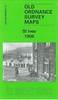
St Helens North West 1906

St Helens North West in 1906 in a fascinating series of reproductions of old Ordnance Survey plans in the Alan Godfrey Editions, ideal for anyone interested in the history of their neighbourhood or family. The map covers the north-western part of St Helens, Denton`s Green and part of Eccleston. Coverage runs from Albion Street westward to Christ Church, Eccleston, and northward to Windlehurst house. Features include Queen`s Recreation Ground, Windle House, Public Baths, tramway, Denton`s Green, Cremona House, Millbrook House, St Thomas Cemetery, Windleshaw Cemetery (at top of map), Bleak Hill Brow, etc. About the Alan Godfrey Editions of the 25” OS Series:Selected towns in Great Britain and Ireland are covered by maps showing the extent of urban development in the last
decades of the 19th and early 20th century. The plans have been taken from the Ordnance Survey mapping and reprinted at about 15 inches to one mile (1:4, 340). On the reverse most maps have historical notes and many also include extracts from contemporary directories. Most maps cover about one mile (1.6kms) north/south, one and a half miles (2.4kms) across; adjoining sheets can be combined to provide wider coverage.FOR MORE INFORMATION AND A COMPLETE LIST OF ALL AVAILABLE TITLES PLEASE CLICK ON THE SERIES LINK.
RIP - This product is no longer available on our network. It was last seen on 25.09.2019

This page now acts as a permanent archive for this product. Add more information using the comments box below to ensure it can still be found by future generations.

Use our search facility to see if it is available from an alternative contributor.
  • External links may include paid for promotion
  • Availability: Out Of Stock
  • Supplier: Stanfords
  • SKU: 9781847844491
Availability: In Stock
£3.50

Product Description

St Helens North West in 1906 in a fascinating series of reproductions of old Ordnance Survey plans in the Alan Godfrey Editions, ideal for anyone interested in the history of their neighbourhood or family. The map covers the north-western part of St Helens, Denton`s Green & part of Eccleston. Coverage runs from Albion Street westward to Christ Church, Eccleston, & northward to Windlehurst house. Features include Queen`s Recreation Ground, Windle House, Public Baths, tramway, Denton`s Green, Cremona House, Millbrook House, St Thomas Cemetery, Windleshaw Cemetery (at top of map), Bleak Hill Brow, etc. About the Alan Godfrey Editions of the 25” OS Series: Selected towns in Great Britain & Ireland are covered by maps showing the extent of urban development in the last decades of the 19th & early 20th century. The plans have been taken from the Ordnance Survey mapping & reprinted at about 15 inches to one mile (1:4, 340). On the reverse most maps have historical notes & many also include extracts from contemporary directories. Most maps cover about one mile (1.6kms) north/south, one & a half miles (2.4kms) across; adjoining sheets can be combined to provide wider coverage.FOR MORE INFORMATION & A COMPLETE LIST OF ALL AVAILABLE TITLES PLEASE CLICK ON THE SERIES LINK.

Reviews/Comments

Add New

Intelligent Comparison

Oooops!
We couldn't find anything!
Perhaps this product's unique.... Or perhaps we are still looking for comparisons!
Click to bump this page and we'll hurry up.

Price History

Vouchers

No voucher codes found.
Do you know a voucher code for this product or supplier? Add it to Insights for others to use.

Facebook

Jargon Buster

Contemporary - Modern era design
Contemporary - A design reference to indicate post war modern design
History - Anything that happens in the past. An acedemic subject.
Contemporary - An object that is living in the same time.
Ideal - Something that satisfies a perfect criteria.
Family - A group of people that live together made up from parents and children.

Supplier Information

Stanfords
Stanfords was established in 1853 and opened their iconic Covent Garden flagship store in 1901. They have become the top retailer of maps, travel books and accessories in the UK and arguably offer the largest selection of maps and travel books worldwide. Famous names such as Captain Robert Falcon Scott, Ranulph Fiennes and Michael Palin have purchased from Stanfords. They now have a shop in Bristol and both stores together with other venues operate a calendar of events including talks, book signings and exhibitions. As a specialist map retailer, the map selection is comprehensive and includes road maps, street maps and walking maps from worldwide destinations, as well as a selection of world atlases and wall maps. Books include travel guides and travel literature. Stanfords also stock globes, from miniatures made of blue marble to magnificent floor-standing globes. The website features a selection of interesting articles on travel topics.
Page Updated: 2023-11-12 20:15:36

Community Generated Product Tags

Oh No! The productWIKI community hasn't generated any tags for this product yet!
Menu