
 United Kingdom
 France
 Germany
 Netherlands
 Sweden
 USA
USA
 Italy
Italy
 Spain
Spain
More From Contributor


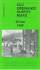

St Helens North West 1906
St Helens North West in 1906 in a fascinating series of reproductions of old Ordnance Survey plans in the Alan Godfrey Editions, ideal for anyone interested in the history of their neighbourhood or family. Selected towns in Great Britain and Ireland are covered by maps showing the extent of urban development in the last decades of the 19th and early 20th century.In this title: the map covers the north-western part of St Helens, Denton's Green and part of Eccleston. Coverage runs from Albion Street westward to Christ Church, Eccleston, and northward to Windlehurst house. Features include Queen's Recreation Ground, Windle House, Public Baths, tramway, Denton's Green, Cremona House, Millbrook House, St Thomas Cemetery, Windleshaw Cemetery (at top of map), Bleak Hill Brow etc.
About the Alan Godfrey Editions of the 25
About the Alan Godfrey Editions of the 25
Product Description
Reviews/Comments
Add New
Intelligent Comparison
Archived Product

St Helens North West 1906 Stanfords
£3.50
Archived Product
St Helens South West 1906 Stanfords
£3.50
Archived Product
St Helens North East 1906 Stanfords
£2.95
Archived Product

St Helens North East 1906 Stanfords
£3.50
Archived Product

St Helens South East 1906 Stanfords
£3.50
Archived Product

St Helens North East 1892 Stanfords
£3.50
Archived Product
Leeds North West 1908 Stanfords
£2.95
Archived Product

St Albans North-West 1897 Stanfords
£3.50
Vouchers
No voucher codes found.
Do you know a voucher code for this product or supplier? Add it to Insights for others to use.
Do you know a voucher code for this product or supplier? Add it to Insights for others to use.
 Denmark