
 United Kingdom
 France
 Germany
 Netherlands
 Sweden
 USA
USA
 Italy
Italy
 Spain
Spain
More From Contributor


Bury North West 1908
Bury North West in 1908 in a fascinating series of reproductions of old Ordnance Survey plans in the Alan Godfrey Editions, ideal for anyone interested in the history of their neighbourhood or family. The map covers the north-western side of Bury, stretching up to the southern part of Tottington. The Tottington Road runs diagonally across the map, with tramway, and several streets of terraces run off this in the south-eastern area of the map by Elton Fold. The LYR Tottington Branch also runs across the map, with Brandlesholme Road Halt, Woolfold station, Sunny Wood Halt, etc. Other features include Elton Fold Works, Woolfold Paper Mills, Woolfold, Bolholt Print Works, Greenhalgh Moss, Bolholt, Walshaw Lane, Christ Church, Victoria Mill, Haslam Hey (SW corner of map),
Lower Walshaw, Glen Mill, Kirklees Brook, Woodhill, Woodhill Mills, etc. On the reverse are extracts from a trade directory, including lists of Coal Dealers, Confectioners and Surgeons. About the Alan Godfrey Editions of the 25” OS Series:Selected towns in Great Britain and Ireland are covered by maps showing the extent of urban development in the last decades of the 19th and early 20th century. The plans have been taken from the Ordnance Survey mapping and reprinted at about 15 inches to one mile (1:4, 340). On the reverse most maps have historical notes and many also include extracts from contemporary directories. Most maps cover about one mile (1.6kms) north/south, one and a half miles (2.4kms) across; adjoining sheets can be combined to provide wider coverage.FOR MORE
INFORMATION AND A COMPLETE LIST OF ALL AVAILABLE TITLES PLEASE CLICK ON THE SERIES LINK.

Product Description
Reviews/Comments
Add New
Intelligent Comparison
Archived Product
Burnley North West 1909 Stanfords
£2.95
Archived Product
Burnley North West 1909 Stanfords
£3.50
Archived Product
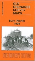
Bury North 1908 Stanfords
£3.50
Archived Product
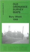
Bury West 1908 Stanfords
£3.50
Archived Product
Hull North West 1909 Stanfords
£3.50
Archived Product
Leeds North West 1908 Stanfords
£2.95
Archived Product
Derby North West 1899 Stanfords
£2.95
Archived Product

Derby North West 1899 Stanfords
£3.50
Vouchers
No voucher codes found.
Do you know a voucher code for this product or supplier? Add it to Insights for others to use.
Do you know a voucher code for this product or supplier? Add it to Insights for others to use.
 Denmark