
 United Kingdom
 France
 Germany
 Netherlands
 Sweden
 USA
USA
 Italy
Italy
 Spain
Spain
More From Contributor


Burnley North West 1909
Burnley North West in 1909 in a fascinating series of reproductions of old Ordnance Survey plans in the Alan Godfrey Editions, ideal for anyone interested in the history of their neighbourhood or family. Selected towns in Great Britain and Ireland are covered by maps showing the extent of urban development in the last decades of the 19th and early 20th century.In this title: the map covers the northern part of Burnley, stretching from Old Hall Street northward to Heald Wood, and from Bishop House Mill westward to the River Calder. Features include the railway with New Hall Bridge Halt, Old Hall Mill and several other mills, tramways and depot, Reedley Hallows Brick Works, Leeds & Liverpool Canal, Reedley Colliery, Lodge Mill, Crow Wood House, Royle. The western half of the map
is quite rural. On the reverse is a good selection of street directory entries, including Abel Street, Barden Lane, Cleaver Street, Grey Street, Hurtley Street, New Hall Street, Waterbarn Street. About the Alan Godfrey Editions of the 25
is quite rural. On the reverse is a good selection of street directory entries, including Abel Street, Barden Lane, Cleaver Street, Grey Street, Hurtley Street, New Hall Street, Waterbarn Street. About the Alan Godfrey Editions of the 25
Product Description
Reviews/Comments
Add New
Intelligent Comparison
Archived Product
Burnley North West 1909 Stanfords
£3.50
Archived Product

Bury North West 1908 Stanfords
£3.50
Archived Product
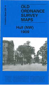
Hull North West 1909 Stanfords
£3.50
Archived Product

Barnsley North East 1904 Stanfords
£3.50
Archived Product
Derby North West 1899 Stanfords
£2.95
Archived Product

Derby North West 1899 Stanfords
£3.50
Archived Product
Burnley East 1909 Stanfords
£2.95
Archived Product
Burnley East 1909 Stanfords
£3.50
Vouchers
No voucher codes found.
Do you know a voucher code for this product or supplier? Add it to Insights for others to use.
Do you know a voucher code for this product or supplier? Add it to Insights for others to use.
 Denmark