
 United Kingdom
 France
 Germany
 Netherlands
 Sweden
 USA
USA
 Italy
Italy
 Spain
Spain
More From Contributor


Burnley East 1909
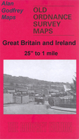
Burnley East in 1909 in a fascinating series of reproductions of old Ordnance Survey plans in the Alan Godfrey Editions, ideal for anyone interested in the history of their neighbourhood or family. Selected towns in Great Britain and Ireland are covered by maps showing the extent of urban development in the last decades of the 19th and early 20th century.In this title: the map covers the eastern edge of Burnley. Coverage extends from Todmorden Road eastward to Heckenhurst Reservoirs, and from Hesandford Mill southward to Fulledge Recreation Ground. Features include Turf Moor football ground, Fulledge Mill, Brownside with Brownside Shed, Queens Park, Brunshaw Bottom, Bee Hole Colliery and Rowley Colliery with tramways, Rowley, Ridge Row. On the reverse are street directory entries
for Admiral Street, Anne Street, Brunshaw Road, Brockenhurst Street, Eastham Street, Holmsley Street, Lebanon Street, Linden Street, Lyndhurst Road and Mitella Street. About the Alan Godfrey Editions of the 25
for Admiral Street, Anne Street, Brunshaw Road, Brockenhurst Street, Eastham Street, Holmsley Street, Lebanon Street, Linden Street, Lyndhurst Road and Mitella Street. About the Alan Godfrey Editions of the 25
Product Description
Reviews/Comments
Add New
Intelligent Comparison
Archived Product
Burnley East 1909 Stanfords
£3.50
Archived Product

Burnley 1910 Stanfords
£3.50
Archived Product
Burnley North West 1909 Stanfords
£2.95
Archived Product
Burnley North West 1909 Stanfords
£3.50
Archived Product
Dunblane East 1899 Stanfords
£2.95
Archived Product

Barnsley North East 1904 Stanfords
£3.50
Archived Product

Barnsley South East 1904 Stanfords
£3.50
Archived Product

Dundee East 1901 Stanfords
£3.50
Vouchers
No voucher codes found.
Do you know a voucher code for this product or supplier? Add it to Insights for others to use.
Do you know a voucher code for this product or supplier? Add it to Insights for others to use.
 Denmark