More From Contributor
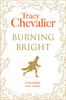
£6.99
A Brutalised Victim in the Wilds: A solitary tent is found to contain the body of a half-buried woman. She`s been stoned to death. There are lash marks across her back. One of her hands has been cut off. A Lone Voice: Two years earlier internet reporter Henning Juul lost his son, Jonas, in a domestic fire. As he returns to work, physically & emotionally scarred, Henning struggles to escape this past & to be taken seriously again as a reporter
- by his colleagues, his ex-wife & the police. A Mystery Ignited: Told to cover the story of the woman in the tent, he finds an increasingly dangerous trail &, despite an early arrest, he is convinced that the story is more complex than the police think...
...
Archived Product
£12.99
A Brutalised Victim in the Wilds: A solitary tent is found to contain the body of a half-buried woman. She's been stoned to death. There are lash marks across her back. One of her hands has been cut off. A Lone Voice: Two years earlier internet reporter Henning Juul lost his son, Jonas, in a domestic fire. As he returns to work, physically & emotionally scarred, Henning struggles to escape this past & to be taken seriously again as a reporter
- by his colleagues, his ex-wife & the police. A Mystery Ignited: Told to cover the story of the woman in the tent, he finds an increasingly dangerous trail &, despite an early arrest, he is convinced that the story is more complex than the police think...
...
Archived Product
£3.50
Burnham-on-Sea in 1929 in a fascinating series of reproductions of old Ordnance Survey plans in the Alan Godfrey Editions, ideal for anyone interested in the history of their neighbourhood or family. The map covers the seaside town of Burnham, which added `on-Sea` to its name in 1917. Most of the town is covered, from Sea View Road southward to Pillsmouth Farm, & inland to Rosewood Farm & Burnham Rhyne. Features include the Somerset & Dorset Railway with station, Burnham Brewery, pier, Convent, Court House, Manor Farm, St Andrew`s church, Esplanade Pavilion, High Street, River Parrett, The Hall, Manor House, & the town centre shown in detail with individual houses neatly delineated. On the reverse is a commercial directory of Burnham. About the Alan Godfrey Editions of the 25” OS Series Selected towns in Great Britain & Ireland are covered by maps showing the extent of urban development in the last decades of the 19th & early 20th century. The plans have been taken from the Ordnance Survey mapping & reprinted at about 15 inches to one mile (1:4, 340). On the reverse most maps have historical notes & many also include extracts from contemporary directories. Most maps cover about one mile (1.6kms) north/south, one & a half miles (2.4kms) across; adjoining sheets can be combined to provide wider coverage.FOR MORE INFORMATION & A COMPLETE LIST OF ALL AVAILABLE TITLES PLEASE CLICK ON THE SERIES LINK. ...
Archived Product
£3.50
Burnhope in 1895 in a fascinating series of reproductions of old Ordnance Survey plans in the Alan Godfrey Editions, ideal for anyone interested in the history of their neighbourhood or family. Tthe map is double-sided. The main map covers the village itself &

Includes::
St John`s church, Burnhope Wagonway, & Burnhope Colliery
- Fortune & Annie Pits. Fell Pit with its own wagonway is also included, as is Ibbetson`s Sike Quarry. The map extends north to Burnhope Engine, east to what is now the hamlet of Peartree. Also included are Holmside Hall, Holmside New Hall & the area now known as Little Holmside. On the reverse is a large section of the adjacent sheet 12.14 which extends coverage north to Morrowedge Quarry, South Moor & (at the top of the map) South Moor Colliery
- Hedley Pit. About the Alan Godfrey Editions of the 25” OS Series: Selected towns in Great Britain & Ireland are covered by maps showing the extent of urban development in the last decades of the 19th & early 20th century. The plans have been taken from the Ordnance Survey mapping & reprinted at about 15 inches to one mile (1:4, 340). On the reverse most maps have historical notes & many also include extracts from contemporary directories. Most maps cover about one mile (1.6kms) north/south, one & a half miles (2.4kms) across; adjoining sheets can be combined to provide wider coverage.FOR MORE INFORMATION & A COMPLETE LIST OF ALL AVAILABLE TITLES PLEASE CLICK ON THE SERIES LINK.


...
Archived Product
£8.99
Flames & funerals, circus feats & seduction, neighbours & nakedness: a sparkling historical drama from the bestselling author of Girl with a Pearl Earring. Uprooting from their quiet Dorset village to the carnal streets of London, young Jem Kellaway & his family feel far from home. The Kellaways struggle to fi nd their place in a tumultuous city, alive with repercussions from the blood-splattered French Revolution. Luckily streetwise Maggie Butterfi eld is on hand to show Jem the ropes. Together they encounter the neighbour they`ve been warned about: radical poet & artist William Blake. Jem & Maggie`s passage from innocence to experience becomes the very stuff of poetic inspiration. ...
Archived Product
£6.99
` If only our country hadn`t been invaded. If only we could have carried on the way we used to, watching other people`s wars on television.` Ellie & her friends are more determined than ever to make an impact on the enemy. But the constant fighting is beginning to take its toll on the group. Kevin is suffering an emotional breakdown, & the friendship that has kept the gang together for so long is under strain. & while there is no time for love in a time of war, Ellie can`t forget her feelings for Lee...A tale of relentless action & gripping intensity from one of the world`s best storytellers. (Book 5 of The Tomorrow Series.) ...
Archived Product
£4.99
The Baron, bored on holiday, begins a flirtation with a beautiful woman via her twelve-year-old son. He befriends the child & charms him, all the while attempting to seduce the mother
- but he cannot begin to imagine the effect he is having on the boy`s life... Burning Secret is a witty, potent look at innocence, adult attraction & childhood passion.
...
Archived Product
£3.50
Burnley in 1910 in a fascinating series of reproductions of old Ordnance Survey plans in the Alan Godfrey Editions, ideal for anyone interested in the history of their neighbourhood or family. The map covers most of central Burnley with its many mills, stretching from Cog Lane & Gannow Junction eastward to Belvedere Road, & from Danes House Road southward to Montague Road & Manchester Road station. Features include Bank Top station, Barracks station, Infantry Barracks, Wood Top Mill, Hargher Clough Mill, Yatefield Mill & numerous other mills, Leeds & Liverpool Canal, Whittlefield Farm, Piccadilly Gardens, Burnley Iron Works, Paper Mill, Clifton Colliery with tramways, Bankhouse Iron Works, Market Hall & all other town centre buildings, cattle market, St Peter`s church, tramways, Technical Institute, Palace Skating Rink, Bank Hall, Bank Hall Colliery (top right corner) with tramway, Keighley Green, mineral railway, Stoneyholme, etc. On the reverse are directory extracts, including a list of cotton manufacturers & street directory entries for St James Street, Sandygate, Westgate, Market Street & Market Place. About the Alan Godfrey Editions of the 25” OS Series: Selected towns in Great Britain & Ireland are covered by maps showing the extent of urban development in the last decades of the 19th & early 20th century. The plans have been taken from the Ordnance Survey mapping & reprinted at about 15 inches to one mile (1:4, 340). On the reverse most maps have historical notes & many also include extracts from contemporary directories. Most maps cover about one mile (1.6kms) north/south, one & a half miles (2.4kms) across; adjoining sheets can be combined to provide wider coverage.FOR MORE INFORMATION & A COMPLETE LIST OF ALL AVAILABLE TITLES PLEASE CLICK ON THE SERIES LINK. ...
Archived Product
£2.95
Burnley East in 1909 in a fascinating series of reproductions of old Ordnance Survey plans in the Alan Godfrey Editions, ideal for anyone interested in the history of their neighbourhood or family. Selected towns in Great Britain & Ireland are covered by maps showing the extent of urban development in the last decades of the 19th & early 20th century. In this title: the map covers the eastern edge of Burnley. Coverage extends from Todmorden Road eastward to Heckenhurst Reservoirs, & from Hesandford Mill southward to Fulledge Recreation Ground. Features include Turf Moor football ground, Fulledge Mill, Brownside with Brownside Shed, Queens Park, Brunshaw Bottom, Bee Hole Colliery & Rowley Colliery with tramways, Rowley, Ridge Row. On the reverse are street directory entries for Admiral Street, Anne Street, Brunshaw Road, Brockenhurst Street, Eastham Street, Holmsley Street, Lebanon Street, Linden Street, Lyndhurst Road & Mitella Street. About the Alan Godfrey Editions of the 25 ...
Archived Product
£3.50
Burnley East in 1909 in a fascinating series of reproductions of old Ordnance Survey plans in the Alan Godfrey Editions, ideal for anyone interested in the history of their neighbourhood or family. The map covers the eastern edge of Burnley, extending from Todmorden Road eastward to Heckenhurst Reservoirs, & from Hesandford Mill southward to Fulledge Recreation Ground. Features include Turf Moor football ground, Fulledge Mill, Brownside with Brownside Shed, Queens Park, Brunshaw Bottom, Bee Hole Colliery & Rowley Colliery with tramways, Rowley, Ridge Row, etc. On the reverse are street directory entries for Admiral Street, Anne Street, Brunshaw Road, Brockenhurst Street, Eastham Street, Holmsley Street, Lebanon Street, Linden Street, Lyndhurst Road & Mitella Street. About the Alan Godfrey Editions of the 25” OS Series: Selected towns in Great Britain & Ireland are covered by maps showing the extent of urban development in the last decades of the 19th & early 20th century. The plans have been taken from the Ordnance Survey mapping & reprinted at about 15 inches to one mile (1:4, 340). On the reverse most maps have historical notes & many also include extracts from contemporary directories. Most maps cover about one mile (1.6kms) north/south, one & a half miles (2.4kms) across; adjoining sheets can be combined to provide wider coverage.FOR MORE INFORMATION & A COMPLETE LIST OF ALL AVAILABLE TITLES PLEASE CLICK ON THE SERIES LINK. ...
Archived Product

Burning Bright

They`re hunting her. Deep in north California`s redwood forests, June Cassidy is hiding. She`s no idea who`s after her, why they want her or how much longer she can survive. But she`s not the only fugitive hiding in the woods. After eight years a soldier, Peter Ash came home with only one souvenir: what he calls `white static`, a crippling claustrophobia due to post-traumatic stress that has driven him far from conventional life and deep into the wilderness, living rough, sleeping under the stars. The odds are against them, but Peter might just be the one man with the skill set to get June out of the woods alive.
RIP - This product is no longer available on our network. It was last seen on 25.09.2019

This page now acts as a permanent archive for this product. Add more information using the comments box below to ensure it can still be found by future generations.

Use our search facility to see if it is available from an alternative contributor.
  • External links may include paid for promotion
  • Availability: Out Of Stock
  • Supplier: Stanfords
  • SKU: 9781788542494
Availability: In Stock
£7.99

Product Description

They`re hunting her. Deep in north California`s redwood forests, June Cassidy is hiding. She`s no idea who`s after her, why they want her or how much longer she can survive. But she`s not the only fugitive hiding in the woods. After eight years a soldier, Peter Ash came home with only one souvenir: what he calls `white static`, a crippling claustrophobia due to post-traumatic stress that has driven him far from conventional life & deep into the wilderness, living rough, sleeping under the stars. The odds are against them, but Peter might just be the one man with the skill set to get June out of the woods alive.

Reviews/Comments

Add New

Intelligent Comparison

Oooops!
We couldn't find anything!
Perhaps this product's unique.... Or perhaps we are still looking for comparisons!
Click to bump this page and we'll hurry up.

Price History

Vouchers

No voucher codes found.
Do you know a voucher code for this product or supplier? Add it to Insights for others to use.

Facebook

Jargon Buster

White - A colour combining all colours
Stress - Also known as tension, a situation where a human can not cope with emotional or physical threats
Set - a group of items usually related to one another. Some objects cannot function without the complete set of items.
Home - A place of permanent residence for families.

Supplier Information

Stanfords
Stanfords was established in 1853 and opened their iconic Covent Garden flagship store in 1901. They have become the top retailer of maps, travel books and accessories in the UK and arguably offer the largest selection of maps and travel books worldwide. Famous names such as Captain Robert Falcon Scott, Ranulph Fiennes and Michael Palin have purchased from Stanfords. They now have a shop in Bristol and both stores together with other venues operate a calendar of events including talks, book signings and exhibitions. As a specialist map retailer, the map selection is comprehensive and includes road maps, street maps and walking maps from worldwide destinations, as well as a selection of world atlases and wall maps. Books include travel guides and travel literature. Stanfords also stock globes, from miniatures made of blue marble to magnificent floor-standing globes. The website features a selection of interesting articles on travel topics.
Page Updated: 2023-11-12 20:15:36

Community Generated Product Tags

Oh No! The productWIKI community hasn't generated any tags for this product yet!
Menu