
 United Kingdom
 France
 Germany
 Netherlands
 Sweden
 USA
USA
 Italy
Italy
 Spain
Spain
More From Contributor


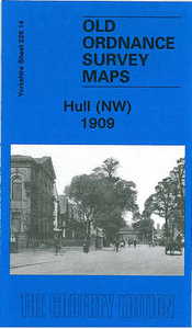
Hull North West 1909
Hull North West in 1909 in a fascinating series of reproductions of old Ordnance Survey plans in the Alan Godfrey Editions, ideal for anyone interested in the history of their neighbourhood or family. The map covers the busy north-western area of Hull, stretching from Perth Street and Richmond Street eastward to Waterloo Street, and from Welbeck Street northward to Torrington Street. This is a mainly residential area with many streets of terraces. Features include Pearson`s Park, Beverley Road station, tramways, Sculcoates Workhouse, Stepney Mills, Stepney area, St John`s Wood area, Stepney station on Victoria Dock Branch, Stepney Lodge, St Augustine`s church, RC Training College, St Cuthbert`s Mission church, electricity works, etc. On the reverse are street directory
entries for Belvoir Street, Marlborough Avenue, Queen`s Road and Victoria Avenue.About the Alan Godfrey Editions of the 25” OS Series:Selected towns in Great Britain and Ireland are covered by maps showing the extent of urban development in the last decades of the 19th and early 20th century. The plans have been taken from the Ordnance Survey mapping and reprinted at about 15 inches to one mile (1:4, 340). On the reverse most maps have historical notes and many also include extracts from contemporary directories. Most maps cover about one mile (1.6kms) north/south, one and a half miles (2.4kms) across; adjoining sheets can be combined to provide wider coverage.FOR MORE INFORMATION AND A COMPLETE LIST OF ALL AVAILABLE TITLES PLEASE CLICK ON THE SERIES LINK.
entries for Belvoir Street, Marlborough Avenue, Queen`s Road and Victoria Avenue.About the Alan Godfrey Editions of the 25” OS Series:Selected towns in Great Britain and Ireland are covered by maps showing the extent of urban development in the last decades of the 19th and early 20th century. The plans have been taken from the Ordnance Survey mapping and reprinted at about 15 inches to one mile (1:4, 340). On the reverse most maps have historical notes and many also include extracts from contemporary directories. Most maps cover about one mile (1.6kms) north/south, one and a half miles (2.4kms) across; adjoining sheets can be combined to provide wider coverage.FOR MORE INFORMATION AND A COMPLETE LIST OF ALL AVAILABLE TITLES PLEASE CLICK ON THE SERIES LINK.

Product Description
Reviews/Comments
Add New
Intelligent Comparison
Archived Product
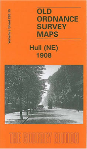
Hull North East 1908 Stanfords
£3.50
Archived Product
Burnley North West 1909 Stanfords
£2.95
Archived Product
Burnley North West 1909 Stanfords
£3.50
Archived Product

Bury North West 1908 Stanfords
£3.50
Archived Product
Halifax North West 1905 Stanfords
£2.95
Archived Product
Walsall North West 1902 Stanfords
£2.95
Archived Product

Walsall North West 1901 Stanfords
£3.50
Archived Product
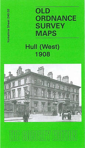
Hull West 1908 Stanfords
£3.50
Vouchers
No voucher codes found.
Do you know a voucher code for this product or supplier? Add it to Insights for others to use.
Do you know a voucher code for this product or supplier? Add it to Insights for others to use.
 Denmark