
 United Kingdom
 France
 Germany
 Netherlands
 Sweden
 USA
USA
 Italy
Italy
 Spain
Spain
More From Contributor


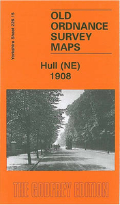
Hull North East 1908
Hull North East in 1908 in a fascinating series of reproductions of old Ordnance Survey plans in the Alan Godfrey Editions, ideal for anyone interested in the history of their neighbourhood or family. The map covers a busy north-eastern area of Hull, stretching from Cannon Street station northward to Lorraine Street, and from St Paul`s Street eastward to New Bridge Road. Holderness Road runs through the map, as does a winding portion of the River Hull, lined with mills, wharves and factories. Features include stretches of the Hull & Barnsley Railway, the North Eastern Railway with Wilmington station and goods sheds; tramways, Wilmington, Sulcoates Cemetery, Hull Municipal Hospital (almshouses), Thistleton, cement works, Summergangs, Reckitt`s Kingston Works, Wincolmlee
Colour Works, the Foredyke Stream, Holderness House, St Mary`s church, Cannon Street station and approaches, Stoneferry Canister Works, etc. On the reverse are street directories for Cleveland Street, Cumberland Street, Durham Street, Oxford Street and Swann Street. About the Alan Godfrey Editions of the 25” OS Series:Selected towns in Great Britain and Ireland are covered by maps showing the extent of urban development in the last decades of the 19th and early 20th century. The plans have been taken from the Ordnance Survey mapping and reprinted at about 15 inches to one mile (1:4, 340). On the reverse most maps have historical notes and many also include extracts from contemporary directories. Most maps cover about one mile (1.6kms) north/south, one and a half miles (2.4kms)
across; adjoining sheets can be combined to provide wider coverage.FOR MORE INFORMATION AND A COMPLETE LIST OF ALL AVAILABLE TITLES PLEASE CLICK ON THE SERIES LINK.

Product Description
Reviews/Comments
Add New
Intelligent Comparison
Archived Product
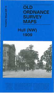
Hull North West 1909 Stanfords
£3.50
Archived Product
Hull East 1908 Stanfords
£3.50
Archived Product
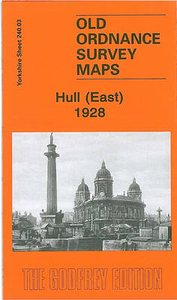
Hull East 1928 Stanfords
£3.50
Archived Product

Bolton North-East 1908 Stanfords
£2.95
Archived Product

Bolton North-East 1908 Stanfords
£3.50
Archived Product
St Helens North East 1906 Stanfords
£2.95
Archived Product

St Helens North East 1906 Stanfords
£3.50
Archived Product

Bury North West 1908 Stanfords
£3.50
Vouchers
No voucher codes found.
Do you know a voucher code for this product or supplier? Add it to Insights for others to use.
Do you know a voucher code for this product or supplier? Add it to Insights for others to use.
 Denmark