More From Contributor
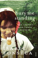
£16.99
Sverigeserien is an outdoor map series consisting of 116 sheets with coverage of southern & central Sweden & the northern coastline. The map is suitable for outdoor activities such as hiking, excursions, trail running, hunting, fishing, riding, cycling, mountain biking, paddling, skating & much more. Every sheet covers an area of 45x 68km. These topographical maps in scale 1:50 000 contain all the information needed for outdoor activities: Terrain information, hiking trails, illuminated tracks, camping, shelters, golf courses, leisure baths, historical remains, roads in different categories, railway lines & much more. Easy to read topography with contour lines, vertical interval 5 m. Sverigeserien is a high-quality map series & is durable for frequent use! Updated content with map data from Lantmäteriet (National Land Survey of Sweden) & printed on Polyart which is water & tear resistant. This means that the map can be folded repeatedly without breaking & can withstand the challenging weather in Sweden during both winter & summer. Legend is in Swedish, English & German. ...
Archived Product
£10.99
Detailed map of Burundi with small villages & settlements, & a street plan of Bujumbura. Contours at 200m & relief shading indicate the terrain & the map also shows various types of vegetation. Roads are shown with distances & petrol stations, & tracks are also marked. Other information

Includes::
national parks ans reserves, hotels & other accommodation, hospitals, various religious establishments, & places of interest. Latitude/longitude lines are drawn at 15` intervals. The map is indexed &

Includes::
a street plan of Bujumbura, a distance table, & an administrative diagram. The legend is in French only.


...
Archived Product
£15.99
Little known in the English-speaking world, Burundi is Rwanda's twin, a small Central African country with a complex history of ethnic tension between its Hutu & Tutsi populations that has itself experienced traumatic events, including mass killings of over 200, 000 people. The country remained in a state of simmering civil war until 2004, after which Julius Nyerere & Nelson Mandela took turns as mediators in a lengthy, & eventually successful, peace process which has endowed Burundi with new institutions, including a new constitution, that led to the election of a majority Hutu government in 2005. But there are many problems still to solve apart from ethnic tensions, above all the entrenched poverty of most Burundians, which has seen it designated by NGOs as one of the most deprived countries on earth. Nigel Watt's book discusses the troubled political fortunes of this beautiful yet disturbed country in the heart of Central Africa. He traces the origins of its political crises, sheds light on Burundi's recent history by means of interviews with leading participants & those whose lives have been affected by horrific events, & helps demystify the country's ethnic divisions. ...
Archived Product
£15.99
Little known in the English-speaking world, Burundi is Rwanda`s twin, a small Central African country with a complex history of ethnic tension between its Hutu & Tutsi populations that has itself experienced traumatic events, including mass killings of over 200, 000 people. The country remained in a state of simmering civil war until 2004, after which Julius Nyerere & Nelson Mandela took turns as mediators in a lengthy, & eventually successful, peace process which has endowed Burundi with new institutions, including a new constitution that led to the election of Pierre Nkurunziza as president in 2005. After some years of modest progress Burundi`s peace was shattered again when the president decided to stand for a third term in 2015. The tensions today are more political than ethnic but the country faces many other problems, above all the entrenched poverty which has seen Burundi designated as one of the most deprived countries on earth. Nigel Watt`s book discusses the troubled political fortunes of this beautiful yet disturbed country which is now part of the East African Community. He traces the origins of its political crises, sheds light on Burundi`s recent history by means of interviews with leading participants & those whose lives have been affected by horrific events, helps demystify the country`s `ethnic` divisions & follows the fortunes of the Nkurunziza regime. ...
Archived Product
£3.50
Bury in 1908 in a fascinating series of reproductions of old Ordnance Survey plans in the Alan Godfrey Editions, ideal for anyone interested in the history of their neighbourhood or family. The map covers much of the centre & southern part of town, stretching from Moorgate southward to Park Hills Road, & from Millett Street eastward to Water Fold Farm. Features include St Mary`s church, St Paul`s church, tramways with depot, railways with Knowsley Street & Bolton Street stations, engine shed, carriage sheds at Buckley Wells, Market Hall, Fishpool, Tentersfield, Castle Armoury, Bury Ground, Peel Tannery, Market Place, numerous mills of which several are named, Fustian Mill, Weaving Shed, Gigg Mills Siding, Water Fold Mill, Holy Trinity church, Park Hills, etc. On the reverse are street directory entries for Bolton Street, Crostons Road, Fleet Street, King Street, Spring Street & a few others. About the Alan Godfrey Editions of the 25” OS Series: Selected towns in Great Britain & Ireland are covered by maps showing the extent of urban development in the last decades of the 19th & early 20th century. The plans have been taken from the Ordnance Survey mapping & reprinted at about 15 inches to one mile (1:4, 340). On the reverse most maps have historical notes & many also include extracts from contemporary directories. Most maps cover about one mile (1.6kms) north/south, one & a half miles (2.4kms) across; adjoining sheets can be combined to provide wider coverage.FOR MORE INFORMATION & A COMPLETE LIST OF ALL AVAILABLE TITLES PLEASE CLICK ON THE SERIES LINK. ...
Archived Product
£10.99
The American West, 1860-1890: years of broken promises, disillusionment, war & massacre. Beginning with the Long Walk of the Navajos & ending with the massacre of Sioux at Wounded Knee, this extraordinary book tells how the American Indians lost their l&, lives & liberty to white settlers pushing westward. Woven into a an engrossing saga of cruelty, treachery & violence are the fascinating stories of such legendary figures as Sitting Bull, Cochise, Crazy Horse & Geronimo. First published in 1970, Dee Brown`s brutal & compelling narrative changed the way people thought about the original inhabitants of America, & focused attention on a national disgrace. ...
Archived Product
£3.50
Bury North in 1908 in a fascinating series of reproductions of old Ordnance Survey plans in the Alan Godfrey Editions, ideal for anyone interested in the history of their neighbourhood or family. The map covers the northern part of Bury, stretching from Bell Lane northward to Little Wood Cross, & from Higher Woodhill eastward to Gorsey Brow. Walmersleys Road runs north-south through the centre of the map. Other features include the River Irwell, Higher Woodhill, Burrs with bleach works, Fern Hill, Fernhill Chemical Works, Peel Mills, a stretch of the LYR railway, a short stretch of the Tottington Branch with Woodhill Halt, Woodhill Fold, Free Town, Clarence Recreation Ground, Chesham, Lowes Brick Works, Springfield Mill, Chesham Field Mills, Alexandra Mill, numerous other mills, Gipsy Brook, etc. On the reverse are extracts from a contemporary trade directory including lists of Beerhouses & Beersellers, Cloggers, Cotton Spinners, Drapers & Pawnbrokers. About the Alan Godfrey Editions of the 25” OS Series: Selected towns in Great Britain & Ireland are covered by maps showing the extent of urban development in the last decades of the 19th & early 20th century. The plans have been taken from the Ordnance Survey mapping & reprinted at about 15 inches to one mile (1:4, 340). On the reverse most maps have historical notes & many also include extracts from contemporary directories. Most maps cover about one mile (1.6kms) north/south, one & a half miles (2.4kms) across; adjoining sheets can be combined to provide wider coverage.FOR MORE INFORMATION & A COMPLETE LIST OF ALL AVAILABLE TITLES PLEASE CLICK ON THE SERIES LINK. ...
Archived Product
£3.50
Bury North West in 1908 in a fascinating series of reproductions of old Ordnance Survey plans in the Alan Godfrey Editions, ideal for anyone interested in the history of their neighbourhood or family. The map covers the north-western side of Bury, stretching up to the southern part of Tottington. The Tottington Road runs diagonally across the map, with tramway, & several streets of terraces run off this in the south-eastern area of the map by Elton Fold. The LYR Tottington Branch also runs across the map, with Brandlesholme Road Halt, Woolfold station, Sunny Wood Halt, etc. Other features include Elton Fold Works, Woolfold Paper Mills, Woolfold, Bolholt Print Works, Greenhalgh Moss, Bolholt, Walshaw Lane, Christ Church, Victoria Mill, Haslam Hey (SW corner of map), Lower Walshaw, Glen Mill, Kirklees Brook, Woodhill, Woodhill Mills, etc. On the reverse are extracts from a trade directory, including lists of Coal Dealers, Confectioners & Surgeons. About the Alan Godfrey Editions of the 25” OS Series: Selected towns in Great Britain & Ireland are covered by maps showing the extent of urban development in the last decades of the 19th & early 20th century. The plans have been taken from the Ordnance Survey mapping & reprinted at about 15 inches to one mile (1:4, 340). On the reverse most maps have historical notes & many also include extracts from contemporary directories. Most maps cover about one mile (1.6kms) north/south, one & a half miles (2.4kms) across; adjoining sheets can be combined to provide wider coverage.FOR MORE INFORMATION & A COMPLETE LIST OF ALL AVAILABLE TITLES PLEASE CLICK ON THE SERIES LINK. ...
Archived Product
£2.95
Bury South in 1907 in a fascinating series of reproductions of old Ordnance Survey plans in the Alan Godfrey Editions, ideal for anyone interested in the history of their neighbourhood or family. Selected towns in Great Britain & Ireland are covered by maps showing the extent of urban development in the last decades of the 19th & early 20th century. In this title: the map covers the southern part of Bury, extending from Gigg Lane southward to Hollins, & from Redvales Farm eastward to Hollins Vale. Features include the football ground, Cemetery, Hampson Mills, Nuttall Square, Barlow Fold, New Bridge Mills, Irwell Bleach Works, Redvales, St Peter's church, Goshen Farm, River Roch, Gigg with paper mills, Hollins Vale with bleach works, Fletcher Fold, Hollins Brook, tramways. On the reverse are various directory extracts. About the Alan Godfrey Editions of the 25 ...
Archived Product
£3.50
Bury South in 1907 in a fascinating series of reproductions of old Ordnance Survey plans in the Alan Godfrey Editions, ideal for anyone interested in the history of their neighbourhood or family. The map covers the southern part of Bury, extending from Gigg Lane southward to Hollins, & from Redvales Farm eastward to Hollins Vale. Features include the football ground, Cemetery, Hampson Mills, Nuttall Square, Barlow Fold, New Bridge Mills, Irwell Bleach Works, Redvales, St Peter`s church, Goshen Farm, River Roch, Gigg with paper mills, Hollins Vale with bleach works, Fletcher Fold, Hollins Brook, tramways, etc. On the reverse are various directory extracts. About the Alan Godfrey Editions of the 25” OS Series: Selected towns in Great Britain & Ireland are covered by maps showing the extent of urban development in the last decades of the 19th & early 20th century. The plans have been taken from the Ordnance Survey mapping & reprinted at about 15 inches to one mile (1:4, 340). On the reverse most maps have historical notes & many also include extracts from contemporary directories. Most maps cover about one mile (1.6kms) north/south, one & a half miles (2.4kms) across; adjoining sheets can be combined to provide wider coverage.FOR MORE INFORMATION & A COMPLETE LIST OF ALL AVAILABLE TITLES PLEASE CLICK ON THE SERIES LINK. ...
Archived Product

Bury Me Standing

Gypsies have always intrigued and fascinated - partly because of their mysterious origins, and partly because of the romance of nomadism. But because they resist assimilation, having survived as a distinct people for over a thousand years, they have also been the victims of other people`s nationalism and xenophobia. In this fascinating and timely study, Fonseca focuses particularly on the gypsies in Eastern Europe (an estimated 6 million), and their future as a distinct race within a nationalist Europe. While researching the book, Fonseca learned Romany and stayed with the gypsies, becoming deeply involved with their lives, and befriending several gypsy kings. The result is a clolourful and frank book, filled with enthusiasm and curiosity, without lapsing into piety or
romanticism.
RIP - This product is no longer available on our network. It was last seen on 25.09.2019

This page now acts as a permanent archive for this product. Add more information using the comments box below to ensure it can still be found by future generations.

Use our search facility to see if it is available from an alternative contributor.
  • External links may include paid for promotion
  • Availability: Out Of Stock
  • Supplier: Stanfords
  • SKU: 9780099740216
Availability: In Stock
£10.99

Product Description

Gypsies have always intrigued & fascinated
- partly because of their mysterious origins, & partly because of the romance of nomadism. But because they resist assimilation, having survived as a distinct people for over a thousand years, they have also been the victims of other people`s nationalism & xenophobia. In this fascinating & timely study, Fonseca focuses particularly on the gypsies in Eastern Europe (an estimated 6 million), & their future as a distinct race within a nationalist Europe. While researching the book, Fonseca learned Romany & stayed with the gypsies, becoming deeply involved with their lives, & befriending several gypsy kings. The result is a clolourful & frank book, filled with enthusiasm & curiosity, without lapsing into piety or romanticism.

Reviews/Comments

Add New

Intelligent Comparison

Oooops!
We couldn't find anything!
Perhaps this product's unique.... Or perhaps we are still looking for comparisons!
Click to bump this page and we'll hurry up.

Price History

Vouchers

No voucher codes found.
Do you know a voucher code for this product or supplier? Add it to Insights for others to use.

Facebook

Jargon Buster

Distinct - Something that can be seen to be slightly different.

Supplier Information

Stanfords
Stanfords was established in 1853 and opened their iconic Covent Garden flagship store in 1901. They have become the top retailer of maps, travel books and accessories in the UK and arguably offer the largest selection of maps and travel books worldwide. Famous names such as Captain Robert Falcon Scott, Ranulph Fiennes and Michael Palin have purchased from Stanfords. They now have a shop in Bristol and both stores together with other venues operate a calendar of events including talks, book signings and exhibitions. As a specialist map retailer, the map selection is comprehensive and includes road maps, street maps and walking maps from worldwide destinations, as well as a selection of world atlases and wall maps. Books include travel guides and travel literature. Stanfords also stock globes, from miniatures made of blue marble to magnificent floor-standing globes. The website features a selection of interesting articles on travel topics.
Page Updated: 2023-11-12 20:15:36

Community Generated Product Tags

Oh No! The productWIKI community hasn't generated any tags for this product yet!
Menu