
 United Kingdom
 France
 Germany
 Netherlands
 Sweden
 USA
USA
 Italy
Italy
 Spain
Spain
More From Contributor


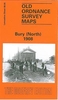

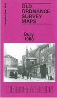
Bury 1908
Bury in 1908 in a fascinating series of reproductions of old Ordnance Survey plans in the Alan Godfrey Editions, ideal for anyone interested in the history of their neighbourhood or family. The map covers much of the centre and southern part of town, stretching from Moorgate southward to Park Hills Road, and from Millett Street eastward to Water Fold Farm. Features include St Mary`s church, St Paul`s church, tramways with depot, railways with Knowsley Street and Bolton Street stations, engine shed, carriage sheds at Buckley Wells, Market Hall, Fishpool, Tentersfield, Castle Armoury, Bury Ground, Peel Tannery, Market Place, numerous mills of which several are named, Fustian Mill, Weaving Shed, Gigg Mills Siding, Water Fold Mill, Holy Trinity church, Park Hills, etc.
On the reverse are street directory entries for Bolton Street, Crostons Road, Fleet Street, King Street, Spring Street and a few others.About the Alan Godfrey Editions of the 25” OS Series:Selected towns in Great Britain and Ireland are covered by maps showing the extent of urban development in the last decades of the 19th and early 20th century. The plans have been taken from the Ordnance Survey mapping and reprinted at about 15 inches to one mile (1:4, 340). On the reverse most maps have historical notes and many also include extracts from contemporary directories. Most maps cover about one mile (1.6kms) north/south, one and a half miles (2.4kms) across; adjoining sheets can be combined to provide wider coverage.FOR MORE INFORMATION AND A COMPLETE LIST OF ALL AVAILABLE TITLES
PLEASE CLICK ON THE SERIES LINK.

Product Description
Reviews/Comments
Add New
Intelligent Comparison
Archived Product
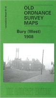
Bury West 1908 Stanfords
£3.50
Archived Product

Burnley 1910 Stanfords
£3.50
Archived Product

Banbury 1900 Stanfords
£3.50
Archived Product
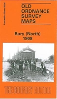
Bury North 1908 Stanfords
£3.50
Archived Product
Barry 1898 Stanfords
£3.50
Vouchers
No voucher codes found.
Do you know a voucher code for this product or supplier? Add it to Insights for others to use.
Do you know a voucher code for this product or supplier? Add it to Insights for others to use.
 Denmark