More From Contributor
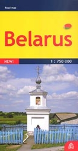
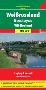
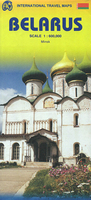
£6.95
Topographic coverage of mainland Spain at 1:50, 000 in the MTN50 (Mapa Topográfico Nacional) series from the Centro Nacional de Información Geografica, the country’s civilian survey organization. The maps have contours at 20m intervals, enhanced by relief shading, plus colouring and/or graphics to show different types of terrain, vegetation or land use. Boundaries of national parks & other protected areas are marked. In addition to all the usual information featured on topographic mapping at this scale, detailed presentation of the road & rail networks, rural tracks & paths, etc, the maps also show campsites & mountain refuges. On more recent editions some GRs, the official long-distance hiking routes, are also marked (although not as clearly as on hiking maps from other publishers). Each map covers 29.5x 18.5 km (with adjustments in the border or coastal areas). The maps have a 1-km UTM grid, plus margin ticks for latitude & longitude at 1` intervals. Map legend is in Spanish only.HOW TO CHOOSE THE RIGHT 50K MAP: all the titles in CNIG’s 200K Provincial Road Maps series at 1:200, 000 are overprinted with the grid for the 1:50, 000 maps & can be used to see the area covered by each 50K title. TO SEE THE LIST OF TITLES IN THIS SERIES PLEASE CLICK ON THE SERIES LINK.PLEASE NOTE
- MAP TITLES: the grids shown on our website serve both the civilian & the military 1:50, 000 topographic series. Although the areas covered by maps in both series are identical (apart from some border or coastal sheets), occasionally map titles differ – only one title is shown on the grid, usually the military one. In Galicia, the Basque country & in the Catalan speaking areas the tendency now is to use local place names rather than the often better known Castilian ones. Where possible, both versions are included in our titles. Map titles listed on our website are based on information received by us at the time of publication, but sometimes maps arrive showing a completely different title! As long as the map number is as ordered, the correct map has been supplied.
...
Archived Product
£7.99
Isobel & Lou moved to Montalcino & became Isabella & Luigi ten years ago & they have now been embraced by the locals & immersed in their antiquated customs & age-old feuds. In BEL VINO Isabella takes the reader on a winding journey to discover the true aristocratic orgins of the world-renowned wine Brunello di Montalcino on whose vintage the fortunes of many of the Montalcinesi depend. Taking us through the seasons of the wine harvest, Dusi weaves a path that brings in the local white-hooded monks who have lived in the Abbey of Sant` Antimo since at least 814; the last remaining local shoemaker; the harvesting of mushrooms, olives & truffles; an archery contest with a local village at which passions run high; & the fight to save a 1000-year-old church with no foundations. As an insider, Dusi is able to portray Tuscan life with all its idyllic charms whilst also giving an intriguing insight into the daily workings of the ancient village of Montalcino. ...
Archived Product
£9.99
Guy de Maupassant`s scandalous tale of an opportunistic young man corrupted by the allure of power, ” Bel-Ami” is translated with an introduction by Douglas Parmee in ” Penguin Classics”. Young, attractive & very ambitious, George Duroy, known to his admirers as Bel-Ami, is offered a job as a journalist on La Vie francaise & soon makes a great success of his new career. But he also comes face to face with the realities of the corrupt society in which he lives
- the sleazy colleagues, the manipulative mistresses & wily financiers
- & swiftly learns to become an arch-seducer, blackmailer & social climber in a world where love is only a means to an end. Written when Maupassant was at the height of his powers, ” Bel-Ami” is a novel of great frankness & cynicism, but it is also infused with the sheer joy of life
- depicting the scenes & characters of Paris in the belle epoque with wit, sensitivity & humanity. Douglas Parmee`s translation captures all the vigour & vitality of Maupassant`s novel. His introduction explores the similarities between Bel-Ami & Maupassant himself & demonstrates the skill with which the author depicts his large cast of characters & the French society of the Third Republic. Guy de Maupassant (1850-1893) was born in Normandy. By the late 1870s, the first signs of syphilis had appeared, & Maupassant had become Flaubert`s pupil in the art of prose. He led a hectic social life, & in 1891, having tried to commit suicide, he was committed to an asylum in Paris, where he died two years later. If you enjoyed ” Bel-Ami”, you might like William Makepeace Thackeray`s ” Vanity Fair”, also available in ” Penguin Classics”.


...
Archived Product
£12.99
Topographic survey of France at 1:25, 000 in IGN`s excellent TOP25 / Série Bleue series. All the maps are GPS compatible, with a 1km UTM grid plus latitude & longitude lines at 5’ intervals. Contours are at 5m intervals except for mountainous areas where the maps have contours at 10m intervals, vividly enhanced by hill shading & graphics for rocky terrain. Colouring with graphics indicates different types of vegetation or land use (deciduous or coniferous forests, moors, orchards, vineyards, etc). PLEASE NOTE: coverage of France at this scale is currently being revised – the format & the presentation of each title are indicated by the letters at the end of its Sheet Reference number (e.g. 0416ET, 3531ETR, 1923SB, etc.)MAPS WITH FULL TOURIST OVERPRINT & AN ENGLISH MAP LEGEND: all TOP25 maps & the SB editions of Série Bleue have an overprint highlighting waymarked walking trails including long-distance GR routes &, where appropriate, ski routes. Symbols indicate campsites, gîtes d’etape, refuges, equestrian centres & other recreational facilities or sites, tourist information centres, cultural heritage, etc. Towns & locations of particular interest are highlighted.- ET or OT = single-sided TOP25 map covering approx. 29x 21 km / 18x 13 miles.- ETR or OTR = waterproof & tear resistant TOP25 map covering the same area as the corresponding ET or OT number, but double-sided, printed on a smaller size sheet with a good overlap between the sides.- SB = Série Bleue map with full tourist overprint; these maps, first introduced in summer 2014, each cover approx. 29x 24km / 18x 15 miles.SÉRIE BLEUE maps with numbers ending in E (Est) or O (Ouest): most editions now indicate the GR routes, but do not show any other tourist information. Map legend is in French only. Each map covers approx. 14x 20km / 9x 12 miles. ...
Archived Product
£9.95
Double-sided road map of the country with hill shading & elevation tinting to represent the relief. Intermediate driving distances on many roads are marked & railways & navigable canals are shown. Symbols denote airports, border crossing points, churches, castles & selected sites of interest. Regional boundaries, national parks & swamp areas are marked. Latitude & longitude lines are drawn at 1 ...
Archived Product
£11.99
Belarus at 1:750, 000 on an indexed detailed road map from the Riga-based Jana Seta publishers showing a large number of small villages & highlighting various locations of interest. All place names are shown transliterated. The map shows the country’s road network, including selected local dirt tracks, indicating driving distance on main routes & border crossings with full or limited access. Railway lines are also included & local airports are marked. The map also shows internal administrative boundaries with names of the provinces. Towns or villages & other places of interest are highlighted. The terrain is shown by colouring for woodlands & graphics for marshlands. National parks are highlighted. Also marked is the extent of the zone affected by the Chernobyl explosion. The map has latitude & longitude lines at intervals of 30’. The index is on the reverse. Map legend

Includes::
English.

...
Archived Product
£6.50
Very detailed, indexed road map of Belarus with all names in Cyrillic alphabet only, but with map legend which

Includes::


...
Archived Product
£20.00
This book is the first in English to explore both Belarus` complicated road to nationhood & to examine in detail its politics & economics since 1991, the nation`s first year of true independence. Andrew Wilson focuses particular attention on Aliaksandr Lukashenka`s surprising longevity as president, despite human rights abuses & involvement in yet another rigged election in December 2010. Wilson looks at Belarusian history as a series of false starts in the medieval & pre-modern periods, & at the many rival versions of Belarusian identity, culminating with the Soviet Belarusian project & the establishment of Belarus` current borders during World War II. He also addresses Belarus` on-off relationship with Russia, its simultaneous attempts to play a game of balance in the no-man`s-land between Russia & the West, & how, paradoxically, Belarus is at last becoming a true nation under the rule of Europe`s ”last dictator”. ...
Archived Product
£9.95
Indexed road map of Belarus at 1:850, 000 from Belkartographia with street plans of Brest, Vitebsk, Homiel, Hrodna, Minsk & Mogilev. All text is Cyrillic alphabet. The main map shows the major road network with distances marked in kilometres. Local roads are marked, with colouring used to show which have pavements & which do not. Fuelling stations, both petrol & gas, are clearly marked; other local facilities including hotels, camping-sites & check-points are shown. Longitude & latitude lines are marked at 1 ...
Archived Product
£9.99
Indexed road map of Belarus at 1:850, 000 from Belkartographia with street plans of Brest, Vitebsk, Homiel, Hrodna, Minsk & Mogilev. * All text is Cyrillic alphabet*. The main map shows the major road network with distances marked in kilometres. Local roads are marked, with colouring used to show which have pavements & which do not. Fuelling stations, both petrol & gas, are clearly marked; other local facilities including hotels, camping-sites & check-points are shown. Longitude & latitude lines are marked at 1° & 40’ intervals respectively. A handy table of driving distances is included with the main map for cities with a population of over 50, 000. The reverse of the map has street plans of Brest (1:69, 000), Vitebsk (1:69, 000), Homiel (1:86, 000), Hrodna (1:69, 000), Minsk (1:88, 000) & Mahiliou (1:86, 000). Major street names are marked, as are railway lines & stations, bus & coach staitions, & airports. Points of interest including hotels & restaurants are indicated. ...
Archived Product

Belarus

Very detailed, indexed road map of Belarus with all names in Cyrillic alphabet only, but with map legend which includes English. More small villages are shown than on other maps of the country. Coverage extends to the southern part of Lithuania with Vilnius and Kaunas. The map shows road network in great detail, including petrol stations and car maintenance facilities, and border crossings for different types of vehicles. Railways and administrative boundaries of regions and districts are also shown. The map has no geographical coordinates. Map legend includes English.
RIP - This product is no longer available on our network. It was last seen on 25.09.2019

This page now acts as a permanent archive for this product. Add more information using the comments box below to ensure it can still be found by future generations.

Use our search facility to see if it is available from an alternative contributor.
  • External links may include paid for promotion
  • Availability: Out Of Stock
  • Supplier: Stanfords
  • SKU: 9789854090795
Availability: In Stock
£6.50

Product Description

Very detailed, indexed road map of Belarus with all names in Cyrillic alphabet only, but with map legend which

Includes::
English. More small villages are shown than on other maps of the country. Coverage extends to the southern part of Lithuania with Vilnius & Kaunas. The map shows road network in great detail, including petrol stations & car maintenance facilities, & border crossings for different types of vehicles. Railways & administrative boundaries of regions & districts are also shown. The map has no geographical coordinates. Map legend

Includes::
English.

Reviews/Comments

Add New

Price History

Vouchers

No voucher codes found.
Do you know a voucher code for this product or supplier? Add it to Insights for others to use.

Facebook

Jargon Buster

Railways - A set of tracks that have been laid for the purpose of trains to travel up and down them
Car - A machine used for transport which runs on roads
Network - A link and communication between things. Often computers or people.
Small - something that takes up less space than normal.
Road - a manmade lane or a path that is used to speed up travel.

Supplier Information

Stanfords
Stanfords was established in 1853 and opened their iconic Covent Garden flagship store in 1901. They have become the top retailer of maps, travel books and accessories in the UK and arguably offer the largest selection of maps and travel books worldwide. Famous names such as Captain Robert Falcon Scott, Ranulph Fiennes and Michael Palin have purchased from Stanfords. They now have a shop in Bristol and both stores together with other venues operate a calendar of events including talks, book signings and exhibitions. As a specialist map retailer, the map selection is comprehensive and includes road maps, street maps and walking maps from worldwide destinations, as well as a selection of world atlases and wall maps. Books include travel guides and travel literature. Stanfords also stock globes, from miniatures made of blue marble to magnificent floor-standing globes. The website features a selection of interesting articles on travel topics.
Page Updated: 2023-11-12 20:15:36

Community Generated Product Tags

Oh No! The productWIKI community hasn't generated any tags for this product yet!
Menu