
 United Kingdom
 France
 Germany
 Netherlands
 Sweden
 USA
USA
 Italy
Italy
 Spain
Spain
More From Contributor


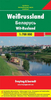
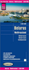

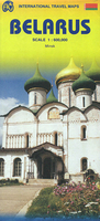
Belarus ITMB
Belarus on an indexed, double-sided map at 1:800, 000 from ITMB with a street plan of Minsk highlighting selected accommodation, embassies, etc. All place names are in the Latin alphabet, with names of main cities also shown in Cyrillic.The map is double-sided, with Minsk included on both sides, and shows the network of the country’s roads and selected local tracks with driving distances marked on main routes and locations of border crossings. Railway lines are included and regional airports are marked. Symbols highlight various places of interest. Topography is indicated by altitude colouring, with graphics showing national parks and other protected areas. The map has latitude and longitude lines at 1º intervals. Each side has a separate index.A large panel provides a street
plan of central Minsk, naming main and selected smaller streets. Metro stations are clearly marked and symbols indicate various facilities and places of interest, including selected hotels and restaurants, foreign embassies, museums, etc.
plan of central Minsk, naming main and selected smaller streets. Metro stations are clearly marked and symbols indicate various facilities and places of interest, including selected hotels and restaurants, foreign embassies, museums, etc.

Product Description
Reviews/Comments
Add New
Vouchers
No voucher codes found.
Do you know a voucher code for this product or supplier? Add it to Insights for others to use.
Do you know a voucher code for this product or supplier? Add it to Insights for others to use.
 Denmark