
 United Kingdom
 France
 Germany
 Netherlands
 Sweden
 USA
USA
 Italy
Italy
 Spain
Spain
More From Contributor

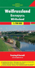
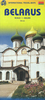
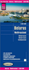


Belarus Road Atlas
Detailed road atlas of Belarus at 1:200, 000 from Belkartografia, with over 150 street plans and English language map legends. Road network includes unpaved cart roads as well as field and forest tracks. Locations of petrol stations, car repair facilities and border crossings are marked and intermediate distances are shown on all paved roads. Railways are shown with stations and local stops.Town are graded according to the number of inhabitants down to villages of less than 500 inhabitants. Administrative centres are indicated and local regional and district boundaries marked. Symbols indicate hotels and “points of feeding”, historical and architectural heritage, war sites and monuments, hospitals and first aid centres, interesting natural features, etc. Boundaries of national
parks and other protected areas are shown. The maps have a latitude grid at intervals of 10’ and longitude at 15’.Following the main section of the atlas are street plans of over 150 towns, with an wide range of symbols showing various facilities: hotels and restaurants, petrol stations and car parks, places of interest, etc. The atlas has an extensive index of localities and also includes a distance table, panels of local traffic signs, an overview map of the country and an administrative map.All place names are in Cyrillic alphabet only. Map legends and the headings for all the sections of the atlas include English.
parks and other protected areas are shown. The maps have a latitude grid at intervals of 10’ and longitude at 15’.Following the main section of the atlas are street plans of over 150 towns, with an wide range of symbols showing various facilities: hotels and restaurants, petrol stations and car parks, places of interest, etc. The atlas has an extensive index of localities and also includes a distance table, panels of local traffic signs, an overview map of the country and an administrative map.All place names are in Cyrillic alphabet only. Map legends and the headings for all the sections of the atlas include English.
Product Description
Reviews/Comments
Add New
Vouchers
No voucher codes found.
Do you know a voucher code for this product or supplier? Add it to Insights for others to use.
Do you know a voucher code for this product or supplier? Add it to Insights for others to use.
 Denmark