More From Contributor
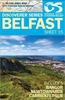
£44.50
Detailed road atlas of Belarus at 1:200, 000 from Belkartografia, with over 150 street plans & English language map legends. Road network

Includes::
unpaved cart roads as well as field & forest tracks. Locations of petrol stations, car repair facilities & border crossings are marked & intermediate distances are shown on all paved roads. Railways are shown with stations & local stops. Town are graded according to the number of inhabitants down to villages of less than 500 inhabitants. Administrative centres are indicated & local regional & district boundaries marked. Symbols indicate hotels and

...
Archived Product
£32.50
Detailed road atlas of Belarus at 1:200, 000 from Belkartografia, with over 150 street plans & English language map legends. Road network

Includes::
unpaved cart roads as well as field & forest tracks. Locations of petrol stations, car repair facilities & border crossings are marked & intermediate distances are shown on all paved roads. Railways are shown with stations & local stops. Town are graded according to the number of inhabitants down to villages of less than 500 inhabitants. Administrative centres are indicated & local regional & district boundaries marked. Symbols indicate hotels & “points of feeding”, historical & architectural heritage, war sites & monuments, hospitals & first aid centres, interesting natural features, etc. Boundaries of national parks & other protected areas are shown. The maps have a latitude grid at intervals of 10’ & longitude at 15’. Following the main section of the atlas are street plans of over 150 towns, with an wide range of symbols showing various facilities: hotels & restaurants, petrol stations & car parks, places of interest, etc. The atlas has an extensive index of localities & also

Includes::
a distance table, panels of local traffic signs, an overview map of the country & an administrative map. All place names are in Cyrillic alphabet only. Map legends & the headings for all the sections of the atlas include English.


...
Archived Product
£14.99
Belarus is perhaps the most inaccessible, unknown & misunderstood country in Europe. This new guide
- the first to focus on the
...
Archived Product
£7.99
Coca-Cola & its logo are everywhere. In our homes, our workplaces, even our schools. It is a company that sponsors the Olympics, backs US presidents & even re-brands Santa Claus. A truly universal product, it has even been served in space. From Istanbul to Mexico City, Mark travels the globe investigating the stories & people Coca-Cola`s iconic advertising campaigns don`t mention. Child labourers in the sugar cane fields of El Salvador. Indian workers exposed to toxic chemicals. Colombian union leaders falsely accused of terrorism & jailed alongside the paramilitaries who want to kill them. & many more... Provocative, funny & stirring, ” Belching Out the Devil” investigates the truth behind one of the planet`s biggest brands. ...
Archived Product
£6.95
Topographic coverage of mainland Spain at 1:50, 000 in the MTN50 (Mapa Topográfico Nacional) series from the Centro Nacional de Información Geografica, the country’s civilian survey organization. The maps have contours at 20m intervals, enhanced by relief shading, plus colouring and/or graphics to show different types of terrain, vegetation or land use. Boundaries of national parks & other protected areas are marked. In addition to all the usual information featured on topographic mapping at this scale, detailed presentation of the road & rail networks, rural tracks & paths, etc, the maps also show campsites & mountain refuges. On more recent editions some GRs, the official long-distance hiking routes, are also marked (although not as clearly as on hiking maps from other publishers). Each map covers 29.5x 18.5 km (with adjustments in the border or coastal areas). The maps have a 1-km UTM grid, plus margin ticks for latitude & longitude at 1` intervals. Map legend is in Spanish only.HOW TO CHOOSE THE RIGHT 50K MAP: all the titles in CNIG’s 200K Provincial Road Maps series at 1:200, 000 are overprinted with the grid for the 1:50, 000 maps & can be used to see the area covered by each 50K title. TO SEE THE LIST OF TITLES IN THIS SERIES PLEASE CLICK ON THE SERIES LINK.PLEASE NOTE
- MAP TITLES: the grids shown on our website serve both the civilian & the military 1:50, 000 topographic series. Although the areas covered by maps in both series are identical (apart from some border or coastal sheets), occasionally map titles differ – only one title is shown on the grid, usually the military one. In Galicia, the Basque country & in the Catalan speaking areas the tendency now is to use local place names rather than the often better known Castilian ones. Where possible, both versions are included in our titles. Map titles listed on our website are based on information received by us at the time of publication, but sometimes maps arrive showing a completely different title! As long as the map number is as ordered, the correct map has been supplied.
...
Archived Product
£6.50
Map No. 15, Belfast, in the Discoverer series from the Ordnance Survey of Northern Ireland presenting the country on detailed topographic maps at 1:50, 000 with waymarked hiking trails, Sustrans National Cycle Network & other tourist information. Coverage in this title

Includes::
Bangor, Newtownards & Carrickfergus. The maps have contours at 10m intervals, with plenty of spot heights & bold altitude colouring above 150m. Graphics indicate different types of woodlands. In coastal areas the maps show high & low water mark, cliffs, mud/shingle or s&, etc. Road network grades minor roads according to their widths,

Includes::
local tracks & shows gradients on steep routes. Railways are shown with stations & the maps include other details expected of topographic mapping at this scale. An overprint highlights waymarked walking trails as well as cycle routes of the Sustrans National Cycle Network. Boundaries of National Trust land are marked, indicating areas with limited opening. Places of interest are prominently highlighted & a range of symbols provide other tourist information including camping or caravan sites & youth hostels, bus stations, parking, picnic areas, viewpoints, gold courses, etc. Each map covers an area of 40 x 30km (25 x 19 miles approximately) & has a 1km UTM grid, plus latitude & longitude margin ticks at 1' intervals. Map legend is English, French & German. On the reverse each sheet has an indexed monochrome map showing townland boundaries. Please note: numbers not listed here cover the Irish Republic (Eire) & are shown on our website in a separate


...
Archived Product
£6.50
Belfast, map No. 15 in the Discoverer series from the Ordnance Survey of Northern Ireland presenting the country on detailed topographic maps at 1:50, 000 with waymarked hiking trails, Sustrans National Cycle Network & other tourist information. Coverage

Includes::
Bangor, Newtownards & Carrickfergus. Current edition G; publication date June 2013. Maps in this series have contours at 10m intervals, with plenty of spot heights & bold altitude colouring above 150m. Graphics indicate different types of woodlands. In coastal areas the maps show high & low water mark, cliffs, mud/shingle or s&, etc. Road network grades minor roads according to their widths,

Includes::
local tracks & shows gradients on steep routes. Railways are shown with stations & the maps include other details expected of topographic mapping at this scale. An overprint highlights waymarked walking trails as well as cycle routes of the Sustrans National Cycle Network. Boundaries of National Trust land are marked, indicating areas with limited opening. Places of interest are prominently highlighted & a range of symbols provide other tourist information including camping or caravan sites & youth hostels, bus stations, parking, picnic areas, viewpoints, gold courses, etc. Each map covers an area of 40 x 30km (25 x 19 miles approximately) & has a 1km UTM grid, plus latitude & longitude margin ticks at 1' intervals. Map legend is English, French & German. On the reverse each sheet has an indexed monochrome map showing townland boundaries.PLEASE NOTE: numbers not listed here cover the Irish Republic (Eire) & are shown on our website in a separate


...
Archived Product
£6.30
Belfast at 1:12, 000 on a large double-sided street plan from the Ordnance Survey of Northern Irel&, with a separate index booklet & information which

Includes::
one way streets, National Cycle Network cycle paths, etc. Coverage extends east to include Dundonald & Ballybeen shown as an inset. The map highlights main traffic arteries across the city & shows one way streets & car parks. Railway lines are shown with station names. Public buildings are highlighted & named. The map shows Sustrans National Cycle Network cycle paths, tow paths & waymarked walking trails. Local administrative boundaries are marked & the map also has 1-km Irish national grid lines. Street index is in a separate booklet attached to the map cover. Current edition of this map was published in 2013.

...
Archived Product
£6.50
Belfast, map No. 15 in the Discoverer series from the Ordnance Survey of Northern Ireland presenting the country on detailed topographic maps at 1:50, 000 with waymarked hiking trails, Sustrans National Cycle Network & other tourist information. Coverage

Includes::
Bangor, Newtownards & Carrickfergus. Current edition G; publication date June 2013. Maps in the Discoverer series have contours at 10m intervals, with plenty of spot heights & bold altitude colouring above 150m. Graphics indicate different types of woodlands. In coastal areas the maps show high & low water mark, cliffs, mud/shingle or s&, etc. Road network grades minor roads according to their widths,

Includes::
local tracks & shows gradients on steep routes. Railways are shown with stations & the maps include other details expected of topographic mapping at this scale. An overprint highlights waymarked walking trails as well as cycle routes of the Sustrans National Cycle Network. Boundaries of National Trust land are marked, indicating areas with limited opening. Places of interest are prominently highlighted & a range of symbols provide other tourist information including camping or caravan sites & youth hostels, bus stations, parking, picnic areas, viewpoints, gold courses, etc. Each map covers an area of 40 x 30km (25 x 19 miles approximately) & has a 1km Irish Grid, plus latitude & longitude margin ticks at 1` intervals. Map legend is English, French & German. On the reverse each sheet has an indexed monochrome map showing townland boundaries. To see the list of all the titles in this series please click on the series link.


...
Archived Product
£3.50
Belfast Bloomfield in 1902 in a fascinating series of reproductions of old Ordnance Survey plans in the Alan Godfrey Editions, ideal for anyone interested in the history of their neighbourhood or family. The map covers parts of east Belfast, east of the Lagan. Coverage stretches from Conn`s Water & Belfast Rope Works eastward to Greenwood, & from Dundela Avenue southward to Orangefield house. Features include Belfast Rope Works, Grove Weaving Factory, Grove Mill, tramways & Knock tram depot, Knock Nursery, Belmont Park area, Greenwood area, Dundela House, Upper Newtownards Road area, Belfast & County Down Railway with Neill`s Hill station, St Columba`s church, Ballyhackamore, Knock River, Neill`s Hill, St Donard`s church, Clara Park, Loop Bridge, Holywood Arches, many villas, plus terraces nearer the city, Knock church (in ruins), Bloomfield House, etc. On the reverse is a selection of street directory entries, including Cheviot Avenue, Cyprus Avenue/ Gardens/ Park, King`s Road, Moorfield Street, Moorgate Street, Newtownards Road Upper, Nevis Avenue & Ravenscroft Street. * About the Alan Godfrey Editions of the 25” OS Series: Selected towns in Great Britain & Ireland are covered by maps showing the extent of urban development in the last decades of the 19th & early 20th century. The plans have been taken from the Ordnance Survey mapping & reprinted at about 15 inches to one mile (1:4, 340). On the reverse most maps have historical notes & many also include extracts from contemporary directories. Most maps cover about one mile (1.6kms) north/south, one & a half miles (2.4kms) across; adjoining sheets can be combined to provide wider coverage.FOR MORE INFORMATION & A COMPLETE LIST OF ALL AVAILABLE TITLES PLEASE CLICK ON THE SERIES LINK. ...
Archived Product

Belfast

Belfast at 1:12, 000 on a large double-sided street plan from the Ordnance Survey of Northern Ireland, with a separate index booklet and information which includes one way streets, National Cycle Network cycle paths, etc.Coverage extends east to include Dundonald and Ballybeen shown as an inset. The map highlights main traffic arteries across the city and shows one way streets and car parks. Railway lines are shown with station names. Public buildings are highlighted and named. The map shows Sustrans National Cycle Network cycle paths, tow paths and waymarked walking trails. Local administrative boundaries are marked and the map also has 1-km Irish national grid lines. Street index is in a separate booklet attached to the map cover.
RIP - This product is no longer available on our network. It was last seen on 25.09.2019

This page now acts as a permanent archive for this product. Add more information using the comments box below to ensure it can still be found by future generations.

Use our search facility to see if it is available from an alternative contributor.
  • External links may include paid for promotion
  • Availability: Out Of Stock
  • Supplier: Stanfords
  • SKU: 9781905306534
Availability: In Stock
£6.30

Product Description

Belfast at 1:12, 000 on a large double-sided street plan from the Ordnance Survey of Northern Irel&, with a separate index booklet & information which

Includes::
one way streets, National Cycle Network cycle paths, etc. Coverage extends east to include Dundonald & Ballybeen shown as an inset. The map highlights main traffic arteries across the city & shows one way streets & car parks. Railway lines are shown with station names. Public buildings are highlighted & named. The map shows Sustrans National Cycle Network cycle paths, tow paths & waymarked walking trails. Local administrative boundaries are marked & the map also has 1-km Irish national grid lines. Street index is in a separate booklet attached to the map cover.

Reviews/Comments

Add New

Price History

Vouchers

No voucher codes found.
Do you know a voucher code for this product or supplier? Add it to Insights for others to use.

Facebook

Jargon Buster

Car - A machine used for transport which runs on roads
Network - A link and communication between things. Often computers or people.
Km - Kilometre. A unit of measurement equal to 1000 metres.
Large - something that takes up more space than normal.

Supplier Information

Stanfords
Stanfords was established in 1853 and opened their iconic Covent Garden flagship store in 1901. They have become the top retailer of maps, travel books and accessories in the UK and arguably offer the largest selection of maps and travel books worldwide. Famous names such as Captain Robert Falcon Scott, Ranulph Fiennes and Michael Palin have purchased from Stanfords. They now have a shop in Bristol and both stores together with other venues operate a calendar of events including talks, book signings and exhibitions. As a specialist map retailer, the map selection is comprehensive and includes road maps, street maps and walking maps from worldwide destinations, as well as a selection of world atlases and wall maps. Books include travel guides and travel literature. Stanfords also stock globes, from miniatures made of blue marble to magnificent floor-standing globes. The website features a selection of interesting articles on travel topics.
Page Updated: 2023-11-12 20:15:36

Community Generated Product Tags

Oh No! The productWIKI community hasn't generated any tags for this product yet!
Menu