
 United Kingdom
 France
 Germany
 Netherlands
 Sweden
 USA
USA
 Italy
Italy
 Spain
Spain
More From Contributor


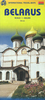
Belarus (Cyrillic Edition)
Indexed road map of Belarus at 1:850, 000 from Belkartographia with street plans of Brest, Vitebsk, Homiel, Hrodna, Minsk and Mogilev. *All text is Cyrillic alphabet*. The main map shows the major road network with distances marked in kilometres. Local roads are marked, with colouring used to show which have pavements and which do not. Fuelling stations, both petrol and gas, are clearly marked; other local facilities including hotels, camping-sites and check-points are shown. Longitude and latitude lines are marked at 1° and 40’ intervals respectively. A handy table of driving distances is included with the main map for cities with a population of over 50, 000.The reverse of the map has street plans of Brest (1:69, 000), Vitebsk (1:69, 000), Homiel (1:86, 000), Hrodna (1:69,
000), Minsk (1:88, 000) and Mahiliou (1:86, 000). Major street names are marked, as are railway lines and stations, bus and coach staitions, and airports. Points of interest including hotels and restaurants are indicated.
000), Minsk (1:88, 000) and Mahiliou (1:86, 000). Major street names are marked, as are railway lines and stations, bus and coach staitions, and airports. Points of interest including hotels and restaurants are indicated.
Product Description
Reviews/Comments
Add New
Vouchers
No voucher codes found.
Do you know a voucher code for this product or supplier? Add it to Insights for others to use.
Do you know a voucher code for this product or supplier? Add it to Insights for others to use.
 Denmark