More From Contributor
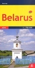
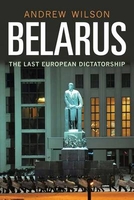
£12.99
Topographic survey of France at 1:25, 000 in IGN`s excellent TOP25 / Série Bleue series. All the maps are GPS compatible, with a 1km UTM grid plus latitude & longitude lines at 5’ intervals. Contours are at 5m intervals except for mountainous areas where the maps have contours at 10m intervals, vividly enhanced by hill shading & graphics for rocky terrain. Colouring with graphics indicates different types of vegetation or land use (deciduous or coniferous forests, moors, orchards, vineyards, etc). PLEASE NOTE: coverage of France at this scale is currently being revised – the format & the presentation of each title are indicated by the letters at the end of its Sheet Reference number (e.g. 0416ET, 3531ETR, 1923SB, etc.)MAPS WITH FULL TOURIST OVERPRINT & AN ENGLISH MAP LEGEND: all TOP25 maps & the SB editions of Série Bleue have an overprint highlighting waymarked walking trails including long-distance GR routes &, where appropriate, ski routes. Symbols indicate campsites, gîtes d’etape, refuges, equestrian centres & other recreational facilities or sites, tourist information centres, cultural heritage, etc. Towns & locations of particular interest are highlighted.- ET or OT = single-sided TOP25 map covering approx. 29x 21 km / 18x 13 miles.- ETR or OTR = waterproof & tear resistant TOP25 map covering the same area as the corresponding ET or OT number, but double-sided, printed on a smaller size sheet with a good overlap between the sides.- SB = Série Bleue map with full tourist overprint; these maps, first introduced in summer 2014, each cover approx. 29x 24km / 18x 15 miles.SÉRIE BLEUE maps with numbers ending in E (Est) or O (Ouest): most editions now indicate the GR routes, but do not show any other tourist information. Map legend is in French only. Each map covers approx. 14x 20km / 9x 12 miles. ...
Archived Product
£9.95
Double-sided road map of the country with hill shading & elevation tinting to represent the relief. Intermediate driving distances on many roads are marked & railways & navigable canals are shown. Symbols denote airports, border crossing points, churches, castles & selected sites of interest. Regional boundaries, national parks & swamp areas are marked. Latitude & longitude lines are drawn at 1 ...
Archived Product
£6.50
Very detailed, indexed road map of Belarus with all names in Cyrillic alphabet only, but with map legend which

Includes::


...
Archived Product
£11.99
Belarus at 1:750, 000 on an indexed detailed road map from the Riga-based Jana Seta publishers showing a large number of small villages & highlighting various locations of interest. All place names are shown transliterated. The map shows the country’s road network, including selected local dirt tracks, indicating driving distance on main routes & border crossings with full or limited access. Railway lines are also included & local airports are marked. The map also shows internal administrative boundaries with names of the provinces. Towns or villages & other places of interest are highlighted. The terrain is shown by colouring for woodlands & graphics for marshlands. National parks are highlighted. Also marked is the extent of the zone affected by the Chernobyl explosion. The map has latitude & longitude lines at intervals of 30’. The index is on the reverse. Map legend

Includes::
English.

...
Archived Product
£6.50
Very detailed, indexed road map of Belarus with all names in Cyrillic alphabet only, but with map legend which

Includes::


...
Archived Product
£9.95
Indexed road map of Belarus at 1:850, 000 from Belkartographia with street plans of Brest, Vitebsk, Homiel, Hrodna, Minsk & Mogilev. All text is Cyrillic alphabet. The main map shows the major road network with distances marked in kilometres. Local roads are marked, with colouring used to show which have pavements & which do not. Fuelling stations, both petrol & gas, are clearly marked; other local facilities including hotels, camping-sites & check-points are shown. Longitude & latitude lines are marked at 1 ...
Archived Product
£9.99
Indexed road map of Belarus at 1:850, 000 from Belkartographia with street plans of Brest, Vitebsk, Homiel, Hrodna, Minsk & Mogilev. * All text is Cyrillic alphabet*. The main map shows the major road network with distances marked in kilometres. Local roads are marked, with colouring used to show which have pavements & which do not. Fuelling stations, both petrol & gas, are clearly marked; other local facilities including hotels, camping-sites & check-points are shown. Longitude & latitude lines are marked at 1° & 40’ intervals respectively. A handy table of driving distances is included with the main map for cities with a population of over 50, 000. The reverse of the map has street plans of Brest (1:69, 000), Vitebsk (1:69, 000), Homiel (1:86, 000), Hrodna (1:69, 000), Minsk (1:88, 000) & Mahiliou (1:86, 000). Major street names are marked, as are railway lines & stations, bus & coach staitions, & airports. Points of interest including hotels & restaurants are indicated. ...
Archived Product
£12.99
Indexed road map of Belarus at 1:850, 000 from Belkartographia with all place names shown in Latin alphabet. Enlargements show main transit routes & streets in Brest, Vitebsk, Homiel, Hrodna, Minsk & Mogiliev. All place names The map shows the road network in detail, indicating driving distances on small local roads. Locations of fuel supplies & car repair services are marked. Border crossings symbols indicate those for all the vehicles, cars only, or cars & buses. Symbols also indicate locations with tourist accommodation. Railways are

Includes::
& local airports are marked. Longitude & latitude lines are marked at 1° & 40’ intervals respectively. A handy table of driving distances is included with the main map for cities with a population of over 50, 000. On the reverse are street maps of Brest (1:69, 000), Vitebsk (1:69, 000), Homiel (1:86, 000), Hrodna (1:69, 000), Minsk (1:88, 000) & Mahiliou/ Mogiliev (1:86, 000) highlighting main traffic arteries & naming a selection of streets. The maps show locations of fuel supplies, car repair facilities & car parks, as well as selected hotels & restaurants or cafes. Map legend & all the text is in English.

...
Archived Product
£6.95
Belarus in the Culture Smart range of pocket-sized guide books; providing detailed information on local customs, culture, etiquette & manners & ensuring that visitors are prepared for a diverse range of social environments. The series covers an extensive number of countries worldwide & are designed both for those working & living abroad, as well as for visitors who do not want to offend, either intentionally or inadvertently. Their aim is to prevent readers from making embarrassing mistakes & feel confident in unfamiliar situations, while preparing them before arrival on what to expect & how to behave. Each guide is arranged thematically, with dedicated individual chapters on land & people, values & attitudes, customs & traditions, making friends, people at home, ‘time-out’, travelling & communicating. There is also a separate chapter for business travelers, with important information on subjects such as business culture, meetings & making appointments. A Further Reading section also offers a list of recommended other history, travel literature & language titles available on the country. ...
Archived Product
£18.99
Belarus in the Travel Guide series from Bradt; encompassing a comprehensive range of titles to destinations worldwide, with a particular focus on Africa, Central & South America. Bradt are one of the country’s leading independent publishers & have an ethos that focuses on responsible travel, in alliance with a philosophy of sustainability; both in the destinations the guides cover but also in encouraging tourists to limit the impact they have on the local environment. Bradt guides have a reputation for appealing to more independent travelers & often cover destinations that are not available from other publishers. Each guide opens with two comprehensive chapters on Background & Practical Information, covering details of the country’s geography, culture, natural history, government & politics, economy, people, language, religion, education & culture. Important practical advice

Includes::
when to visit, highlights, suggested itineraries, tour operators, red tape, embassies & consulates, getting there & away, health, safety, what to take, money, budgeting, getting around, accommodation, eating & drinking, public holidays, shopping, arts & entertainment, media & communications, business, travel culture & cultural etiquette. Individual sections are organized geographically by region & typically open with information on practicalities & orientation, before focusing on what to see & where to go. Information on what to see, where to stay, where to eat & how to find your way around is provided, with a range of budgets catered for. Simple black & white maps locate key visitor sites & places of accommodation. Bradt Travel Guides include appendices that provide an in-depth introduction to the language of each country, a glossary of terms & a listing of books & internet resources providing further information on the destination.

...
Archived Product

Belarus

This book is the first in English to explore both Belarus` complicated road to nationhood and to examine in detail its politics and economics since 1991, the nation`s first year of true independence. Andrew Wilson focuses particular attention on Aliaksandr Lukashenka`s surprising longevity as president, despite human rights abuses and involvement in yet another rigged election in December 2010. Wilson looks at Belarusian history as a series of false starts in the medieval and pre-modern periods, and at the many rival versions of Belarusian identity, culminating with the Soviet Belarusian project and the establishment of Belarus` current borders during World War II. He also addresses Belarus` on-off relationship with Russia, its simultaneous attempts to play a game of balance in the
no-man`s-land between Russia and the West, and how, paradoxically, Belarus is at last becoming a true nation under the rule of Europe`s ”last dictator”.
RIP - This product is no longer available on our network. It was last seen on 25.09.2019

This page now acts as a permanent archive for this product. Add more information using the comments box below to ensure it can still be found by future generations.

Use our search facility to see if it is available from an alternative contributor.
  • External links may include paid for promotion
  • Availability: Out Of Stock
  • Supplier: Stanfords
  • SKU: 9780300134353
Availability: In Stock
£20.00

Product Description

This book is the first in English to explore both Belarus` complicated road to nationhood & to examine in detail its politics & economics since 1991, the nation`s first year of true independence. Andrew Wilson focuses particular attention on Aliaksandr Lukashenka`s surprising longevity as president, despite human rights abuses & involvement in yet another rigged election in December 2010. Wilson looks at Belarusian history as a series of false starts in the medieval & pre-modern periods, & at the many rival versions of Belarusian identity, culminating with the Soviet Belarusian project & the establishment of Belarus` current borders during World War II. He also addresses Belarus` on-off relationship with Russia, its simultaneous attempts to play a game of balance in the no-man`s-land between Russia & the West, & how, paradoxically, Belarus is at last becoming a true nation under the rule of Europe`s ”last dictator”.

Reviews/Comments

Add New

Intelligent Comparison

Oooops!
We couldn't find anything!
Perhaps this product's unique.... Or perhaps we are still looking for comparisons!
Click to bump this page and we'll hurry up.

Price History

Vouchers

No voucher codes found.
Do you know a voucher code for this product or supplier? Add it to Insights for others to use.

Facebook

Jargon Buster

Human - A highly developed and adapted mamal and deminant species on earth
History - Anything that happens in the past. An acedemic subject.
World - A physical grouping, commonly used to describe earth and everything associated with ti
Year - The time it takes the planet earth to orbit the sun. This takes around 365.25 days.
Road - a manmade lane or a path that is used to speed up travel.
Balance - Something that is evenly weighted to keep something upright.
Year - 365 days (366 days in a leap year), the time taken for planet earth to make one full revolution around the sun.
Borders - A line that sometimes can be built up separating off an area, e.g. countries "the welsh boarder"

Supplier Information

Stanfords
Stanfords was established in 1853 and opened their iconic Covent Garden flagship store in 1901. They have become the top retailer of maps, travel books and accessories in the UK and arguably offer the largest selection of maps and travel books worldwide. Famous names such as Captain Robert Falcon Scott, Ranulph Fiennes and Michael Palin have purchased from Stanfords. They now have a shop in Bristol and both stores together with other venues operate a calendar of events including talks, book signings and exhibitions. As a specialist map retailer, the map selection is comprehensive and includes road maps, street maps and walking maps from worldwide destinations, as well as a selection of world atlases and wall maps. Books include travel guides and travel literature. Stanfords also stock globes, from miniatures made of blue marble to magnificent floor-standing globes. The website features a selection of interesting articles on travel topics.
Page Updated: 2023-11-12 20:15:36

Community Generated Product Tags

Oh No! The productWIKI community hasn't generated any tags for this product yet!
Menu