
 United Kingdom
 France
 Germany
 Netherlands
 Sweden
 USA
USA
 Italy
Italy
 Spain
Spain
More From Contributor


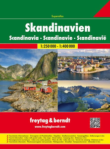
Scandinavia F&B Road Atlas
Spiral-bound atlas of Scandinavia covering Norway, Denmark, Sweden, Finland, the Benelux and norther Germany at a scale of 1:250, 000-400, 000. Small parts of the adjacent countries are also covered. Details combines clear road mapping with subtle hillshading and peak heights.Eight different types of roads are shown, with clearly marked road names, distances between junctions, gradients, service stations, parkings and motels. Toll roads, border crossings and scenic & tourists routes are also indicated. Railways, ferry lines, and national & provincial boundaries are marked alongside national parks and military areas. Also a series of symbols depicts places of interest, viewpoints, airports & harbours, campings, archeological sites and mountain huts.Following the main mapping
is an extensive index with postal codes, and 33 street plans of major town centres at 1:15, 000 with corresponding indexes.All Legends are in 8 different languages including English.
is an extensive index with postal codes, and 33 street plans of major town centres at 1:15, 000 with corresponding indexes.All Legends are in 8 different languages including English.

Product Description
Reviews/Comments
Add New
Intelligent Comparison
Archived Product
Saudi Arabia Road Atlas Stanfords
£54.95
Archived Product
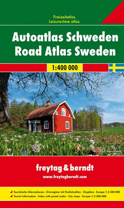
Sweden F&B Road Atlas Stanfords
£18.50
Archived Product
India Road Atlas Stanfords
£17.50
Archived Product
India Road Atlas Stanfords
£4.95
Archived Product
India Road Atlas Stanfords
£17.50
Archived Product
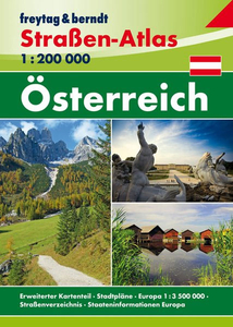
Austria F&B Road Atlas Stanfords
£13.99
Vouchers
No voucher codes found.
Do you know a voucher code for this product or supplier? Add it to Insights for others to use.
Do you know a voucher code for this product or supplier? Add it to Insights for others to use.
 Denmark