More From Contributor

£21.99
Clear & colourful 79x 99cm wallmap of Norway, Sweden, Denmark, Finland & the Baltic States. Iceland & the Faeroes are shown in an inset. Towns, main roads & railways are marked, along with elevation colouring & provincial boundaries. Legend in English. The publishers, Norstedts Kartförlaget, is the now privatized section of Sweden’s national survey organization, Lantmäteriet. ...
Archived Product
£5.99
The Michelin National road map of Scandinavia & Finland at 1:1, 500, 000 scale is ideal for route planning. The map gives comprehensive coverage of national road networks showing all major motorways, dual carriageways, national & regional main roads & some single-lane roads. Also shows unsurfaced roads & tracks & major footpaths. The map is divided by grid showing latitude & longitude. Distances between major locations are marked along roads, with total distance & several intermediate distances shown. A quick-reference chart of distances & driving times between major locations is also included. The map also

Includes::
a grid-referenced index of principal place names. Clear, easy-to read cartography shows roads in reds, yellows & white with black outlines. Woodland & forest is marked with green shading. Built-up urban areas are clearly marked in yellow. Airports, ferries, railways, are also marked. National divisions are marked, as are areas restricted to foreigners & towns having a toll (Norway only). Places of interest such as waterfalls, historical houses & rock carvings are also shown. Also

Includes::
a quick reference panel giving national driving regulations, including speed limits, equipment requirements (e.g. bulb kits, warning triangles) & seatbelt rules, for all countries principally shown. Town plans & regional enlargements:- Stockholm area at 1:250, 000 scale- Helsinki at 1:250, 000 scale- Oslo at 1:250, 000 scale- Copenhagen at 1:250, 000 scale- Bergen at 1:250, 000 scale- Gothenburg at 1:250, 000 scale


...
Archived Product
£14.99
Scandinavia & Finland in the Green Guide series from Michelin; detailed guides exploring the major sights & attractions of a range of cities, regions & countries. Drawing on a long publishing history, Michelin guides are renowned for their individual ...
Archived Product
£5.99
Scandinavia & Finland map at 1:1, 500, 000 from Michelin, including the whole of Denmark, Norway, & Sweden, with enlargements showing in greater detail road networks around Helsinki, the Copenhagen
- Malmo area, Oslo, Bergen, Stockholm & Gothenburg. Road network is presented graded according to the width & the number of lanes, indicating full/limited interchanges, toll barriers, driving distances, steep sections, seasonal closures, etc. The map also highlights scenic roads & tourist routes. Railway lines & ferry routes are included & local airports are marked. Symbols highlight various places of interest & mark locations of campsites. Within each country the map also shows internal administrative boundaries with names of the provinces. Topography is indicated by relief shading with colouring for the forested areas. National parks are highlighted. Latitude & longitude lines are drawn at intervals of 1°. The index, arranged by country, is next to the map. Multilingual map legend

Includes::
English. Insets show in greater detail road networks around Helsinki, the Copenhagen
- Malmo
- Helsingborg area, Oslo, Bergen, Stockholm & Gothenburg. Also included are a distance table, basic traffic regulations, plus a seasonal chart indicating the length of daylight.


...
Archived Product
£16.99
Experience Scandinavia with Lonely Planet. Our 9th edition will help you explore the distinct Nordic landscapes across the seasons
-
...
Archived Product
£140.00
Sweden & Norway, an original antique map by S.A. Mitchell, published in Philadelphia, 1846. Copperplate, original colour. Map size 25 x 30 cm, overall mounted size 40.5 x 46 cm.A detailed map of these two Scandinavian countries. Samuel Augustus Mitchell's New Universal Atlas.. . comprised finely engraved & delicately h&-coloured maps & plans of all areas of the world. Antique maps from various original publishers are presented on the Stanford ...
Archived Product
£29.99
Spiral-bound atlas of Scandinavia covering Norway, Denmark, Sweden, Finl&, the Benelux & norther Germany at a scale of 1:250, 000-400, 000. Small parts of the adjacent countries are also covered. Details combines clear road mapping with subtle hillshading & peak heights. Eight different types of roads are shown, with clearly marked road names, distances between junctions, gradients, service stations, parkings & motels. Toll roads, border crossings & scenic & tourists routes are also indicated. Railways, ferry lines, & national & provincial boundaries are marked alongside national parks & military areas. Also a series of symbols depicts places of interest, viewpoints, airports & harbours, campings, archeological sites & mountain huts. Following the main mapping is an extensive index with postal codes, & 33 street plans of major town centres at 1:15, 000 with corresponding indexes. All Legends are in 8 different languages including English. ...
Archived Product
£16.99
Scandinavia Insight Guide is dedicated to exploring the destination in detail with a selection of glossy illustrations. Extensive introductory sections explore the region’s history & culture & there are also short articles written by locals about distinctive local issues, whilst selective photo-features illustrate the variety of the place. The ‘ Places’ section is grouped geographically & provides details of the area including places to visit, suggestions for tours & other activities. Each section has its own listings of the best restaurants, bars & cafes. Essential practical information is provided in the Travel Tips chapter on accommodation, shopping & local activities. A useful location finder & travel tip index with relevant page numbers are given on the inside covers. Overview street plans are also provided for the main cities in the region or country. ...
Archived Product
£9.99
Scandinavia at 1:1, 350, 000 on an indexed map from ITMB, presenting on one side Denmark with southern Norway & Sweden, & on the reverse, with an overlap between the sides, northern Norway & Sweden with Finl&. Road & rail networks are shown on a single-colour green background, with topography indicated only by spot heights. Also marked are selected ferry connections annotated with the duration of transit. Symbols indicate various places of interest & facilities; the map also shows national parks & restricted entry zones. Latitude & longitude lines are drawn at 1º & 2º respectively. Each side has a separate index. ...
Archived Product
£16.99
Scandinavia at 1:2, 765, 000 on a wall map,

Size:
77 x 60cm (30” x 24” approx) – encapsulated version,

...
Archived Product

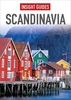
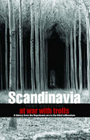
Scandinavia - At War With Trolls

This work is a compact, briskly-written introduction to the history, politics and culture of Sweden, Finland, Norway and Denmark, from the Napoleonic era to the present. It aims to diminish national stereotypes. It describes the salient events and personalities, including artists, musicians and intellectuals such as Ibsen, Bergman, Kierkegaard, Munch and Sibelius.
RIP - This product is no longer available on our network. It was last seen on 25.09.2019

This page now acts as a permanent archive for this product. Add more information using the comments box below to ensure it can still be found by future generations.

Use our search facility to see if it is available from an alternative contributor.
  • Availability: Out Of Stock
  • Supplier: Stanfords
  • SKU: 9781850653172
Availability: In Stock
£12.95

Product Description

This work is a compact, briskly-written introduction to the history, politics & culture of Sweden, Finl&, Norway & Denmark, from the Napoleonic era to the present. It aims to diminish national stereotypes. It describes the salient events & personalities, including artists, musicians & intellectuals such as Ibsen, Bergman, Kierkegaard, Munch & Sibelius.

Reviews/Comments

Add New

Intelligent Comparison

Oooops!
We couldn't find anything!
Perhaps this product's unique.... Or perhaps we are still looking for comparisons!
Click to bump this page and we'll hurry up.

Price History

Vouchers

No voucher codes found.
Do you know a voucher code for this product or supplier? Add it to Insights for others to use.

Facebook

Jargon Buster

Denmark - A country in Scandinavia, Northern Europe.
compact - Carefuly designed to ensure an item has a minimal physical size
History - Anything that happens in the past. An acedemic subject.
Compact - something that has a lot combined within a small space.

Supplier Information

Stanfords
Stanfords was established in 1853 and opened their iconic Covent Garden flagship store in 1901. They have become the top retailer of maps, travel books and accessories in the UK and arguably offer the largest selection of maps and travel books worldwide. Famous names such as Captain Robert Falcon Scott, Ranulph Fiennes and Michael Palin have purchased from Stanfords. They now have a shop in Bristol and both stores together with other venues operate a calendar of events including talks, book signings and exhibitions. As a specialist map retailer, the map selection is comprehensive and includes road maps, street maps and walking maps from worldwide destinations, as well as a selection of world atlases and wall maps. Books include travel guides and travel literature. Stanfords also stock globes, from miniatures made of blue marble to magnificent floor-standing globes. The website features a selection of interesting articles on travel topics.
Page Updated: 2023-11-12 20:15:36

Community Generated Product Tags

Oh No! The productWIKI community hasn't generated any tags for this product yet!
Menu