
 United Kingdom
 France
 Germany
 Netherlands
 Sweden
 USA
USA
 Italy
Italy
 Spain
Spain
More From Contributor


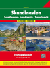


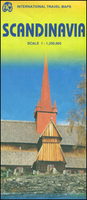
Scandinavia ITMB
Scandinavia at 1:1, 350, 000 on an indexed map from ITMB, presenting on one side Denmark with southern Norway and Sweden, and on the reverse, with an overlap between the sides, northern Norway and Sweden with Finland. Road and rail networks are shown on a single-colour green background, with topography indicated only by spot heights. Also marked are selected ferry connections annotated with the duration of transit. Symbols indicate various places of interest and facilities; the map also shows national parks and restricted entry zones. Latitude and longitude lines are drawn at 1º and 2º respectively. Each side has a separate index.

Product Description
Reviews/Comments
Add New
Vouchers
No voucher codes found.
Do you know a voucher code for this product or supplier? Add it to Insights for others to use.
Do you know a voucher code for this product or supplier? Add it to Insights for others to use.
 Denmark