
 United Kingdom
 France
 Germany
 Netherlands
 Sweden
 USA
USA
 Italy
Italy
 Spain
Spain
More From Contributor


Preston West 1909
Preston West in 1909 in a fascinating series of reproductions of old Ordnance Survey plans in the Alan Godfrey Editions, ideal for anyone interested in the history of their neighbourhood or family. The map covers the western part of Preston, including the dock area. Coverage stretches from Brook Street westward to Ashton Park, and from Eldon Street southward to the River Ribble. Features include railways with LNWR engine shed, Greenbank Goods station, Maudland Goods station, Maudland Viaduct, lines in docks; English Electric Works, United Electric Car Works, Albert Edward Dock, Spa Mill, Wellfield Road Mill, St Walburge`s RC church, Caledonian Mill, Fylde Road Mill, Soho Foundry, Lancaster Canal, tramways, Aqueduct Mill, Progress Mill, Eldon Street Mill, Brookhouse
Mill, Shelley Road Mills, Arkwright Mill, Ashton on Ribble area, Ashton Park, Tulketh Hall, etc. On the reverse are extracts from a street directory, including Fylde Road, Marsh Lane, Maudland Bank, Waterloo Road, Waterloo Terrace and Watery Lane. About the Alan Godfrey Editions of the 25” OS Series:Selected towns in Great Britain and Ireland are covered by maps showing the extent of urban development in the last decades of the 19th and early 20th century. The plans have been taken from the Ordnance Survey mapping and reprinted at about 15 inches to one mile (1:4, 340). On the reverse most maps have historical notes and many also include extracts from contemporary directories. Most maps cover about one mile (1.6kms) north/south, one and a half miles (2.4kms) across; adjoining
sheets can be combined to provide wider coverage.FOR MORE INFORMATION AND A COMPLETE LIST OF ALL AVAILABLE TITLES PLEASE CLICK ON THE SERIES LINK.

Product Description
Reviews/Comments
Add New
Intelligent Comparison
Archived Product
Rishton West 1909 Stanfords
£2.95
Archived Product

Rishton West 1909 Stanfords
£3.50
Archived Product

Preston Central 1909 Stanfords
£3.50
Archived Product

Weston East 1902 Stanfords
£3.50
Archived Product
Denton West 1916 Stanfords
£2.95
Archived Product

Denton West 1916 Stanfords
£3.50
Archived Product
Halesowen West 1901 Stanfords
£2.95
Archived Product
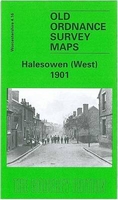
Halesowen West 1901 Stanfords
£3.50
Vouchers
No voucher codes found.
Do you know a voucher code for this product or supplier? Add it to Insights for others to use.
Do you know a voucher code for this product or supplier? Add it to Insights for others to use.
 Denmark