
 United Kingdom
 France
 Germany
 Netherlands
 Sweden
 USA
USA
 Italy
Italy
 Spain
Spain
More From Contributor


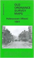
Halesowen West 1901
Halesowen West in 1901 in a fascinating series of reproductions of old Ordnance Survey plans in the Alan Godfrey Editions, ideal for anyone interested in the history of their neighbourhood or family. Selected towns in Great Britain and Ireland are covered by maps showing the extent of urban development in the last decades of the 19th and early 20th century.In this title: the map covers the western part of Halesowen and part of Hasbury, including Lower Hasbury and the suburbs of Town's End, Spring Hill and Short Cross. Features include St John the Baptist church, Otterbourne Court, Spring Villas, Grammar School, Newfield House, Hasbury Farm, Lower Hasbury, St Margaret's Well, Sampson & Lion pub, Witley Colliery, Lutley Mill, Bassnage Farm. On the reverse is a commercial
directory of Halesowen in 1896. About the Alan Godfrey Editions of the 25
directory of Halesowen in 1896. About the Alan Godfrey Editions of the 25
Product Description
Reviews/Comments
Add New
Intelligent Comparison
Archived Product
Halesowen West 1901 Stanfords
£3.50
Archived Product

Halesowen East 1913 Stanfords
£3.50
Archived Product
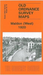
Maldon West 1920 Stanfords
£3.50
Archived Product
Preston West 1909 Stanfords
£3.50
Vouchers
No voucher codes found.
Do you know a voucher code for this product or supplier? Add it to Insights for others to use.
Do you know a voucher code for this product or supplier? Add it to Insights for others to use.
 Denmark