More From Contributor
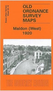
£4.99
Maldives in the Pocket Guide series from Berlitz; a collection of handy, pocket-sized guides dedicated to an extensive range of cities, regions & countries worldwide. Written in narrative form, individual guides explore the history, main sights & attractions, food & drink, accommodation & local culture of the destination in detail. Each Berlitz pocket guide has a similar format, with colour-coded sections helping readers locate information quickly in addition to distinctive chapters exploring the city or region. An introduction outlines the destination for visitors & a section dedicated to `A Brief History` actually explores the area in relative depth. A where to go chapter is organized by region & city & is written in prose form with references to individual sites highlighted in bold for clarity. There are also further suggestions on where & when to eat. Recommendations for leisure activities in the region, including sport, nightlife & shopping, are also provided & tailored accordingly for each destination. Handy travel tips are listed alphabetically in a dedicated section, providing practical guidance & helping visitors make the most of their stay. The main hotels, particularly for cities, are also listed in an accommodation section, offering a brief overview with approximate price bandings & relevant contact details. ...
Archived Product
£14.99
Divers & Travellers Maldives Map 3, Southern Atolls is a detailed map showing the location of all the islands, resorts, protected marine areas, shipwrecks & major dive sites. Maps feature guesthouse islands & ecologically significant areas such as mangroves, wetlands, lakes, turtle nesting islands & bird resting islands. This map is a useful reference & perfect souvenir of your Maldives diving & travelling experience. ...
Archived Product
£4.99
The Globetrotter Travel Map of Maldives caters specifically for the needs of tourists who are new to a destination. The town plans of the major centers pinpoint key buildings & places of interest as well as where to stay. Distance & climate charts enable travelers to plan their visits, while stunning photographs evoke the atmosphere of Maldives.

...
Archived Product
£9.99
The handy pocket-size guide is packed with useful information, tips & recommendations, accompanied by colour photographs, charts & maps for the first-time traveller who wants to experience the major highlights that the Maldives have to offer. The fold-out map of the Maldives is ideal for tourists & visitors. ...
Archived Product
£3.50
Maldon East in 1920 in a fascinating series of reproductions of old Ordnance Survey plans in the Alan Godfrey Editions, ideal for anyone interested in the history of their neighbourhood or family. Maldon is covered on two maps. The Maldon East map covers the eastern part of the town, stretching from Market Hill & High Street eastward to Heybridge Basin. Features include Maldon East station, River Chelmer, ironworks, Mill Road, Wantz Road, Cross Road, Fullbridge, saltings. Part of Heybridge is covered with Heybridge Hall at the top of the map; features here include part of the Chelmer & Blackwater Canal, Heybridge Basin. On the reverse is the second part of the 1922 trade directory, P to Z, plus the Private Residents entry. About the Alan Godfrey Editions of the 25” OS Series Selected towns in Great Britain & Ireland are covered by maps showing the extent of urban development in the last decades of the 19th & early 20th century. The plans have been taken from the Ordnance Survey mapping & reprinted at about 15 inches to one mile (1:4, 340). On the reverse most maps have historical notes & many also include extracts from contemporary directories. Most maps cover about one mile (1.6kms) north/south, one & a half miles (2.4kms) across; adjoining sheets can be combined to provide wider coverage.FOR MORE INFORMATION & A COMPLETE LIST OF ALL AVAILABLE TITLES PLEASE CLICK ON THE SERIES LINK. ...
Archived Product
£11.50
Topographic survey of France at 1:25, 000 in IGN`s excellent TOP25 / Série Bleue series. All the maps are GPS compatible, with a 1km UTM grid plus latitude & longitude lines at 5’ intervals. Contours are at 5m intervals except for mountainous areas where the maps have contours at 10m intervals, vividly enhanced by hill shading & graphics for rocky terrain. Colouring with graphics indicates different types of vegetation or land use (deciduous or coniferous forests, moors, orchards, vineyards, etc). PLEASE NOTE: coverage of France at this scale is currently being revised – the format & the presentation of each title are indicated by the letters at the end of its Sheet Reference number (e.g. 0416ET, 3531ETR, 1923SB, etc.)MAPS WITH FULL TOURIST OVERPRINT & AN ENGLISH MAP LEGEND: all TOP25 maps & the SB editions of Série Bleue have an overprint highlighting waymarked walking trails including long-distance GR routes &, where appropriate, ski routes. Symbols indicate campsites, gîtes d’etape, refuges, equestrian centres & other recreational facilities or sites, tourist information centres, cultural heritage, etc. Towns & locations of particular interest are highlighted.- ET or OT = single-sided TOP25 map covering approx. 29x 21 km / 18x 13 miles.- ETR or OTR = waterproof & tear resistant TOP25 map covering the same area as the corresponding ET or OT number, but double-sided, printed on a smaller size sheet with a good overlap between the sides.- SB = Série Bleue map with full tourist overprint; these maps, first introduced in summer 2014, each cover approx. 29x 24km / 18x 15 miles.SÉRIE BLEUE maps with numbers ending in E (Est) or O (Ouest): most editions now indicate the GR routes, but do not show any other tourist information. Map legend is in French only. Each map covers approx. 14x 20km / 9x 12 miles. ...
Archived Product
£12.99
Topographic survey of France at 1:25, 000 in IGN`s excellent TOP25 / Série Bleue series. All the maps are GPS compatible, with a 1km UTM grid plus latitude & longitude lines at 5’ intervals. Contours are at 5m intervals except for mountainous areas where the maps have contours at 10m intervals, vividly enhanced by hill shading & graphics for rocky terrain. Colouring with graphics indicates different types of vegetation or land use (deciduous or coniferous forests, moors, orchards, vineyards, etc). PLEASE NOTE: coverage of France at this scale is currently being revised – the format & the presentation of each title are indicated by the letters at the end of its Sheet Reference number (e.g. 0416ET, 3531ETR, 1923SB, etc.)MAPS WITH FULL TOURIST OVERPRINT & AN ENGLISH MAP LEGEND: all TOP25 maps & the SB editions of Série Bleue have an overprint highlighting waymarked walking trails including long-distance GR routes &, where appropriate, ski routes. Symbols indicate campsites, gîtes d’etape, refuges, equestrian centres & other recreational facilities or sites, tourist information centres, cultural heritage, etc. Towns & locations of particular interest are highlighted.- ET or OT = single-sided TOP25 map covering approx. 29x 21 km / 18x 13 miles.- ETR or OTR = waterproof & tear resistant TOP25 map covering the same area as the corresponding ET or OT number, but double-sided, printed on a smaller size sheet with a good overlap between the sides.- SB = Série Bleue map with full tourist overprint; these maps, first introduced in summer 2014, each cover approx. 29x 24km / 18x 15 miles.SÉRIE BLEUE maps with numbers ending in E (Est) or O (Ouest): most editions now indicate the GR routes, but do not show any other tourist information. Map legend is in French only. Each map covers approx. 14x 20km / 9x 12 miles. ...
Archived Product
£5.99
Malhamdale (24 walks) is the Hillside mini guide to walking 24 concisely described routes of between 4.5 & 9.5 miles in the Malhamdale area of the Yorkshire Dales, with first rate walking around the River Aire from Malham through Gargrave to Skipton. Hillside Great Britain Mini Walking Guides series is a collection of mini guides by Paul Hannon to the walking country in Great Britain. Featured walks are presented with route detail text, relevant summit/ascent data, start position, distance, national grid references, Ordnance Survey map details, access information & simple black & white overview route maps. Guides feature a table of summits & walk log. ...
Archived Product
£10.99
Mali at 1:2, 000, 000 on an indexed road map from the IGN, France’s national survey organization, with a street plan of Bamako, an administrative map of the country, a distance table, climate charts, etc. Road network is graded into six types & indicates seasonal routes & tracks not recommended for vehicles. Driving distances are marked on main routes & other permanent roads, & locations of fuel supplies are shown. Railway lines are included & different sizes of airports & aerodromes are marked. Also shown are internal administrative boundaries. The map indicates locations with various facilities such as tourist accommodation, medical centres, post offices, as well as various places of interest. The base map with dark colouring & faint relief shading provides little impression of the country’s topography, although the map has spot heights & shows various geographical features such as dunes, permanent & temporary lakes, etc. Latitude & longitude grid is drawn at 2º intervals & the map is indexed. Map legend is in French only. Additional features include a street plan of Bamako, administrative maps of the capital & of the whole country, a distance table with a map of main road connections, plus a climate chart.NB. The map also shows the grid for the 1:200, 000 topographic survey of Mali prepared by IGN. Detailed topographic maps of France`s ex-colonies are now available only as reproductions from the IGN library, & in many cases special permits from the African governments are needed to purchase them. Costs vary, but are always considerably higher than for current topographic maps of this kind. In any enquiries please indicate full sheet numbers & titles, e.g. Sikasso, NC-30-XIX. ...
Archived Product
£7.95
This outstanding series provides concise & lively introductions to countries & the major development issues they face. Packed full of factual information, photographs & maps, the guides also focus on ordinary people & the impact that historical, economic & environmental issues have on their lives. ...
Archived Product

Maldon West 1920

Maldon West in 1920 in a fascinating series of reproductions of old Ordnance Survey plans in the Alan Godfrey Editions, ideal for anyone interested in the history of their neighbourhood or family. Maldon is covered on two maps. The Maldon West map covers the area from the Town Hall and Market Place westward to Little Beeleigh Farm. Features include Maldon Hall, Maldon West station, Institution (old workhouse), London Road, Spital Road, Fambridge Road, Gate Street, Silver Street, Coach Lane, All Saints church, Spital Farm. The first part of a 1922 trade directory, A to O, is on the reverse. About the Alan Godfrey Editions of the 25” OS SeriesSelected towns in Great Britain and Ireland are covered by maps showing the extent of urban development in the last decades of the 19th
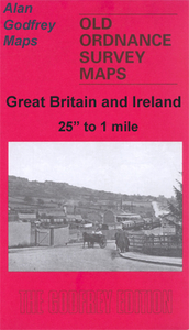
and early 20th century. The plans have been taken from the Ordnance Survey mapping and reprinted at about 15 inches to one mile (1:4, 340). On the reverse most maps have historical notes and many also include extracts from contemporary directories. Most maps cover about one mile (1.6kms) north/south, one and a half miles (2.4kms) across; adjoining sheets can be combined to provide wider coverage.FOR MORE INFORMATION AND A COMPLETE LIST OF ALL AVAILABLE TITLES PLEASE CLICK ON THE SERIES LINK.
RIP - This product is no longer available on our network. It was last seen on 25.09.2019

This page now acts as a permanent archive for this product. Add more information using the comments box below to ensure it can still be found by future generations.

Use our search facility to see if it is available from an alternative contributor.
  • External links may include paid for promotion
  • Availability: Out Of Stock
  • Supplier: Stanfords
  • SKU: 9781841519364
Availability: In Stock
£3.50

Product Description

Maldon West in 1920 in a fascinating series of reproductions of old Ordnance Survey plans in the Alan Godfrey Editions, ideal for anyone interested in the history of their neighbourhood or family. Maldon is covered on two maps. The Maldon West map covers the area from the Town Hall & Market Place westward to Little Beeleigh Farm. Features include Maldon Hall, Maldon West station, Institution (old workhouse), London Road, Spital Road, Fambridge Road, Gate Street, Silver Street, Coach Lane, All Saints church, Spital Farm. The first part of a 1922 trade directory, A to O, is on the reverse. About the Alan Godfrey Editions of the 25” OS Series Selected towns in Great Britain & Ireland are covered by maps showing the extent of urban development in the last decades of the 19th & early 20th century. The plans have been taken from the Ordnance Survey mapping & reprinted at about 15 inches to one mile (1:4, 340). On the reverse most maps have historical notes & many also include extracts from contemporary directories. Most maps cover about one mile (1.6kms) north/south, one & a half miles (2.4kms) across; adjoining sheets can be combined to provide wider coverage.FOR MORE INFORMATION & A COMPLETE LIST OF ALL AVAILABLE TITLES PLEASE CLICK ON THE SERIES LINK.

Reviews/Comments

Add New

Price History

Vouchers

No voucher codes found.
Do you know a voucher code for this product or supplier? Add it to Insights for others to use.

Facebook

Jargon Buster

Contemporary - Modern era design
Silver - A colour based on the colour of the metal
Silver - A chemical element, metalic. Has the highest elctrical conductance of any element. Also known for its exceptional anitmicrobal properties
Contemporary - A design reference to indicate post war modern design
History - Anything that happens in the past. An acedemic subject.
Road - a manmade lane or a path that is used to speed up travel.
Contemporary - An object that is living in the same time.
Hall - A room at the inside of an entrance of a house.
Ideal - Something that satisfies a perfect criteria.
Family - A group of people that live together made up from parents and children.

Supplier Information

Stanfords
Stanfords was established in 1853 and opened their iconic Covent Garden flagship store in 1901. They have become the top retailer of maps, travel books and accessories in the UK and arguably offer the largest selection of maps and travel books worldwide. Famous names such as Captain Robert Falcon Scott, Ranulph Fiennes and Michael Palin have purchased from Stanfords. They now have a shop in Bristol and both stores together with other venues operate a calendar of events including talks, book signings and exhibitions. As a specialist map retailer, the map selection is comprehensive and includes road maps, street maps and walking maps from worldwide destinations, as well as a selection of world atlases and wall maps. Books include travel guides and travel literature. Stanfords also stock globes, from miniatures made of blue marble to magnificent floor-standing globes. The website features a selection of interesting articles on travel topics.
Page Updated: 2023-11-12 20:15:36

Community Generated Product Tags

Oh No! The productWIKI community hasn't generated any tags for this product yet!
Menu