
 United Kingdom
 France
 Germany
 Netherlands
 Sweden
 USA
USA
 Italy
Italy
 Spain
Spain
More From Contributor


Mali
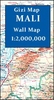
Mali at 1:2, 000, 000 on an indexed road map from the IGN, France’s national survey organization, with a street plan of Bamako, an administrative map of the country, a distance table, climate charts, etc. Road network is graded into six types and indicates seasonal routes and tracks not recommended for vehicles. Driving distances are marked on main routes and other permanent roads, and locations of fuel supplies are shown. Railway lines are included and different sizes of airports and aerodromes are marked. Also shown are internal administrative boundaries.The map indicates locations with various facilities such as tourist accommodation, medical centres, post offices, as well as various places of interest. The base map with dark colouring and faint relief shading provides
little impression of the country’s topography, although the map has spot heights and shows various geographical features such as dunes, permanent and temporary lakes, etc. Latitude and longitude grid is drawn at 2º intervals and the map is indexed. Map legend is in French only.Additional features include a street plan of Bamako, administrative maps of the capital and of the whole country, a distance table with a map of main road connections, plus a climate chart.NB. The map also shows the grid for the 1:200, 000 topographic survey of Mali prepared by IGN. Detailed topographic maps of France`s ex-colonies are now available only as reproductions from the IGN library, and in many cases special permits from the African governments are needed to purchase them. Costs vary, but are
always considerably higher than for current topographic maps of this kind. In any enquiries please indicate full sheet numbers and titles, e.g. Sikasso, NC-30-XIX.

Product Description
Reviews/Comments
Add New
Vouchers
No voucher codes found.
Do you know a voucher code for this product or supplier? Add it to Insights for others to use.
Do you know a voucher code for this product or supplier? Add it to Insights for others to use.
 Denmark