
 United Kingdom
 France
 Germany
 Netherlands
 Sweden
 USA
USA
 Italy
Italy
 Spain
Spain
More From Contributor

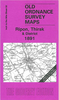


Rishton West 1909
Rishton West in 1909 in a fascinating series of reproductions of old Ordnance Survey plans in the Alan Godfrey Editions, ideal for anyone interested in the history of their neighbourhood or family. Selected towns in Great Britain and Ireland are covered by maps showing the extent of urban development in the last decades of the 19th and early 20th century.In this title: the map covers the western part of Rishton and the area linking it westward to the Blackburn outskirts. Features include railway with Rishton station, stretch of Great Harwood Loop railway, stretch of Leeds & Liverpool Canal, Rishton Reservoir, cricket ground, St Peter & St Paul church, Whitebirk Moss, Higher Whitebirk, brick works, Higher Side Beet, Cut Farm. On the reverse is a 1918 directory of RishtonAbout the
Alan Godfrey Editions of the 25
Alan Godfrey Editions of the 25
Product Description
Reviews/Comments
Add New
Intelligent Comparison
Archived Product

Rishton West 1909 Stanfords
£3.50
Archived Product

Preston West 1909 Stanfords
£3.50
Archived Product
Rushden West 1923 Stanfords
£2.95
Archived Product

Rushden West 1923 Stanfords
£3.50
Archived Product

Warrington West 1905 Stanfords
£3.50
Vouchers
No voucher codes found.
Do you know a voucher code for this product or supplier? Add it to Insights for others to use.
Do you know a voucher code for this product or supplier? Add it to Insights for others to use.
 Denmark