More From Contributor

£11.19
Laminated waterproof edition of a detailed topographic map of Ripon & Boroughbridge from the Ordnance Survey Explorer series, covering Easingwold. Edition A1 with minor changes: Publication date May 2008 About this series: These highly detailed maps show all the administrative boundaries, settlements as small as isolated farms, the road network down to unfenced roads & country tracks, & field boundaries (hedges & drystone walls) which make navigation across the countryside much easier. Steep gradients on roads are indicated. Various landmarks, e.g. powerlines, archaeological sites, windmills, churches & lighthouses are shown & additional graphics indicate natural terrain features such as cliffs, scree, mud & vegetation variations. The contour interval is 5 metres in the lower parts of the country & 10 metres in the uplands, & spot heights are marked. Each map covers an area of 30 x 20km (i.e. approx. 19 x 12 miles), with some double-sided maps covering more, as indicated in the individual descriptions. The maps are fully GPS compatible, with the National Grid shown at 1km intervals & latitude & longitude indicated by margin ticks at 1'. The Explorer series has replaced the earlier, green-cover Pathfinder maps. The Explorer series is now complete & covers all of Engl&, Wales & Scotl&. Some sheets for popular areas like the National Parks are still branded as Outdoor Leisure (OL) maps, but are now included in this series as the cartography is the same as that in the Explorer Maps. The Explorer maps offer a substantial improvement on the Pathfinder series, with greater use of colour, larger area per map, & stronger emphasis on information for ramblers & tourists. This series is ideal for walking & other outdoor pursuits & each map shows a large amount of information for ramblers & tourists. Public rights of way are shown (except in Scotland), together with other routes with public access: National Trails & Recreational Paths, permitted paths & bridleways, & selected cycle routes. Open access land created under the Countryside & Rights of Way Act 2000 is marked. Tourist information

Includes::
caravan & camp sites, Park & Ride locations, recreation/leisure/sport centres, museums, historic buildings, English Heritage & National Trust sites, rural pubs, etc. The map legend is in English only, except for the tourist information content which is also in French & German.

...
Archived Product
£2.95
Ripon in 1908 in a fascinating series of reproductions of old Ordnance Survey plans in the Alan Godfrey Editions, ideal for anyone interested in the history of their neighbourhood or family. Selected towns in Great Britain & Ireland are covered by maps showing the extent of urban development in the last decades of the 19th & early 20th century. In this title: the map is double-sided. The main map gives good coverage of the centre of this small cathedral city, with coverage extending westward to Bishopton, Bishopton Mills & Bishopton Close. Features include the Minster or Cathedral, Bondgate, Spa Gardens & Hydropathic Establishment, Borrage Green, Training College, Workhouse, Market Place. On the reverse is part of the adjacent sheet 119.07 extending coverage eastward to show the railway (but not station), Skellfield House, Fisher Green, canal, River Skell, St Mary Magdalen's chapel, River Ure, Sharow Cross. About the Alan Godfrey Editions of the 25 ...
Archived Product
£3.50
Ripon, Thirsk & District in 1891 in a series of reproductions of Ordnance Survey’s famous ” Inch to the Mile” maps published in the Alan Godfrey Editions to provide a historical record of England & Wales in the second half of 19th & early 20th century. The map stretches from West Tinfield eastward to Coxwold, & from North Otterington southward to Ripon. Features include several long closed railways, Newburgh Park, Sutton Bank, & the lower reaches of the River Swale. Coverage

Includes::
Boltby, Brafferton, Burneston, Carlton Miniott, Cold Kirkby, Coxwold, Cundall, Dalton, Dishforth, Feliskirk, Great Thirkleby, Husthwaite, Hutton Conyers, Kilburn, Kirkby Knowle, Kirky Wiske, Kirklington, Newby Wiske, North Otterington, North Stainley, Old Byl&, Pickhill, Raskelf, Scawton, Sessay, South Kilvington, South Otterington, Sowerby, Thormanby, Thornton le Street, Wath, Well, West Tinfield, etc. On the reverse is a detailed map of Topcliffe. About the Alan Godfrey Editions of the OS Inch to the Mile Maps: the maps provide an invaluable overview of a wider area, typically 18 x 12 miles (29 x 19 kms approx.), & offer historical mapping for small towns & villages not covered by the more detailed series for which the Godfrey Editions are better known. On the reverse all the maps have historical notes & most titles also include a more detailed, large scale map of a small town or a village in the area. To see other titles in this series please click on the series link.

...
Archived Product
£8.99
A gripping thriller from the bestselling Isabel Allende. For Amanda Martin & her friends, Ripper was all just a game. But when security guard Ed Staton is found dead in the middle of a school gym, the murder presents a mystery that baffles the San Francisco police, not least Amanda`s father, Deputy Chief Martin. Amanda goes online, offering ` The Case of the Misplaced Baseball Bat` to her fellow sleuths as a challenge to their real-life wits. & so begins a most dangerous obsession. The murders begin to mount up but the Ripper players, free from any moral & legal restraints, are free to pursue any line of enquiry. As their unique power of intuition lead them ever closer to the truth, the case becomes all too personal when Amanda`s mother suddenly vanishes. Could her disappearance be linked to the serial killer? & will Amanda & her online accomplices solve the mystery before it`s too late? ...
Archived Product
£25.00
Great Britain's geopolitical role in the global scheme of things has undergone many radical changes over the last four centuries. Once a maritime superpower & ruler of half the world, Britain's current position as an isolated, economically fragile island squabbling with its European neighbours often seems difficult to accept, it not comprehend. Although still afforded nominal status through membership of groups such as G7 & the retention of a permanent seat on the UN Security Coucil, the simple truth is that Britian has been resting on her laurels since 1945, if not before. This book covers the history of the British expansion overseas from the 16th century to the 20th century. Narrative & analysis are interwoven with revealing eyewitness"ation to provide keen insight into the minds of those involved in conquering, settling & ruling the greatest empire the world has ever seen. Throughout, there are consistent themes: the search for profit & the moral misgivings it generated; domestic developments which made imperial expansion desirable; & the sense of national & personal identity felt by the empire-builders. ...
Archived Product
£2.95
Rishton West in 1909 in a fascinating series of reproductions of old Ordnance Survey plans in the Alan Godfrey Editions, ideal for anyone interested in the history of their neighbourhood or family. Selected towns in Great Britain & Ireland are covered by maps showing the extent of urban development in the last decades of the 19th & early 20th century. In this title: the map covers the western part of Rishton & the area linking it westward to the Blackburn outskirts. Features include railway with Rishton station, stretch of Great Harwood Loop railway, stretch of Leeds & Liverpool Canal, Rishton Reservoir, cricket ground, St Peter & St Paul church, Whitebirk Moss, Higher Whitebirk, brick works, Higher Side Beet, Cut Farm. On the reverse is a 1918 directory of Rishton About the Alan Godfrey Editions of the 25 ...
Archived Product
£3.50
Rishton West in 1909 in a fascinating series of reproductions of old Ordnance Survey plans in the Alan Godfrey Editions, ideal for anyone interested in the history of their neighbourhood or family. The map covers the western part of Rishton & the area linking it westward to the Blackburn outskirts. Features include railway with Rishton station, stretch of Great Harwood Loop railway, stretch of Leeds & Liverpool Canal, Rishton Reservoir, cricket ground, St Peter & St Paul church, Whitebirk Moss, Higher Whitebirk, brick works, Higher Side Beet, Cut Farm, etc. On the reverse is a 1918 directory of Rishton About the Alan Godfrey Editions of the 25” OS Series: Selected towns in Great Britain & Ireland are covered by maps showing the extent of urban development in the last decades of the 19th & early 20th century. The plans have been taken from the Ordnance Survey mapping & reprinted at about 15 inches to one mile (1:4, 340). On the reverse most maps have historical notes & many also include extracts from contemporary directories. Most maps cover about one mile (1.6kms) north/south, one & a half miles (2.4kms) across; adjoining sheets can be combined to provide wider coverage.FOR MORE INFORMATION & A COMPLETE LIST OF ALL AVAILABLE TITLES PLEASE CLICK ON THE SERIES LINK. ...
Archived Product
£2.95
Rishton, Church & Dunkenhalgh Park in 1909 in a fascinating series of reproductions of old Ordnance Survey plans in the Alan Godfrey Editions, ideal for anyone interested in the history of their neighbourhood or family. Selected towns in Great Britain & Ireland are covered by maps showing the extent of urban development in the last decades of the 19th & early 20th century. In this title: the map is centred on Dunkenhalgh Park. Most of Rishton is in the north-west corner & the map extends southward to the Church Works & eastward to Dill Hall. Features include Dunkenhalgh Hall, two stretches of the Leeds & Liverpool Canal plus the Peel Arm, Rishton Colliery, Rishton Mill, Wheatfield Mill, Daisyhill Mill, Rishton town centre as far west as Walmsley Street, Henfield House, Prospect Mill, Atlas Works, part of Enfield area, Whin Isle Farm, Accrington & Church Sewage Works, Dill Hall area, Churchbank Mill, St James church, Church Kirk Bridge, Church Works, Peel Bank, Church Hall, Elmfield Hall, Coppy Clough Chemical Works (in ruins) etc. On the reverse is a 1918 directory of Church. About the Alan Godfrey Editions of the 25 ...
Archived Product
£3.50
Rishton, Church & Dunkenhalgh Park in 1909 in a fascinating series of reproductions of old Ordnance Survey plans in the Alan Godfrey Editions, ideal for anyone interested in the history of their neighbourhood or family. The map is centred on Dunkenhalgh Park. Most of Rishton is in the north-west corner & the map extends southward to the Church Works & eastward to Dill Hall. Features include Dunkenhalgh Hall, two stretches of the Leeds & Liverpool Canal plus the Peel Arm, Rishton Colliery, Rishton Mill, Wheatfield Mill, Daisyhill Mill, Rishton town centre as far west as Walmsley Street, Henfield House, Prospect Mill, Atlas Works, part of Enfield area, Whin Isle Farm, Accrington & Church Sewage Works, Dill Hall area, Churchbank Mill, St James church, Church Kirk Bridge, Church Works, Peel Bank, Church Hall, Elmfield Hall, Coppy Clough Chemical Works (in ruins), etc. On the reverse is a 1918 directory of Church. About the Alan Godfrey Editions of the 25” OS Series: Selected towns in Great Britain & Ireland are covered by maps showing the extent of urban development in the last decades of the 19th & early 20th century. The plans have been taken from the Ordnance Survey mapping & reprinted at about 15 inches to one mile (1:4, 340). On the reverse most maps have historical notes & many also include extracts from contemporary directories. Most maps cover about one mile (1.6kms) north/south, one & a half miles (2.4kms) across; adjoining sheets can be combined to provide wider coverage.FOR MORE INFORMATION & A COMPLETE LIST OF ALL AVAILABLE TITLES PLEASE CLICK ON THE SERIES LINK. ...
Archived Product
£9.99
Shortlisted for the 2015 Stanford Dolman Travel Book of the Year. When Philip Marsden moved to a remote, creekside farmhouse in Cornwall, the intensity of his response took him aback. It led him to wonder why we react so strongly to certain places & set him off on a journey on foot westwards to Land`s End through one of the most myth-rich regions of Europe. From the Neolithic ritual landscape of Bodmin Moor to the Arthurian traditions at Tintagel, from the mysterious china-clay region to the granite tors & tombs of the far south-west, Marsden assembles a chronology of Britain`s attitude to place. In archives, he uncovers the life & work of other enthusiasts before him
- medieval chroniclers & Tudor topographers, eighteenth-century antiquarians, post-industrial poets & abstract painters. Drawing also on his travels from further afield, Marsden reveals that the shape of the land lies not just at the heart of our own history but of man`s perennial struggle to belong on this earth.
...
Archived Product

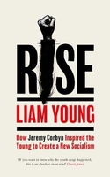
Rise: How Jeremy Corbyn Inspired The Young To Create A New Socialism

`Liam is one of Britain`s most brilliant young writers. He was ridiculed for believing a Corbyn-led Labour party could inspire people - but ultimately completely vindicated. If you want to know why the youth surge happened, this is an absolute must-read.` Owen JonesThe 2017 general election saw Jeremy Corbyn inspire young people to demand a new kind of socialism. Now, from the heart of the Labour Party, Liam Young asks how this new movement can help secure a fairer and better society for all. When Jeremy Corbyn decided to stand for the Labour leadership in 2015, Liam Young - then just 19 years old - knew this was a watershed moment for the party and for young people across the country. He joined Corbyn`s campaign and was soon writing for the Independent and the New Statesman,
explaining how the new leader would energise the youth vote and bring forward a new kind of politics. While many commentators questioned Corbyn`s actions, Young wrote about how his policies would work and be hugely popular. He harnessed the power of social media and is emerging as one of the most influential voices on the left for his generation and beyond. When the general election results of 2017 came through, he was not surprised by the surge in support for Corbyn`s Labour.Rise is not only a superb insider account of how the youth movement in the Labour Party galvanised a nation that will appeal to readers of books by Owen Jones and Paul Mason, but it is also a manifesto for the future and a call to action for anyone who believes it should be possible to create a better Britain.
RIP - This product is no longer available on our network. It was last seen on 25.09.2019

This page now acts as a permanent archive for this product. Add more information using the comments box below to ensure it can still be found by future generations.

Use our search facility to see if it is available from an alternative contributor.
  • Availability: Out Of Stock
  • Supplier: Stanfords
  • SKU: 9781471171345
Availability: In Stock
£12.99

Product Description

` Liam is one of Britain`s most brilliant young writers. He was ridiculed for believing a Corbyn-led Labour party could inspire people
- but ultimately completely vindicated. If you want to know why the youth surge happened, this is an absolute must-read.` Owen Jones The 2017 general election saw Jeremy Corbyn inspire young people to demand a new kind of socialism. Now, from the heart of the Labour Party, Liam Young asks how this new movement can help secure a fairer & better society for all. When Jeremy Corbyn decided to stand for the Labour leadership in 2015, Liam Young
- then just 19 years old
- knew this was a watershed moment for the party & for young people across the country. He joined Corbyn`s campaign & was soon writing for the Independent & the New Statesman, explaining how the new leader would energise the youth vote & bring forward a new kind of politics. While many commentators questioned Corbyn`s actions, Young wrote about how his policies would work & be hugely popular. He harnessed the power of social media & is emerging as one of the most influential voices on the left for his generation & beyond. When the general election results of 2017 came through, he was not surprised by the surge in support for Corbyn`s Labour. Rise is not only a superb insider account of how the youth movement in the Labour Party galvanised a nation that will appeal to readers of books by Owen Jones & Paul Mason, but it is also a manifesto for the future & a call to action for anyone who believes it should be possible to create a better Britain.

Reviews/Comments

Add New

Intelligent Comparison

Oooops!
We couldn't find anything!
Perhaps this product's unique.... Or perhaps we are still looking for comparisons!
Click to bump this page and we'll hurry up.

Price History

Vouchers

No voucher codes found.
Do you know a voucher code for this product or supplier? Add it to Insights for others to use.

Facebook

Jargon Buster

LED - Light Emitting Diode - a small light source
Heart - An organ that pumps blood around the body. Usually related to love.
LED - Light Emitting Diode. A bulb that is very efficient at producing light. Often small.
Popular - Something that is admired and liked by many people.

Supplier Information

Stanfords
Stanfords was established in 1853 and opened their iconic Covent Garden flagship store in 1901. They have become the top retailer of maps, travel books and accessories in the UK and arguably offer the largest selection of maps and travel books worldwide. Famous names such as Captain Robert Falcon Scott, Ranulph Fiennes and Michael Palin have purchased from Stanfords. They now have a shop in Bristol and both stores together with other venues operate a calendar of events including talks, book signings and exhibitions. As a specialist map retailer, the map selection is comprehensive and includes road maps, street maps and walking maps from worldwide destinations, as well as a selection of world atlases and wall maps. Books include travel guides and travel literature. Stanfords also stock globes, from miniatures made of blue marble to magnificent floor-standing globes. The website features a selection of interesting articles on travel topics.
Page Updated: 2023-11-12 20:15:36

Community Generated Product Tags

Oh No! The productWIKI community hasn't generated any tags for this product yet!
Menu