
 United Kingdom
 France
 Germany
 Netherlands
 Sweden
 USA
USA
 Italy
Italy
 Spain
Spain
More From Contributor

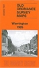


Warrington West 1905
Warrington West in 1905 in a fascinating series of reproductions of old Ordnance Survey plans in the Alan Godfrey Editions, ideal for anyone interested in the history of their neighbourhood or family. The map covers the western part of Warrington, extending westward to Sankey Bridges. Features include Bank Quay station, Bank Quay Cable Works, Bank Park, St Paul`s church, Whitecross Works, Bank Quay Soap Works, Little Sankey Green, Workhouse, isolation hospital, Grange`s Farm, Sankey Brook, Iron Works, Mersey Rivet Works, Mersey Tube Works, Sankey Hall, St Helen`s Canal, Sankey Lodge, Sankey Wire Mills, Mersey White Lead Works, Gate Warth Farm, etc. On the reverse are railway timetables for the Liverpool-Arpley-Manchester line. About the Alan Godfrey Editions of the
25” OS Series:Selected towns in Great Britain and Ireland are covered by maps showing the extent of urban development in the last decades of the 19th and early 20th century. The plans have been taken from the Ordnance Survey mapping and reprinted at about 15 inches to one mile (1:4, 340). On the reverse most maps have historical notes and many also include extracts from contemporary directories. Most maps cover about one mile (1.6kms) north/south, one and a half miles (2.4kms) across; adjoining sheets can be combined to provide wider coverage.FOR MORE INFORMATION AND A COMPLETE LIST OF ALL AVAILABLE TITLES PLEASE CLICK ON THE SERIES LINK.
25” OS Series:Selected towns in Great Britain and Ireland are covered by maps showing the extent of urban development in the last decades of the 19th and early 20th century. The plans have been taken from the Ordnance Survey mapping and reprinted at about 15 inches to one mile (1:4, 340). On the reverse most maps have historical notes and many also include extracts from contemporary directories. Most maps cover about one mile (1.6kms) north/south, one and a half miles (2.4kms) across; adjoining sheets can be combined to provide wider coverage.FOR MORE INFORMATION AND A COMPLETE LIST OF ALL AVAILABLE TITLES PLEASE CLICK ON THE SERIES LINK.

Product Description
Reviews/Comments
Add New
Intelligent Comparison
Archived Product

Warrington 1905 Stanfords
£3.50
Archived Product

Darlington West 1898 Stanfords
£3.50
Archived Product
Carrington 1904 Stanfords
£2.95
Archived Product
Carrington 1904 Stanfords
£3.50
Archived Product

Bangor West 1901 Stanfords
£3.50
Archived Product

Preston West 1909 Stanfords
£3.50
Archived Product

Longton West 1898 Stanfords
£3.50
Archived Product
Rishton West 1909 Stanfords
£2.95
Vouchers
No voucher codes found.
Do you know a voucher code for this product or supplier? Add it to Insights for others to use.
Do you know a voucher code for this product or supplier? Add it to Insights for others to use.
 Denmark