
 United Kingdom
 France
 Germany
 Netherlands
 Sweden
 USA
USA
 Italy
Italy
 Spain
Spain
More From Contributor


Darlington West 1898
Darlington West in 1898 in a fascinating series of reproductions of old Ordnance Survey plans in the Alan Godfrey Editions, ideal for anyone interested in the history of their neighbourhood or family. The map is double-sided. The main map covers an area from Stanhope Green and Larchfield Street near the town centre westward to Mowden and Hillclose House, and from Bell Lane southward to Duke Street. Features include St Clare`s Abbey, Stanhope Green, Pierremont, Brinkburn, St Joseph`s School, horse tramway along Woodlands Road, West Lodge, Carmel House Convent, Pierremont Park Nursery, etc. Part of Cockerton is on the map, including The Green. On the reverse is half of the adjacent sheet 55.09 extending coverage south and this includes Coniscliffe Road as far west as Carmel Road.
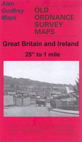
Blackwell Hall is near the south-west corner. Features include Blackwell Grange, Blackwell Mill, Harewood Hill and West Cemetery.About the Alan Godfrey Editions of the 25” OS Series:Selected towns in Great Britain and Ireland are covered by maps showing the extent of urban development in the last decades of the 19th and early 20th century. The plans have been taken from the Ordnance Survey mapping and reprinted at about 15 inches to one mile (1:4, 340). On the reverse most maps have historical notes and many also include extracts from contemporary directories. Most maps cover about one mile (1.6kms) north/south, one and a half miles (2.4kms) across; adjoining sheets can be combined to provide wider coverage.FOR MORE INFORMATION AND A COMPLETE LIST OF ALL AVAILABLE TITLES PLEASE CLICK
ON THE SERIES LINK.

Product Description
Reviews/Comments
Add New
Intelligent Comparison
Archived Product

Darlington Central 1898 Stanfords
£3.50
Archived Product

Darlington South 1898 Stanfords
£3.50
Archived Product

Longton West 1898 Stanfords
£3.50
Archived Product

Warrington West 1905 Stanfords
£3.50
Archived Product

Darlington North 1896 Stanfords
£3.50
Archived Product
Denton West 1916 Stanfords
£2.95
Archived Product
Denton West 1916 Stanfords
£3.50
Archived Product
Harlingen West Stanfords
£17.99
Vouchers
No voucher codes found.
Do you know a voucher code for this product or supplier? Add it to Insights for others to use.
Do you know a voucher code for this product or supplier? Add it to Insights for others to use.
 Denmark