
 United Kingdom
 France
 Germany
 Netherlands
 Sweden
 USA
USA
 Italy
Italy
 Spain
Spain
More From Contributor


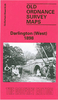


Darlington South 1898
Darlington South in 1898 in a fascinating series of reproductions of old Ordnance Survey plans in the Alan Godfrey Editions, ideal for anyone interested in the history of their neighbourhood or family. The map covers the southern part of the town around the main railway station and includes the railway approaches to the south with Polam Junction, Geneva Junction and part of Croft Junction. Other features include Cleveland Bridge Works, Horticultural Works, Bank Top, Victoria Road, Feethams cricket and football ground, Polam Hill, Skerne House, Eastbourne, Workhouse, etc. Yarm Road runs along the top of the map. Extracts from a street directory are on the reverse.About the Alan Godfrey Editions of the 25” OS Series:Selected towns in Great Britain and Ireland are covered by maps
showing the extent of urban development in the last decades of the 19th and early 20th century. The plans have been taken from the Ordnance Survey mapping and reprinted at about 15 inches to one mile (1:4, 340). On the reverse most maps have historical notes and many also include extracts from contemporary directories. Most maps cover about one mile (1.6kms) north/south, one and a half miles (2.4kms) across; adjoining sheets can be combined to provide wider coverage.FOR MORE INFORMATION AND A COMPLETE LIST OF ALL AVAILABLE TITLES PLEASE CLICK ON THE SERIES LINK.
showing the extent of urban development in the last decades of the 19th and early 20th century. The plans have been taken from the Ordnance Survey mapping and reprinted at about 15 inches to one mile (1:4, 340). On the reverse most maps have historical notes and many also include extracts from contemporary directories. Most maps cover about one mile (1.6kms) north/south, one and a half miles (2.4kms) across; adjoining sheets can be combined to provide wider coverage.FOR MORE INFORMATION AND A COMPLETE LIST OF ALL AVAILABLE TITLES PLEASE CLICK ON THE SERIES LINK.

Product Description
Reviews/Comments
Add New
Intelligent Comparison
Archived Product

Darlington North 1896 Stanfords
£3.50
Archived Product

Darlington West 1898 Stanfords
£3.50
Archived Product

Darlington Central 1898 Stanfords
£3.50
Archived Product

Carshalton South 1895 Stanfords
£3.50
Archived Product
Workington South 1923 Stanfords
£2.95
Archived Product
Earlestown South 1891 Stanfords
£2.95
Archived Product
Workington South 1923 Stanfords
£2.95
Archived Product

Earlestown South 1891 Stanfords
£3.50
Vouchers
No voucher codes found.
Do you know a voucher code for this product or supplier? Add it to Insights for others to use.
Do you know a voucher code for this product or supplier? Add it to Insights for others to use.
 Denmark