
 United Kingdom
 France
 Germany
 Netherlands
 Sweden
 USA
USA
 Italy
Italy
 Spain
Spain
More From Contributor

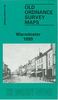


Warrington 1905
Warrington in 1905 in a fascinating series of reproductions of old Ordnance Survey plans in the Alan Godfrey Editions, ideal for anyone interested in the history of their neighbourhood or family. The map covers the centre of Warrington, extending eastward to the cemetery, and from Buckley Street southward to Black Bear Bridge at Latchford. Features include Warrington Bridge, River Mersey, Arpley station, tramways, St James church, football ground, Palatine Works, Raddon Court, Latchford Grange, Queen`s Gardens, Castle Rubber Works, Victoria Park, stretch of Latchford Canal, Central station, General Market, Tanners Lane Tannery, Running Pump Tannery, Cockhedge Mills, Scotland Bank Works, Wire Works, St Elphin`s church, Howley Tannery, Holmesfield Tannery, Mersey
Mill, Fennel Street Tannery, Boteler Grammar School, St Katharine`s chapel, Holy Trinity church, Buttermarket Street, Brewery, etc. On the reverse are street directories for Buttermarket Street and Church Street. About the Alan Godfrey Editions of the 25” OS Series:Selected towns in Great Britain and Ireland are covered by maps showing the extent of urban development in the last decades of the 19th and early 20th century. The plans have been taken from the Ordnance Survey mapping and reprinted at about 15 inches to one mile (1:4, 340). On the reverse most maps have historical notes and many also include extracts from contemporary directories. Most maps cover about one mile (1.6kms) north/south, one and a half miles (2.4kms) across; adjoining sheets can be combined to provide
wider coverage.FOR MORE INFORMATION AND A COMPLETE LIST OF ALL AVAILABLE TITLES PLEASE CLICK ON THE SERIES LINK.

Product Description
Reviews/Comments
Add New
Intelligent Comparison
Archived Product
Carrington 1904 Stanfords
£2.95
Archived Product
Carrington 1904 Stanfords
£3.50
Archived Product

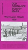
Warrington West 1905 Stanfords
£3.50
Archived Product
Patrington 1904 Stanfords
£2.95
Archived Product

Patrington 1904 Stanfords
£3.50
Archived Product
Warrington Stanfords
£3.99
Archived Product
Garston 1905 Stanfords
£2.95
Archived Product

Garston 1905 Stanfords
£3.50
Vouchers
No voucher codes found.
Do you know a voucher code for this product or supplier? Add it to Insights for others to use.
Do you know a voucher code for this product or supplier? Add it to Insights for others to use.
 Denmark