
 United Kingdom
 France
 Germany
 Netherlands
 Sweden
 USA
USA
 Italy
Italy
 Spain
Spain
More From Contributor


Bangor West 1901
Bangor West in 1901 in a fascinating series of reproductions of old Ordnance Survey plans in the Alan Godfrey Editions, ideal for anyone interested in the history of their neighbourhood or family. The map covers the west of the town; coverage extends from Main Street westward to Carnalea House, and from St Comgall`s RC church northward to the shore and Wilson`s Point. Features include railway terminus, Royal Belfast Golf Links, Bryansburn, Brunswick Road area, Maxwell Road area, Mornington Park, Smelt Mill Bay, Sandy Row, Old and New Piers, Royal Hotel, Burlington Hotel, Grand Hotel, Pickie Rock, Town Hall, etc. On the reverse are directory extracts, including a list of inhabitants, entries A to H. About the Alan Godfrey Editions of the 25” OS Series:Selected towns in
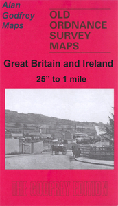
Great Britain and Ireland are covered by maps showing the extent of urban development in the last decades of the 19th and early 20th century. The plans have been taken from the Ordnance Survey mapping and reprinted at about 15 inches to one mile (1:4, 340). On the reverse most maps have historical notes and many also include extracts from contemporary directories. Most maps cover about one mile (1.6kms) north/south, one and a half miles (2.4kms) across; adjoining sheets can be combined to provide wider coverage.FOR MORE INFORMATION AND A COMPLETE LIST OF ALL AVAILABLE TITLES PLEASE CLICK ON THE SERIES LINK.
Great Britain and Ireland are covered by maps showing the extent of urban development in the last decades of the 19th and early 20th century. The plans have been taken from the Ordnance Survey mapping and reprinted at about 15 inches to one mile (1:4, 340). On the reverse most maps have historical notes and many also include extracts from contemporary directories. Most maps cover about one mile (1.6kms) north/south, one and a half miles (2.4kms) across; adjoining sheets can be combined to provide wider coverage.FOR MORE INFORMATION AND A COMPLETE LIST OF ALL AVAILABLE TITLES PLEASE CLICK ON THE SERIES LINK.

Product Description
Reviews/Comments
Add New
Intelligent Comparison
Archived Product

Bangor East 1901 Stanfords
£3.50
Archived Product
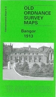
Bangor 1913 Stanfords
£3.50
Archived Product
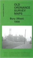
Bury West 1908 Stanfords
£3.50
Archived Product

Salford West 1916 Stanfords
£3.50
Archived Product

Warrington West 1905 Stanfords
£3.50
Archived Product
Wigan West 1908 Stanfords
£3.50
Archived Product
Wigan North West 1907 Stanfords
£2.95
Vouchers
No voucher codes found.
Do you know a voucher code for this product or supplier? Add it to Insights for others to use.
Do you know a voucher code for this product or supplier? Add it to Insights for others to use.
 Denmark