More From Contributor
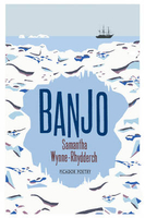
£3.50
Bangor East in 1901 in a fascinating series of reproductions of old Ordnance Survey plans in the Alan Godfrey Editions, ideal for anyone interested in the history of their neighbourhood or family. The map is covers the east of the town; coverage extends from Crosby Street & St Comgall`s church eastward to Ballyholme & northward to the shore & a large house called Glenganagh. Features St Comgall`s church, Presbyterian church, handkerchief works, Ballymagee Street area, The Big Hole, Royal Ulster Yacht Club House, Victoria Road area, The Tower, Fairview House, Grove Hill, windmill, corn mill, Ballyholme Bridge, Lukes Point, etc. On the reverse are directory extracts, including a list of inhabitants, entries H to Y. About the Alan Godfrey Editions of the 25” OS Series: Selected towns in Great Britain & Ireland are covered by maps showing the extent of urban development in the last decades of the 19th & early 20th century. The plans have been taken from the Ordnance Survey mapping & reprinted at about 15 inches to one mile (1:4, 340). On the reverse most maps have historical notes & many also include extracts from contemporary directories. Most maps cover about one mile (1.6kms) north/south, one & a half miles (2.4kms) across; adjoining sheets can be combined to provide wider coverage.FOR MORE INFORMATION & A COMPLETE LIST OF ALL AVAILABLE TITLES PLEASE CLICK ON THE SERIES LINK. ...
Archived Product
£3.50
Bangor West in 1901 in a fascinating series of reproductions of old Ordnance Survey plans in the Alan Godfrey Editions, ideal for anyone interested in the history of their neighbourhood or family. The map covers the west of the town; coverage extends from Main Street westward to Carnalea House, & from St Comgall`s RC church northward to the shore & Wilson`s Point. Features include railway terminus, Royal Belfast Golf Links, Bryansburn, Brunswick Road area, Maxwell Road area, Mornington Park, Smelt Mill Bay, Sandy Row, Old & New Piers, Royal Hotel, Burlington Hotel, Grand Hotel, Pickie Rock, Town Hall, etc. On the reverse are directory extracts, including a list of inhabitants, entries A to H. About the Alan Godfrey Editions of the 25” OS Series: Selected towns in Great Britain & Ireland are covered by maps showing the extent of urban development in the last decades of the 19th & early 20th century. The plans have been taken from the Ordnance Survey mapping & reprinted at about 15 inches to one mile (1:4, 340). On the reverse most maps have historical notes & many also include extracts from contemporary directories. Most maps cover about one mile (1.6kms) north/south, one & a half miles (2.4kms) across; adjoining sheets can be combined to provide wider coverage.FOR MORE INFORMATION & A COMPLETE LIST OF ALL AVAILABLE TITLES PLEASE CLICK ON THE SERIES LINK. ...
Archived Product
£4.95
Bangor, Conwy, Rhyl, Colwyn Bay, Llandudno & Caernarfon Street Atlas from the Geographers` A-Z Map Company in an A5 paperback format at 1:19, 000 (3.33” to a mile), with an enlargement showing town centre of Caernarfon at 1:4, 750 (13.34” to 1 mile). Coverage

Includes::
Abergele, Beaumaris, Denbigh, Llanfairfechen, Prestatyn & St. Asaph. Current edition of this title was published in 2013. To see other titles in this series of A-Z street atlases of towns & cities please click on the series link. A-Z also publish a series of County Street Atlases, for a list of titles in that series please search for SI00000917.A-Z street atlases present motorways plus A & B roads highlighted by colouring & shown with route numbers. One way or restricted access streets & car parks are marked, as are in more recently published titles locations of speed cameras. Also shown are selected cycleway routes. Where appropriate, A & B roads are annotated with selected house numbers for easier identification of addresses. Railway lines are shown with stations & level crossings. Colouring indicates different types of buildings: educational, hospitals & healthcare, industrial, leisure & recreational, shopping centres & markets, public buildings, & places of interest. Symbols mark locations of facilities usually indicated on street mapping: post offices, emergency services, public toilets, etc. Also marked are postcode & local authority boundaries. Each page has the lines & coordinates of the British National Grid. The indexes list streets, places & areas, hospitals, industrial estates, blocks of flats on housing estates, railway stations, & selected places o interest; the latter are printed in contrasting colouring to make them easier to find

...
Archived Product
£10.95
Map of the city & surroundings, including the international airport. The map is based on aerial photography which has been augmented with contours at 10m interval & colouring to highlight roads, water features & selected buildings & places of worship. Powerlines & administrative boundaries are marked, & latitude & longitude margin ticks are at 2.5 degree intervals. The city centre is presented in an inset at 1:5, 000. The map is indexed for notable buildings eg. ministries, missions, factories, embassies, hospitals, but not for streets. Map legend is in French only. ...
Archived Product
£11.99
One of the titles in a series of topographic maps covering much of north-west Africa, produced as part of the IMW* project in 1960’s. Each map covers an area spanning 6° in longitude & 4° in latitude. There is some variation in colouring & the depiction of terrain, but hill-shading, spot heights & contours are used to show the general relief. Additional graphics show features such as dunes, rock outcrops, cliffs, sand areas, escarpments, marshes, seasonal lakes & watercourses, & areas liable to flooding. Bathymetric contours are also included. Communications detail

Includes::
roads, major trails & railways, although there is some inconsistency in colouring & the extent of classification, e.g. not all maps distinguish seasonal roads. On most maps intermediate road distances are indicated on main routes. Symbols show airports, mosques, mines, oil & gas fields, lighthouses, ruins & significant isolated buildings. Administrative boundaries are marked & latitude & longitude lines are drawn at 1° intervals, with further margin ticks at 1’ intervals. The map legend is in French only on some sheets, & in English & French on others.* The International Map of the World was a project conceived in the early 20th century to compile a world map series at 1:1, 000, 000 through the efforts of participating nations. The value of the program has declined since 1970 & the IMW is no longer regarded as an active international series.

...
Archived Product
£3.50
Bank & the City area of London in 1873 in a series of exceptionally detailed reproductions of old Ordnance Survey street plans for areas of larger cities which have undergone substantial redevelopment in the late 19th or the early 20th century, published in the Alan Godfrey Editions. The plans, printed in back & white, have been taken from the original Ordnance Survey mapping at 1:1, 056 & reproduced at 1:1, 760 – the equivalent of 36 inches (or one yard) to a mile. The maps provide an unrivalled, house-by-house picture of streets & individual buildings with inner courtyards, outbuildings, pavements, covered passages, etc. Many important institutions are named; within the National Galley on Trafalgar Square even the individual rooms (the map is from 1871, so no French Impressionists as yet!). On the reverse are historical notes about the area covered by the map, plus extracts from contemporary street directories. These maps provide a fascinating addition to Alan Godfrey’s huge series of some 2, 000 titles presenting reproductions of street plans at taken from the Ordnance Survey mapping at 1:2, 500 (25” to 1 mile) & reprinted at about 15 inches to one mile (1:4, 340). ...
Archived Product
£29.95
” Bankrupt Britain” is a unique atlas giving a comprehensive picture of the effect of the recession on Britain. In detailed colour maps, it shows how economic, social & environmental fortunes have been affected in different areas in the wake of the 2007 banking crisis, 2008 economic crash & 2009 credit crunch. It is essential reading for a broad audience with detailed local level data & a national snap-shot of Britain during this time. ...
Archived Product
£36.95
Military topographic survey mapping with contours. These maps are designed primarily as flying charts for aircraft, but they are useful as general topographical maps where nothing else is available. Contours are shown in feet, with elevation colouring & spot heights. Towns, villages, major roads, railways & airports are shown (but please note that many of the smaller settlements are not named, & the road information is not necessarily up to date). Some air navigation information also appears on the map, such as radio beacons & restricted flying zones. Double-sided sheet. ...
Archived Product
£20.00
The story of historic district on the south bank of the Thames & beyond
- the original playground of Londoners, complete with
...
Archived Product
£3.50
Bankside area of London in 1873 in a series of exceptionally detailed reproductions of old Ordnance Survey street plans for areas of larger cities which have undergone substantial redevelopment in the late 19th or the early 20th century, published in the Alan Godfrey Editions. The plans, printed in back & white, have been taken from the original Ordnance Survey mapping at 1:1, 056 & reproduced at 1:1, 760 – the equivalent of 36 inches (or one yard) to a mile. The maps provide an unrivalled, house-by-house picture of streets & individual buildings with inner courtyards, outbuildings, pavements, covered passages, etc. Many important institutions are named; within the National Galley on Trafalgar Square even the individual rooms (the map is from 1871, so no French Impressionists as yet!). On the reverse are historical notes about the area covered by the map, plus extracts from contemporary street directories. These maps provide a fascinating addition to Alan Godfrey’s huge series of some 2, 000 titles presenting reproductions of street plans at taken from the Ordnance Survey mapping at 1:2, 500 (25” to 1 mile) & reprinted at about 15 inches to one mile (1:4, 340). ...
Archived Product

Banjo

While Banjo opens with a clutch of fine lyrics, elegies and set-pieces, at the heart of Samantha Wynne-Rhydderch`s new book is a remarkable tale of darkness and light, music and silence. Celebrating the centenary of Captain Scott`s arrival at the South Pole in 1912, Banjo gives us new psychological insight into the lives of the early Antarctic pioneers, as well as an extraordinary account of the role played by music in surviving the long Antarctic winters. Banjo is Wynne-Rhydderch`s most accomplished collection to date, and further evidence of a writer of great imaginative versatility. `Everything is close to the nerve, everything under cool emotional pressure. The cuts blossom into freshness and colour. And delight, the delight borne out of precision of sound and an exquisite
command of register` George Szirtes `Lines full of beauty, sometimes gorgeous, sometimes stark.. .implicating us in the essential human situations, life, death and survival, she explores` Philip Gross
RIP - This product is no longer available on our network. It was last seen on 25.09.2019

This page now acts as a permanent archive for this product. Add more information using the comments box below to ensure it can still be found by future generations.

Use our search facility to see if it is available from an alternative contributor.
  • External links may include paid for promotion
  • Availability: Out Of Stock
  • Supplier: Stanfords
  • SKU: 9780330544665
Availability: In Stock
£9.99

Product Description

While Banjo opens with a clutch of fine lyrics, elegies & set-pieces, at the heart of Samantha Wynne-Rhydderch`s new book is a remarkable tale of darkness & light, music & silence. Celebrating the centenary of Captain Scott`s arrival at the South Pole in 1912, Banjo gives us new psychological insight into the lives of the early Antarctic pioneers, as well as an extraordinary account of the role played by music in surviving the long Antarctic winters. Banjo is Wynne-Rhydderch`s most accomplished collection to date, & further evidence of a writer of great imaginative versatility. ` Everything is close to the nerve, everything under cool emotional pressure. The cuts blossom into freshness & colour. & delight, the delight borne out of precision of sound & an exquisite command of register` George Szirtes ` Lines full of beauty, sometimes gorgeous, sometimes stark.. .implicating us in the essential human situations, life, death & survival, she explores` Philip Gross

Reviews/Comments

Add New

Intelligent Comparison

Oooops!
We couldn't find anything!
Perhaps this product's unique.... Or perhaps we are still looking for comparisons!
Click to bump this page and we'll hurry up.

Price History

Vouchers

No voucher codes found.
Do you know a voucher code for this product or supplier? Add it to Insights for others to use.

Facebook

Jargon Buster

Blossom - A common term used to describe the flowers of stone fruit trees
Date - A day on a calendar
Date - A social activity whith a current or potential partner
Human - A highly developed and adapted mamal and deminant species on earth
Colour - The categorised spectrum of light visable to humans
Set - a group of items usually related to one another. Some objects cannot function without the complete set of items.
Heart - An organ that pumps blood around the body. Usually related to love.

Supplier Information

Stanfords
Stanfords was established in 1853 and opened their iconic Covent Garden flagship store in 1901. They have become the top retailer of maps, travel books and accessories in the UK and arguably offer the largest selection of maps and travel books worldwide. Famous names such as Captain Robert Falcon Scott, Ranulph Fiennes and Michael Palin have purchased from Stanfords. They now have a shop in Bristol and both stores together with other venues operate a calendar of events including talks, book signings and exhibitions. As a specialist map retailer, the map selection is comprehensive and includes road maps, street maps and walking maps from worldwide destinations, as well as a selection of world atlases and wall maps. Books include travel guides and travel literature. Stanfords also stock globes, from miniatures made of blue marble to magnificent floor-standing globes. The website features a selection of interesting articles on travel topics.
Page Updated: 2023-11-12 20:15:36

Community Generated Product Tags

Oh No! The productWIKI community hasn't generated any tags for this product yet!
Menu