
 United Kingdom
 France
 Germany
 Netherlands
 Sweden
 USA
USA
 Italy
Italy
 Spain
Spain
More From Contributor


Prestwich 1915
Prestwich in 1915 in a fascinating series of reproductions of old Ordnance Survey plans in the Alan Godfrey Editions, ideal for anyone interested in the history of their neighbourhood or family. The map covers most of Prestwich, just north of Manchester. Coverage extends from Gardner Road northward to Phillips Park Road, and from South Wood eastward to Randlesham Street. Bury New Road runs north-south through the map. Features include a stretch of the Manchester-Radcliffe line with Prestwich station, tramways, and the communities of Holyrood and Prestwich Park shown just outside Prestwich itself. Dominant features are the main Prestwich County Lunatic Asylum and its large Annexe further south. Other features include Waterdale Dye Works, St Mary`s church, Britannia Mill, Asylum
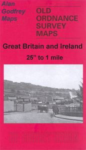
Farm, hospitals, etc. On the reverse are 1903 street directory extracts for Bury New Road, Church Lane, Dashwood Road, Ernest Street, Guest Road and Sharp Street.About the Alan Godfrey Editions of the 25” OS Series:Selected towns in Great Britain and Ireland are covered by maps showing the extent of urban development in the last decades of the 19th and early 20th century. The plans have been taken from the Ordnance Survey mapping and reprinted at about 15 inches to one mile (1:4, 340). On the reverse most maps have historical notes and many also include extracts from contemporary directories. Most maps cover about one mile (1.6kms) north/south, one and a half miles (2.4kms) across; adjoining sheets can be combined to provide wider coverage.FOR MORE INFORMATION AND A COMPLETE LIST
OF ALL AVAILABLE TITLES PLEASE CLICK ON THE SERIES LINK.

Product Description
Reviews/Comments
Add New
Intelligent Comparison
Archived Product
Prestwick 1908 Stanfords
£3.50
Vouchers
No voucher codes found.
Do you know a voucher code for this product or supplier? Add it to Insights for others to use.
Do you know a voucher code for this product or supplier? Add it to Insights for others to use.
 Denmark