
 United Kingdom
 France
 Germany
 Netherlands
 Sweden
 USA
USA
 Italy
Italy
 Spain
Spain
More From Contributor


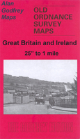
Preston Central 1909
Preston Central in 1909 in a fascinating series of reproductions of old Ordnance Survey plans in the Alan Godfrey Editions, ideal for anyone interested in the history of their neighbourhood or family. The map covers the central area of Preston, stretching from Adelphi Street eastward to Acregate Lane, and from St Thomas`s Road southward to Syke Street. Most of the town centre is shown, and features include Fishergate, Church Street, tramways and depot, Yard Works, Royal Infirmary, Deepdale Enclosure, St Peter`s church, Town Hall, St John`s church, New Preston Mills, Alliance Works, Fishwick Mills, India Mill, Peel Mill, Deepdale Mill, Alexandra Mill, Victoria Mills, Deepdale Siding, Park Mills, Bute Mill, Marathon Skating Rink, Market Place, Sovereign Mill, St
Paul`s church, Green Bank Mills, St Ignatius`s RC church, Cliff Mill, Ribbleton Mill, Albert Mill, Wharton Mill, etc. Note that the station is just off the map to the south. Selections from a street directory are on the reverse, including Back Lane, Corporation Street, Deepdale Road, Lune Street and Tithebarn Street. About the Alan Godfrey Editions of the 25” OS Series:Selected towns in Great Britain and Ireland are covered by maps showing the extent of urban development in the last decades of the 19th and early 20th century. The plans have been taken from the Ordnance Survey mapping and reprinted at about 15 inches to one mile (1:4, 340). On the reverse most maps have historical notes and many also include extracts from contemporary directories. Most maps cover about one mile
(1.6kms) north/south, one and a half miles (2.4kms) across; adjoining sheets can be combined to provide wider coverage.FOR MORE INFORMATION AND A COMPLETE LIST OF ALL AVAILABLE TITLES PLEASE CLICK ON THE SERIES LINK.

Product Description
Reviews/Comments
Add New
Intelligent Comparison
Archived Product

Preston West 1909 Stanfords
£3.50
Archived Product

Glasgow Central 1909 Stanfords
£3.50
Archived Product

Wrexham Central 1909 Stanfords
£3.50
Archived Product

Aberdeen Central 1900 Stanfords
£3.50
Archived Product

Ossett Central 1890 Stanfords
£3.50
Archived Product
Ossett Central 1905 Stanfords
£3.50
Archived Product

Southport Central 1909 Stanfords
£3.50
Archived Product
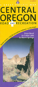
Oregon Central Stanfords
£8.50
Vouchers
No voucher codes found.
Do you know a voucher code for this product or supplier? Add it to Insights for others to use.
Do you know a voucher code for this product or supplier? Add it to Insights for others to use.
 Denmark