
 United Kingdom
 France
 Germany
 Netherlands
 Sweden
 USA
USA
 Italy
Italy
 Spain
Spain
More From Contributor


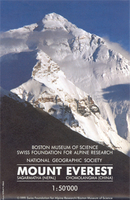
Mount Everest
Mount Everest on a visually stunning map published by the Swiss Foundation for Alpine Research, with its reverse side showing the summit area enlarged and overprinted with various ascent routes, plus a history of first ascents by different routes between 1953 and 1990.The map presents an exceptionally clear and detailed picture of the highest part of the Himalayas, with its finely drawn cartography by the Swiss national survey organization providing a 3-D impression of the peaks, ridges and glaciers. The map is based on data drawn from a number of sources, from the earliest explorers’ surveys to imaging taken by the Columbia Shuttle in 1983, and covers an area from Pangboche in Nepal to Rongpudoi Si just north of the main Base Camp on the Tibetan side.Contour lines are drawn at 40m
intervals, with numerous spot heights and names of peaks, ridges, glaciers, etc. A variety of shadings and hatchings indicate land type: rock, scree, glacier ice, moraine, etc. and types of vegetation. The map has a 5km UTM grid, plus latitude and longitude margin ticks at 5’ intervals.On the reverse an enlargement shows the summit area in greater detail, including the peaks of Lhotse, Nuptse and Changtse (Bei Peak), overprinted with various ascent routes, all cross-referenced to a history of first ascents by different routes between 1953 and 1990. Each panel with information on a first ascent includes the date, the route taken, names of climbers taking part, and a brief description. Map legend and all the text are in English only. Traditionalist among map collectors will
be pleased to see Mount Everest still shown with its old height of 8848m!The main map, without the information provided on the reverse, is also available as a wall map published by the National Geographic Society.

Product Description
Reviews/Comments
Add New
Intelligent Comparison
Archived Product
Mount Everest Stanfords
£14.50
Archived Product
Mount Everest Notebook Stanfords
£9.99
Archived Product
Mount Elbrus Stanfords
£9.95
Archived Product

Monte Ceresa Stanfords
£11.95
Archived Product
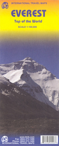
Mt Everest ITMB Stanfords
£9.99
Archived Product
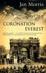
Coronation Everest Stanfords
£9.99
Vouchers
No voucher codes found.
Do you know a voucher code for this product or supplier? Add it to Insights for others to use.
Do you know a voucher code for this product or supplier? Add it to Insights for others to use.
 Denmark