
 United Kingdom
 France
 Germany
 Netherlands
 Sweden
 USA
USA
 Italy
Italy
 Spain
Spain
More From Contributor


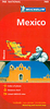


Mexico Marco Polo Map
Mexico, with Guatemala, Belize, El Salvador and most of Honduras, at 1:2, 500, 000 from Marco Polo Travel Publishing with special features to aid route planning or navigation, plus an extensive index which also includes natural features such are rivers or mountain chains, etc.A fold-out extension of the map cover gives at-a-glance overview of the whole area covered by the map with the adjoining regions, highlighting main places of interest and making it much easier to find various localities on the main map and/or plan a route. A set of seven peel-on/peel-off stickers, removable without damaging the map, is provided to make routes or locations more prominent when navigating.Coverage of Central America extends to Managua to include important Maya sites outside Mexico’s borders.
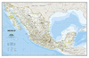
In the US the map covers Texas to just north of Dallas and the Gulf coast including most of the Florida panhandle. Cartography is from the renowned German publishers MairDumont. Topography is shown by relief shading with spot heights and plenty of names of mountain ranges, plateaux, deserts, etc. Locations of interest are prominently highlighted, with separate colouring for towns, villages or archaeological sites and for natural features. National parks and other protected areas are marked. Adjoining areas of other countries are similarly presented. Road network includes many local tracks and gives driving distances on main highways and on most connecting routes. Railways lines, local airports, state boundaries and time zones are shown. The map has latitude and longitude lines at
intervals of 1º. Multilingual map legend includes English.Extensive index, covering both Mexico and the neighbouring countries, is in a separate 40-page booklet attached to the map cover and lists town and villages plus natural features: rivers, lakes, mountains, etc. Also provided for the whole area are a separate list of World Heritage Sites and an extensive list of national parks, plus a distance table.

Product Description
Reviews/Comments
Add New
Intelligent Comparison
Archived Product

China Marco Polo Map Stanfords
£6.99
Archived Product

USA Marco Polo Map Stanfords
£6.99
Archived Product

France Marco Polo Map Stanfords
£6.99
Archived Product
Norway Marco Polo Map Stanfords
£6.99
Archived Product

Turkey Marco Polo Map Stanfords
£6.99
Archived Product

Europe Marco Polo Map Stanfords
£6.99
Archived Product
Alps Marco Polo Map Stanfords
£6.99
Archived Product

Germany Marco Polo Map Stanfords
£6.99
Vouchers
No voucher codes found.
Do you know a voucher code for this product or supplier? Add it to Insights for others to use.
Do you know a voucher code for this product or supplier? Add it to Insights for others to use.
 Denmark