
 United Kingdom
 France
 Germany
 Netherlands
 Sweden
 USA
USA
 Italy
Italy
 Spain
Spain
More From Contributor


China Marco Polo Map
China at 1:4, 000, 000 on a road map from Marco Polo Travel Publishing with special features to aid route planning, extensive index including mountain chains, rivers, etc, plus a street plan of central Beijing.A fold-out extension of the map cover gives at-a-glance overview of the whole area covered by the map with the adjoining regions, highlighting main places of interest and making it much easier to find various localities on the main map and/or plan a route. A set of seven peel-on/peel-off stickers, removable without damaging the map, is provided to make routes or locations more prominent when navigating.Cartography is from the renowned German publishers MairDumont. Topography is indicated by relief shading with spot heights and names of mountain and hill ranges and selected
peaks. Colouring and/or graphics indicate deserts and marches. Internal administrative borders are shown with names of the provinces. All place names are given only transliterated.The map presents the country’s road and rail networks and indicates local airports and coastal ferry routes, plus time zones. Numerous towns and villages worth visiting, as well as interesting natural sites are prominently highlighted. Latitude and longitude lines are marked at intervals of 2º. Multilingual map legend includes English.Extensive index of place names is in a separate 32-page booklet attached to the map jacket and includes names of mountains, glaciers, rivers, lakes, etc., all coded with appropriate signs, as well as separate lists of national parks and World Heritage Sites. Also provided
is a street plan of central Beijing, plus a table with distances/traveling times.

Product Description
Reviews/Comments
Add New
Intelligent Comparison
Archived Product
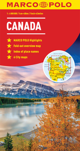
Canada Marco Polo Map Stanfords
£6.99
Archived Product

Caribbean Marco Polo Map Stanfords
£6.99
Archived Product

Austria Marco Polo Map Stanfords
£6.99
Archived Product

Tunisia Marco Polo Map Stanfords
£5.99
Archived Product

USA Marco Polo Map Stanfords
£6.99
Archived Product

France Marco Polo Map Stanfords
£6.99
Archived Product
Norway Marco Polo Map Stanfords
£6.99
Archived Product

Mexico Marco Polo Map Stanfords
£6.99
Vouchers
No voucher codes found.
Do you know a voucher code for this product or supplier? Add it to Insights for others to use.
Do you know a voucher code for this product or supplier? Add it to Insights for others to use.
 Denmark