
 United Kingdom
 France
 Germany
 Netherlands
 Sweden
 USA
USA
 Italy
Italy
 Spain
Spain
More From Contributor

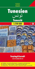


Tunisia Marco Polo Map
Tunisia at 1:800, 000 from Marco Polo Travel Publishing with special features for route planning, street plan of Tunis, Sousse and Kairouan, an enlargement of the Jerba Island, and an index which includes geographical features. A fold-out extension of the map cover gives at-a-glance overview of the whole area covered by the map with the adjoining regions, highlighting main places of interest and making it much easier to find various localities on the main map and/or plan a route. A set of seven peel-on/peel-off stickers, removable without damaging the map, is provided to make routes or locations more prominent when navigating.Cartography is from the renowned German publishers MairDumont. Relief shading with names of mountain ranges and spot heights shows the topography, with salt
lakes, oasis, national parks, etc. Road network includes selected desert tracks indicates seasonal closures and restricted entry routes, and gives diving distances on most secondary roads. Restricted entry zone in the couth of the country is clearly marked. Railway lines are included and local airports are marked. Also shown are internal administrative boundaries.Interesting towns or villages and main cultural sights or natural curiosities are prominently highlighted and the road network shows scenic routes. Symbols indicate locations of campsites, youth hostels and other selected accommodation. The map has latitude and longitude lines at intervals of 30’. Extensive index is in a separate booklet attached to the map cover and includes major sights and topographic features such as
rivers, lakes, etc. Multilingual map legend includes English.Also provided are street plan of Tunis, Sousse and Kairouan, plus an enlargement of Ile de Jerba.

Product Description
Reviews/Comments
Add New
Intelligent Comparison
Archived Product

Austria Marco Polo Map Stanfords
£6.99
Archived Product

Australia Marco Polo Map Stanfords
£6.99
Archived Product

China Marco Polo Map Stanfords
£6.99
Archived Product

Turkey Marco Polo Map Stanfords
£6.99
Archived Product
Canada Marco Polo Map Stanfords
£6.99
Archived Product
Alps Marco Polo Map Stanfords
£6.99
Archived Product

Florida Marco Polo Map Stanfords
£6.99
Archived Product

California Marco Polo Map Stanfords
£6.99
Vouchers
No voucher codes found.
Do you know a voucher code for this product or supplier? Add it to Insights for others to use.
Do you know a voucher code for this product or supplier? Add it to Insights for others to use.
 Denmark