
 United Kingdom
 France
 Germany
 Netherlands
 Sweden
 USA
USA
 Italy
Italy
 Spain
Spain
More From Contributor


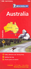

Australia Marco Polo Map
Australia on a large map at 1:4, 000, 000 from Marco Polo Travel Publishing with the road and rail networks presented on a base with plenty of topographic information, plus an extensive index including natural features such are rivers or mountain chains, etc. New Zealand is shown as an inset at the same scale.A fold-out extension of the map cover gives at-a-glance overview of the whole area covered by the map with the adjoining regions, highlighting main places of interest and making it much easier to find various localities on the main map and/or plan a route. A set of seven peel-on/peel-off stickers, removable without damaging the map, is provided to make routes or locations more prominent when navigating.Cartography is from the renowned German publishers MairDumont. Topography is
shown by relief shading with spot heights and colouring for the arid areas of the Outback. Numerous national parks and Aboriginal lands are marked and locations of interest are prominently highlighted, with separate colouring for towns or villages and for natural sites. The map provides and overview of the country’s road and rail networks, with picturesque routes highlighted. Local airports and aerodromes, state boundaries and time zones are also shown. The map has latitude and longitude lines at intervals of 2º. Multilingual map legend includes English.Extensive index is in a separate 31-page booklet attached to the map cover and lists town and villages plus natural features: rivers, lakes, mountains, etc. Also provided are a separate list of World Heritage Sites and national
parks or other protected areas, plus a distance table.

Product Description
Reviews/Comments
Add New
Intelligent Comparison
Archived Product

Austria Marco Polo Map Stanfords
£6.99
Archived Product

Tunisia Marco Polo Map Stanfords
£5.99
Archived Product
Alps Marco Polo Map Stanfords
£6.99
Archived Product
USA East Marco Polo Map Stanfords
£6.99
Archived Product
USA West Marco Polo Map Stanfords
£6.99
Archived Product
Australia Wall Map Stanfords
£18.95
Archived Product

France Marco Polo Map Stanfords
£6.99
Archived Product
Norway Marco Polo Map Stanfords
£6.99
Vouchers
No voucher codes found.
Do you know a voucher code for this product or supplier? Add it to Insights for others to use.
Do you know a voucher code for this product or supplier? Add it to Insights for others to use.
 Denmark