
 United Kingdom
 France
 Germany
 Netherlands
 Sweden
 USA
USA
 Italy
Italy
 Spain
Spain
More From Contributor


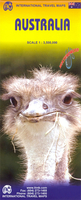
Australia ITMB
Australia at 1:3, 500, 000 on a double-sided, indexed map from ITMB, printed on light, waterproof and tear-resistant plastic paper, with large, clear street plans of central Sydney, Melbourne and Brisbane. Elevation colouring, in feet, shows the topography, with peak height given on both feet and metres. Names of various mountain ranges, deserts and other geographical features are also provided, and aboriginal lands and selected national parks are marked.The map is best used as an overview of Australia’s network of main highways, annotated where appropriate with their names, plus selected connecting roads and outback tracks. Driving distances are shown on main routes. Railways lines are included and local airports are marked. A range of symbols indicate various places of
interest. The map has latitude and longitude lines at intervals of 2° and a separate index for each side.Also provided are large, clear street plans of central Sydney, Melbourne and Brisbane, all annotated with selected hotels and places of interest.
interest. The map has latitude and longitude lines at intervals of 2° and a separate index for each side.Also provided are large, clear street plans of central Sydney, Melbourne and Brisbane, all annotated with selected hotels and places of interest.

Product Description
Reviews/Comments
Add New
Intelligent Comparison
Archived Product
Australia Stanfords
£9.95
Archived Product
Australia Stanfords
£4.99
Archived Product
Australia Stanfords
£7.95
Archived Product
Australia Stanfords
£9.95
Archived Product
Australia Stanfords
£9.50
Archived Product

Australia Stanfords
£7.95
Archived Product
Australia Stanfords
£13.59
Archived Product
Australia Stanfords
£15.19
Vouchers
No voucher codes found.
Do you know a voucher code for this product or supplier? Add it to Insights for others to use.
Do you know a voucher code for this product or supplier? Add it to Insights for others to use.
 Denmark