
 United Kingdom
 France
 Germany
 Netherlands
 Sweden
 USA
USA
 Italy
Italy
 Spain
Spain
More From Contributor


France Marco Polo Map
France at 1:800, 000 on a double-sided road map from Marco Polo Travel Publishing with prominent highlighting of interesting locations, 10 more detailed enlargements, plus an index booklet with town centre plans 18 cities, brief descriptions of 15 selected top sights, etc. The map has a good overlap between the sides and coverage extends north to Antwerp, Bruges and Ghent, north-west to Cologne to include Luxembourg and the Eifel, and within Italy past Milan to Parma and along the Italian Riviera to Pisa.Cartography is from the renowned German publishers MairDumont. Road network includes minor roads, highlights scenic roads and shows intermediate driving distances on main roads. Railway lines and local airports are included, as well as administrative divisions with names of the
departments. Locations of interest are highlighted, with separate colouring for towns or villages and for natural sites; 15 most interesting sights are cross-referenced to their descriptions in a booklet attached to the map cover. Symbols show locations of selected campsites, youth hostels, etc. National parks and other protected areas are marked and topography is presented by relief shading. Latitude and longitude lines are drawn at 1º intervals. The index listing locations with their postcodes is in the booklet.Enlargements show in greater detail the environs of Paris, Bordeaux, Lille, Lyon, Marseille, Nantes, Strasbourg and Toulouse, plus the French Riviera between Cannes and Nice, and Andorra. Town centres street plans cover these cities plus of Ajaccio, Avignon, Brest,
Grenoble, Le Havre, Monaco/Monte Carlo, Nîmes and Reims. In addition to the brief descriptions of 15 top sites, booklet also includes plans of the Channel Tunnel terminals in Folkestone and Calais; a list of mountain passes and tunnels indicating likely seasonal opening, suitability for caravans, etc; lists of UNESCO World Heritage sites, national parks, airports, and amusement parks. Multilingual map legend and all the text include English.A fold-out flap in the cover shows for route planning an overview of the whole area covered by the map plus the adjacent regions, prominently highlighting main places of interest, with the grid reference system in the margins making it easier to find locations on the main map. Also included are a distance/driving times table and basic
driving regulations.

Product Description
Reviews/Comments
Add New
Intelligent Comparison
Archived Product

Germany Marco Polo Map Stanfords
£6.99
Archived Product

Florida Marco Polo Map Stanfords
£6.99
Archived Product
Norway Marco Polo Map Stanfords
£6.99
Archived Product

Turkey Marco Polo Map Stanfords
£6.99
Archived Product

Europe Marco Polo Map Stanfords
£6.99
Archived Product
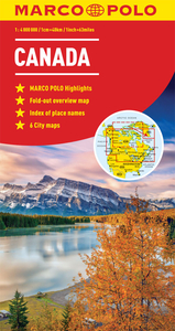
Canada Marco Polo Map Stanfords
£6.99
Archived Product

Caribbean Marco Polo Map Stanfords
£6.99
Archived Product

Austria Marco Polo Map Stanfords
£6.99
Vouchers
No voucher codes found.
Do you know a voucher code for this product or supplier? Add it to Insights for others to use.
Do you know a voucher code for this product or supplier? Add it to Insights for others to use.
 Denmark