
 United Kingdom
 France
 Germany
 Netherlands
 Sweden
 USA
USA
 Italy
Italy
 Spain
Spain
More From Contributor


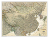

China NGS Classic Wall Map ENCAPSULATED
China NGS Classic Style Wall Map from the National Geographic Society, encapsulated version, showing the country at 1:7, 804, 000 with its administrative boundaries and road/rail networks. Light base with international boundaries picked out in colour and the seas in blue are characteristic of the NGS Classic Style.Coverage includes the whole of Mongolia and the Koreas, southern Japan, the arch of the Himalayas with Nepal and Bhutan, northern India and the northern part of South-East Asia. Within China and Mongolia the map shows internal administrative boundaries with names of the provinces. Road and rail networks are presented on a base with light relief shading and graphics for deserts, swamps and glaciers to show the topography, with plenty of names of mountain ranges, deserts,
etc. Heights are shown in metres. All place names are given only transliterated into Latin alphabet. Latitude and longitude lines are drawn at intervals of 4°. * This map is also available on paper without the encapsulation.*LAMINATED and ENCAPSULATED WALL MAPS:*- *laminated* wall maps have a thin layer of plastic usually applied to the printed side only. They can be written on with suitable marker pens without any damage to the map but, unless laminated on both sides, they are not damp-proof.- *encapsulated* wall maps are sealed between two sheets of plastic. They are more rigid and heavier than laminated maps of the same size. They are damp-proof and do not crinkle in humid conditions. Encapsulation gives the map a shiny surface, similar to being displayed behind glass.- *please
note:* many publishers and retailers often use these two terms interchangeably. Our map titles and descriptions follow the definitions provided above.
Product Description
Reviews/Comments
Add New
Intelligent Comparison
Archived Product
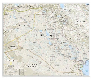
Iraq NGS Classic Wall Map ENCAPSULATED Stanfords
£17.99
Archived Product
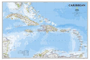
Caribbean NGS Classic Wall Map ENCAPSULATED Stanfords
£20.99
Archived Product
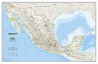
Mexico NGS Classic Wall Map ENCAPSULATED Stanfords
£17.99
Archived Product
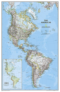
The Americas NGS Classic Wall Map ENCAPSULATED Stanfords
£17.99
Archived Product
Cuba NGS Classic Style Wall Map ENCAPSULATED Stanfords
£28.95
Archived Product

China NGS Executive Wall Map ENCAPSULATED Stanfords
£17.99
Archived Product
Brazil NGS Classic Style Wall Map ENCAPSULATED Stanfords
£21.95
Archived Product
Brazil NGS Classic Style Wall Map ENCAPSULATED Stanfords
£21.95
Vouchers
No voucher codes found.
Do you know a voucher code for this product or supplier? Add it to Insights for others to use.
Do you know a voucher code for this product or supplier? Add it to Insights for others to use.
 Denmark