
 United Kingdom
 France
 Germany
 Netherlands
 Sweden
 USA
USA
 Italy
Italy
 Spain
Spain
More From Contributor


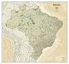
Brazil NGS Classic Style Wall Map ENCAPSULATED
Brazil at 1:5, 000, 000 on a large wall map, encapsulated version, from the National Geographic Society showing the division of the country into administrative states, together with the rail and road networks and basic topographic information.The predominantly white base map has subtle relief shading, with names of mountain ranges and spot heights. Graphics show main swamp regions and colouring highlights national parks and other protected areas. Numerous rivers are named, particularly within the Amazon Basin. The map shows the country
Product Description
Reviews/Comments
Add New
Intelligent Comparison
Archived Product
Brazil NGS Classic Style Wall Map ENCAPSULATED Stanfords
£21.95
Archived Product
Cuba NGS Classic Style Wall Map ENCAPSULATED Stanfords
£28.95
Archived Product
Brazil NGS Classic Style Wall Map PAPER Stanfords
£15.95
Archived Product
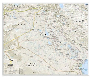
Iraq NGS Classic Wall Map ENCAPSULATED Stanfords
£17.99
Archived Product
China NGS Classic Wall Map ENCAPSULATED Stanfords
£19.99
Archived Product
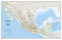
Mexico NGS Classic Wall Map ENCAPSULATED Stanfords
£17.99
Archived Product
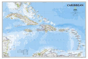
Caribbean NGS Classic Wall Map ENCAPSULATED Stanfords
£20.99
Archived Product
Iraq NGS Classic Style Wall Map PAPER Stanfords
£13.95
Vouchers
No voucher codes found.
Do you know a voucher code for this product or supplier? Add it to Insights for others to use.
Do you know a voucher code for this product or supplier? Add it to Insights for others to use.
 Denmark