
 United Kingdom
 France
 Germany
 Netherlands
 Sweden
 USA
USA
 Italy
Italy
 Spain
Spain
More From Contributor


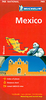

Mexico ITMB
Mexico at 1:2, 000, 000 on an indexed, double-sided, waterproof and tear-resistant map from ITMB with altitude colouring to show the topography, plus large additional panels presenting clearly drawn street plans of central Mexico City, Guadalajara and Oaxaca. The map divides the country north/south with an overlap between the sides; coverage includes the whole of Belize and northern Guatemala up to Guatemala City.Bold elevation colouring shows the topography, with names of mountain ranges, etc, plus spot heights. Road network indicates toll expressways and shows distances and locations of petrol stations on main routes. Railway lines are included and local airports are marked. Symbols highlight various places of interest including beaches, national parks and turtle sanctuaries,
archaeological and historical locations, UNESCO World Heritage sites, etc. The map has latitude and longitude lines at 1º intervals and each side has a separate index. Large, clear street plans show central Mexico City, Guadalajara and Oaxaca, highlighting selected hotels, restaurants, shopping centres, cultural institutions, etc.
archaeological and historical locations, UNESCO World Heritage sites, etc. The map has latitude and longitude lines at 1º intervals and each side has a separate index. Large, clear street plans show central Mexico City, Guadalajara and Oaxaca, highlighting selected hotels, restaurants, shopping centres, cultural institutions, etc.

Product Description
Reviews/Comments
Add New
Vouchers
No voucher codes found.
Do you know a voucher code for this product or supplier? Add it to Insights for others to use.
Do you know a voucher code for this product or supplier? Add it to Insights for others to use.
 Denmark