
 United Kingdom
 France
 Germany
 Netherlands
 Sweden
 USA
USA
 Italy
Italy
 Spain
Spain
More From Contributor


Caucasus ITMB
Indexed, double-sided map of the Caucasus region from ITMB with small plans of Yerevan, Baku and Tbilisi, printed on durable waterproof paper. Relief is depicted by altitude tinting, with spot heights for selected peaks. Swamp areas, national parks and reserves are marked, and bathymetric tinting is applied to the sea areas. Road detail distinguishes seasonal tracks, and high pass altitudes and months of opening are indicated. Intermediate driving distances are indicated on many routes. Railways, canals, sea ferries links, airports and airfields are also marked. Provincial boundaries are drawn and further symbols depict places of interest, antiquities, historical sites, fortresses, churches, mosques, winter sport sites, beaches, etc. Latitude and longitude lines are drawn
at 1° intervals. The map is indexed for place names and the legend is in English only.Three inset plans show central Yerevan, Baku and Tbilisi - clear maps indicating notable buildings, metro stations, landmarks and embassies. Another small inset map portrays the ethnographic distribution in Armenia and Azerbaijan.
at 1° intervals. The map is indexed for place names and the legend is in English only.Three inset plans show central Yerevan, Baku and Tbilisi - clear maps indicating notable buildings, metro stations, landmarks and embassies. Another small inset map portrays the ethnographic distribution in Armenia and Azerbaijan.

Product Description
Reviews/Comments
Add New
Intelligent Comparison
Archived Product
Caucasus F&B Stanfords
£10.99
Archived Product
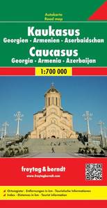
Caucasus Stanfords
£9.50
Vouchers
No voucher codes found.
Do you know a voucher code for this product or supplier? Add it to Insights for others to use.
Do you know a voucher code for this product or supplier? Add it to Insights for others to use.
 Denmark