
 United Kingdom
 France
 Germany
 Netherlands
 Sweden
 USA
USA
 Italy
Italy
 Spain
Spain
More From Contributor


Caucasus Bezingi
A basic trekking map that shows mountain ridges, peaks, glaciers, rivers and wooded areas in a simple uncluttered manner. Roads, paths and buildings are also marked. On the reverse there is additional information about trekking routes and base camps. Panorama diagrams show routes up the main peaks and ridges.
Product Description
Reviews/Comments
Add New
Intelligent Comparison
Archived Product
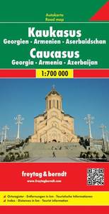
Caucasus F&B Stanfords
£10.99
Vouchers
No voucher codes found.
Do you know a voucher code for this product or supplier? Add it to Insights for others to use.
Do you know a voucher code for this product or supplier? Add it to Insights for others to use.
 Denmark