
 United Kingdom
 France
 Germany
 Netherlands
 Sweden
 USA
USA
 Italy
Italy
 Spain
Spain
More From Contributor


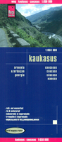
Caucasus Reise Know-How
The Caucasus at 1:650, 000 on a double-sided, indexed, waterproof and tear-resistant road map from Reise-Know-How with topographic and tourist information, plus very clear presentation of the region’s international and internal administrative boundaries and border crossing restrictions. Tbilisi and Yerevan are included on both sides of the map.Abkhazia and South Ossetia are shown as part of Georgia but with no road access from the rest of the country. Also clearly marked are the two Azeri enclaves in northern Armenia, plus the Armenian enclave in Azerbaijan, as well as the 1994 ceasefire line around Nagorno-Karabakh where alternative Armenian place names are indicated. Coverage in Russia includes the whole of Chechnya and Ingushetia, plus much of Dagestan. Within Georgia, Armenia
and Russia names of main cities are also shown in each country’s alphabet. Road and rail networks are easy to see on a clear base which shows the area’s topography by altitude colouring with contours, spot heights, mountain passes and names of mountain ranges. The map covers the whole of the Caucasus Mountains, highlighting numerous national parks and protected areas both in Russia and on the southern side. Road network includes local unsurfaced roads and seasonal tracks. A wide range of symbols highlights various places of interest, including UNESCO heritage sites, archaeological remains, selected hotels and campsites, beaches, caves and hot springs, etc. The map has a latitude and longitude grid at intervals of 1° and an index of place names with a separate list of national
parks and reserves. Map legend includes English.

Product Description
Reviews/Comments
Add New
Vouchers
No voucher codes found.
Do you know a voucher code for this product or supplier? Add it to Insights for others to use.
Do you know a voucher code for this product or supplier? Add it to Insights for others to use.
 Denmark