More From Contributor
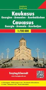
£9.99
Map No. 755, Catskill Park NY at 1:75, 000 in an extensive series of GPS compatible, contoured hiking maps of USA’s national & state parks or forests & other popular recreational areas. Cartography based on the national topographic survey, with additional tourist information. The maps, with most titles now printed on light, waterproof & tear-resistant plastic paper, highlight walking trails along with campsites & other accommodation, picnic sites, areas for various recreational pursuits such as horse riding or skiing, drinking water sources, & many other facilities of interest to the outdoor enthusiast. Cartography is based on information from the USGS (United States Geological Survey
- the country’s national survey organization), revised by the National Geographic Maps in cooperation with the National Park Service, USDA Forest Service, etc. Topography is excellently presented by contours (interval varies according to scale), enhanced by relief shading & colouring/graphics for wood cover, glaciers, etc. All heights are given in feet. The maps have a UTM grid plus latitude & longitude margin ticks & GPS waypoints for selected important locations. Each map is double-sided to give either maximum coverage of the chosen area or additional enlargements of its important sections. Accompanying notes provide useful information on relevant regulations, safety precautions, contact addresses, etc.* *IMPORTANT
- PLEASE NOTE: the series is very extensive, ranging in scale from 1:400, 000 for the vast national parks of Alaska to 1:25, 000 for local map in several states. We recommend, therefore, viewing the series by state rather than the whole list.*

...
Archived Product
£9.99
Known as the Transkeian beak who had a soft spot for the reivers & rustlers of his unruly district, Frank Brownlee established a reputation as the pioneer transcriber of oral testimony into written texts. The Sunday Times described his Cattle Thief as 'a picaresque novel, its hero having a well developed inherited appetite for other people's property, notably their cattle & horses'. The second work included here
- published for the first time
- features Christina as Brownlee's indiscreet informant. As she remarks to him: ' Yes, it's only an old Griqua woman what's talking to you. But we has our inside feelings.' The vernacular farrago which follows is to be savoured for the sympathetic manner in which it reveals a vanished lifestyle on the old Cape frontier.

...
Archived Product
£7.99
Told with deadpan humour & bitter irony, Kurt Vonnegut`s cult tale of global destruction preys on our deepest fears of witnessing Armageddon &, worse still, surviving it.. . Dr Felix Hoenikker, one of the founding `fathers` of the atomic bomb, has left a deadly legacy to the world. For he is the inventor of `ice-nine`, a lethal chemical capable of freezing the entire planet. The search for its whereabouts leads to Hoenikker`s three ecentric children, to a crazed dictator in the Caribbean, to madness. Felix Hoenikker`s Death Wish comes true when his last, fatal gift to mankind brings about the end, that for all of us, is nigh... ...
Archived Product
£14.99
If you look up at the sky on a dark night, what do you see? There`s a whole universe staring back at you. In the company of Felicity the cat discover the phases of the moon, the constellations & how to spot the Northern Lights & the Milky Way. This beautiful, fun book will introduce you to the beauty of the night sky & show you the stars like you`ve never seen them before. ...
Archived Product
£5.99
“ One of the best-established trades: a customer & the cat’s-meat man ” in a series of prints of sepia photos of some of old London’s best loved landmarks, presented by Soho Publishing in an A3 (29.6 x 39.6 cm) format. Under the photo are brief notes about cats rather that than the trade! Ideal for framing, these reproductions show many long gone or much changed sites & offer a unique way of decorating your home or office with photos of near by or close-to-your-heart parts of the capital. Please note: the prints are supplied flat rather than rolled, with an A3 protective piece of cardboard, so the package will be larger than the standard size letterbox. To see other titles in this series please click on the series link. ...
Archived Product
£9.99
The Caucasus at 1:1, 000, 000 from Gizi Map, presenting the region in a geographical edition with bright altitude coloring to show its topography. Coverage

Includes::
the southern republics of Russia. International boundaries are clearly marked. Within Georgia the map indicates the boundaries of South Ossetia, Abkhazia & Adjara; in Azerbaijan the border of Nagorno Karabach & the ceasefire line are marked. Coverage within Russia extends north of Krasnodar & Stavropol, with boundaries of individual republics including Chechnya, North Ossetia & Dagestan. Place names are shown in Latin alphabet, but within Georgia, Armenia & Russia larger towns are also named in local script. Bright altitude colouring with plenty of names of geographical features such as individual mountain ranges, peaks, swamps, salt flats, etc, presents the topography. Road network is graded in six types, with driving distances on main & selected connecting routes. Railway lines are included & local airports are marked. Symbols highlight various places of interest. Latitude & longitude lines are drawn at 1° intervals. The index, arranged by country, is on the reverse. Multilingual map legend

Includes::
English.A separate insets presents at-a-glance the political & administrative division of the region.PLEASE NOTE: this map is also available as a wall map, plus the same cartography but without the altitude colouring is also used in Gizi Map’s road edition of this title, also available folded or flat.


...
Archived Product
£9.99
The Caucasus at 1:1, 000, 000 from Gizi Map, presenting the region in a road edition with relief shading to show its topography & make the road network stand out better against the background. Coverage

Includes::
the southern republics of Russia. International boundaries are clearly marked. Within Georgia the map indicates the boundaries of South Ossetia, Abkhazia & Adjara; in Azerbaijan the border of Nagorno Karabach & the ceasefire line are marked. Coverage within Russia extends north of Krasnodar & Stavropol, with boundaries of individual republics including Chechnya, North Ossetia & Dagestan. Place names are shown in Latin alphabet, but within Georgia, Armenia & Russia larger towns are also named in local script. Relief shading with plenty of names of geographical features such as individual mountain ranges, peaks, swamps, salt flats, etc, presents the topography. Road network is graded in six types, with driving distances on main & selected connecting routes. Railway lines are included & local airports are marked. Symbols highlight various places of interest. Latitude & longitude lines are drawn at 1° intervals. The index, arranged by country, is on the reverse. Multilingual map legend

Includes::
English.A separate insets presents at-a-glance the political & administrative division of the region.PLEASE NOTE: this map is also available as a wall map, plus the same cartography but with altitude colouring to emphasize the topography is also used in Gizi Map’s geographical edition of this title, also available folded or flat.


...
Archived Product
£8.95
A basic trekking map that shows mountain ridges, peaks, glaciers, rivers & wooded areas in a simple uncluttered manner. Roads, paths & buildings are also marked. On the reverse there is additional information about trekking routes & base camps. Panorama diagrams show routes up the main peaks & ridges. ...
Archived Product
£9.95
Clear topographic mapping of the central Caucasus with roads, tracks, paths & bus routes marked. Spot heights & contours at 100m intervals show the relief. Glaciers, rivers, cliffs marshes & forest areas are also marked. Latitude & Longitude grid at 30' intervals. On the reverse there is additional information for trekkers, including information about the towns in the area & a list of first ascents of the principal peaks ...
Archived Product
£10.99
The Caucasus countries, Georgia, Armenia & Azerbaijan, on an indexed road map from Freytag & Berndt, with coverage of the adjoining Russian republics of Chechnya, Northern Ossetia, Kabardino-Balkaria & Karachaevo-circassia. International borders & internal administrative boundaries are clearly shown, indicating Southern Ossetia & Abkhazia in Georgia, as well Nagorno-Karabakh & the Azerbaijani enclave within Armenia. Names of larger towns in Georgia, Armenia & Russia are also given in each country’s alphabet. Topography is shown by relief shading & numerous spot heights, plus names of many chains within the Caucasus Mountains. Road network shows border crossings & driving distances on primary routes, &

Includes::
many secondary local roads & tracks. Railway lines & local airports are also shown. Symbols mark main places of interest including World Heritage sites, & national parks or nature reserves are highlighted. The map has latitude & longitude lines at intervals of 1º. The index is in a separate booklet attached to the map cover. Map legend

Includes::
English.


...
Archived Product

Caucasus

The Caucasus at 1:650, 000 on an indexed, waterproof and tear-resistant road map with topographic and tourist information, plus very clear presentation of the international and internal administrative boundaries. The map, published by Reise Know-How as part of their highly acclaimed World Mapping Project is double-sided to provide the best balance between a good scale and a convenient size sheet.In addition to the international borders, internal administrative boundaries are also marked, showing in Russia Chechnya, Ingushetia, North Ossetia and other republics, and in Georgia Abkhazia, South Ossetia and Ajaria. Also clearly marked are the two Azeri enclaves in northern Armenia, plus an Armenian enclave in Azerbaijan, as well as the 1994 ceasefire line around Nagorno-Karabakh
where alternative Armenian place names are indicated. Within Georgia, Armenia and Russia names of main cities are also shown in each country
RIP - This product is no longer available on our network. It was last seen on 25.09.2019

This page now acts as a permanent archive for this product. Add more information using the comments box below to ensure it can still be found by future generations.

Use our search facility to see if it is available from an alternative contributor.
  • External links may include paid for promotion
  • Availability: Out Of Stock
  • Supplier: Stanfords
  • SKU: 9783831771585
Availability: In Stock
£9.50

Product Description

The Caucasus at 1:650, 000 on an indexed, waterproof & tear-resistant road map with topographic & tourist information, plus very clear presentation of the international & internal administrative boundaries. The map, published by Reise Know-How as part of their highly acclaimed World Mapping Project is double-sided to provide the best balance between a good scale & a convenient size sheet. In addition to the international borders, internal administrative boundaries are also marked, showing in Russia Chechnya, Ingushetia, North Ossetia & other republics, & in Georgia Abkhazia, South Ossetia & Ajaria. Also clearly marked are the two Azeri enclaves in northern Armenia, plus an Armenian enclave in Azerbaijan, as well as the 1994 ceasefire line around Nagorno-Karabakh where alternative Armenian place names are indicated. Within Georgia, Armenia & Russia names of main cities are also shown in each country

Reviews/Comments

Add New

Price History

Vouchers

No voucher codes found.
Do you know a voucher code for this product or supplier? Add it to Insights for others to use.

Facebook

Jargon Buster

Waterproof - Resistant to water, usualy specified by depth in metres
World - A physical grouping, commonly used to describe earth and everything associated with ti
Size - is the measurement of how big an object is in space.
Road - a manmade lane or a path that is used to speed up travel.
Resistant - Something that can repel against something.
Alternative - Another available choice or possibility
Balance - Something that is evenly weighted to keep something upright.
Borders - A line that sometimes can be built up separating off an area, e.g. countries "the welsh boarder"
Convenient - Something that suits and fits well to other activities.

Supplier Information

Stanfords
Stanfords was established in 1853 and opened their iconic Covent Garden flagship store in 1901. They have become the top retailer of maps, travel books and accessories in the UK and arguably offer the largest selection of maps and travel books worldwide. Famous names such as Captain Robert Falcon Scott, Ranulph Fiennes and Michael Palin have purchased from Stanfords. They now have a shop in Bristol and both stores together with other venues operate a calendar of events including talks, book signings and exhibitions. As a specialist map retailer, the map selection is comprehensive and includes road maps, street maps and walking maps from worldwide destinations, as well as a selection of world atlases and wall maps. Books include travel guides and travel literature. Stanfords also stock globes, from miniatures made of blue marble to magnificent floor-standing globes. The website features a selection of interesting articles on travel topics.
Page Updated: 2023-11-12 20:15:36

Community Generated Product Tags

Oh No! The productWIKI community hasn't generated any tags for this product yet!
Menu