
 United Kingdom
 France
 Germany
 Netherlands
 Sweden
 USA
USA
 Italy
Italy
 Spain
Spain
More From Contributor


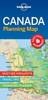


Canada MapArt Road Atlas
Canada on an A4, 69-page paperback road atlas from the Canadian Cartographics Corporation with map scales varying according to the density of the road network, plus additional city maps for main towns, an index, and a distance table. The southern, more populates parts of Québec and Ontario, plus the Atlantic Provinces are covered at scales of around 1:1, 000, 000. Most of British Columbia, Alberta, Saskatchewan and Manitoba are shown at scales of around 1:2, 000, 000. Scales of the remaining regions are less detailed.The maps provide an overview of the road network on a base prominently highlighting national or provincial parks and other protected areas. Driving distances are shown on main routes. Railway lines are not included. Symbols mark campsites and historic sites. The maps
have no geographical coordinates. The index is arranged by province.Main urban areas are also shown in greater detail on enlargements, usually at around 1:250, 000. Also provided is a distance table in miles and kilometres.*Please note:* following a number changes among Canadian cartographic publishers titles previously published by MapArt Publishing may now be available under one of the following imprints: MapArt, Canadian Cartographics Corporation or JDM Géo Inc.
have no geographical coordinates. The index is arranged by province.Main urban areas are also shown in greater detail on enlargements, usually at around 1:250, 000. Also provided is a distance table in miles and kilometres.*Please note:* following a number changes among Canadian cartographic publishers titles previously published by MapArt Publishing may now be available under one of the following imprints: MapArt, Canadian Cartographics Corporation or JDM Géo Inc.

Product Description
Reviews/Comments
Add New
Intelligent Comparison
Archived Product
Ireland AA Road Atlas Stanfords
£7.99
Archived Product
Ontario MapArt Back Road Atlas Stanfords
£23.99
Vouchers
No voucher codes found.
Do you know a voucher code for this product or supplier? Add it to Insights for others to use.
Do you know a voucher code for this product or supplier? Add it to Insights for others to use.
 Denmark