More From Contributor

£15.99
Canada in the Key Guide series from AA Publishing; exploring a range of international destinations & recently been re-launched with full colour pages. Thorough & detailed in style, the guides are targeted at an older audience, exploring the principal sights, walks, activities, restaurants & accommodation of the destination. A detailed introductory section provides comprehensive information about the destination, including the economy, politics, heritage & language. There are also specific sections unique to each destination, covering society, the urban & rural, sports & leisure, art media & culture, history & science & technology. Each title is organised in the same way with destinations grouped by region or district & colour-coded to help readers navigate around the guide. An On the Move section provides details on transport, with important information on arriving, getting around (including distinctive local transport features such as metro & underground networks) & for visitors with a disability. Individual regional sections cover Sights, driving & walking opportunities, what to do, eating & accommodation. Local listings are accompanied by addresses, opening times, prices, directions & local transport options, though options for younger travellers & those with children are more limited. Extensive colour photography accompanies the text, with a range of pictures illustrations the main sites of the city, region or country. An extensive Practicalities chapter at the back of each guide carries essential information on weather, documents & customs, money, health, communication, tourist information, useful websites, finding help, opening times & entrance fees, media & books, films & maps. There is also basic information on entertainment & nightlife, sports & activities, film & music & festivals & events. ...
Archived Product
£4.99
With an easy-fold, easy-to-use format, Lonely Planet Planning Maps are your conveniently sized passport to traveling with ease. Get more from your map & your trip with images & information about top country attractions, itinerary suggestions & themed lists. ...
Archived Product
£12.99
Canada on an A4, 69-page paperback road atlas from the Canadian Cartographics Corporation with map scales varying according to the density of the road network, plus additional city maps for main towns, an index, & a distance table. The southern, more populates parts of Québec & Ontario, plus the Atlantic Provinces are covered at scales of around 1:1, 000, 000. Most of British Columbia, Alberta, Saskatchewan & Manitoba are shown at scales of around 1:2, 000, 000. Scales of the remaining regions are less detailed. The maps provide an overview of the road network on a base prominently highlighting national or provincial parks & other protected areas. Driving distances are shown on main routes. Railway lines are not included. Symbols mark campsites & historic sites. The maps have no geographical coordinates. The index is arranged by province. Main urban areas are also shown in greater detail on enlargements, usually at around 1:250, 000. Also provided is a distance table in miles & kilometres.* Please note:* following a number changes among Canadian cartographic publishers titles previously published by Map Art Publishing may now be available under one of the following imprints: Map Art, Canadian Cartographics Corporation or JDM Géo Inc. ...
Archived Product
£6.99
Canada at 1:4, 000, 000 on a map from Marco Polo Travel Publishing with plenty of topographic information, plus a booklet attached to the map cover with an extensive index, six street plans, two enlargements of national parks, descriptions of 15 best sights, etc. Coverage extends to 74º north to include the whole of the Northwest Passage; a separate panel presents the rest of Arctic Canada at 1:12, 000, 000. Cartography is from the renowned German publishers Mair Dumont. Topography is shown by relief shading with spot heights & plenty of names of mountain ranges, plateaux, etc. Locations of interest are prominently highlighted, with separate colouring for towns or villages & for natural sites; 15 selected places are cross-referenced to brief descriptions in the index booklet. Provincial parks or other protected areas as well as Indian Reservations are also marked. Adjoining regions of USA are similarly presented. Provincial &, in the US, state boundaries & time zones are marked. Road network varies according to the density population. Driving distances are shown in kilometres (in USA in miles). Railways & ferry routes are marked. The map has latitude & longitude lines at intervals of 2º. Extensive index, covering both Canada & the adjoining regions of USA, is in a separate 79-page booklet attached to the map cover & lists town/villages & natural

Features:
rivers, lakes, mountains, etc; also provided are separate lists of UNESCO World Heritage Sites & national parks. The booklet also

Includes::
street plans of central Calgary, Montreal, Ottawa, Quebec City & Toronto, plus enlargements for the Banff/ Jasper/ Yoho/ Kootenay & Waterton Lakes/ Glacier national parks in the Rockies. Multilingual map legend & the descriptions include English.A fold-out flap in the cover shows for route planning an overview map of Canada, prominently highlighting main places of interest, with the grid reference system in the margins making it easier to find locations on the main map. Also provided is a distance table & basic diving regulations.


...
Archived Product
£5.99
Updated regularly, Michelin National Maps will give you an overall picture of your journey thanks to their clear & accurate imagery & mapping scales. This map will help you easily plan your safe & enjoyable journey thanks to comprehensive keys, complete name indexes as well clever time & distance charts. Michelin`s driving information will help you navigate safely in all circumstances. With Michelin National Maps, find more than just your way. ...
Archived Product
£16.99
Respected cultural travel guides featuring Michelin stars & tours. This completely revised edition features Canada`s top attractions, most interesting towns, best driving tours, shopping hot spots, hotels & restaurants. Divided into regions, Green Guide Canada`s tours, maps, illustrations & colour photographs bring serene landscapes & rich history to life. Whether hiking through the Rockies, dog-sledding in Nunavut, or brushing up on your French in Quebec, Michelin`s celebrated star-rating system & respected maps make sure you see the best that Canada has to offer. ...
Archived Product
£14.99
Canada’s 42 National Parks highlighted by the National Geographic on a folded map of the whole country with enlargements for the most popular locations such as Banff or Jasper plus lists of National Historic Sites of Canada, etc. The map presents the country against a light beige background, with its topography indicated by relief shading & the division into provinces. All the parks are prominently highlighted & the map also shows locations of Marine Conservation Areas & selected National Historic Sites administered by the Parks Canada institution. Separate lists name other Historic Sites in Ontario, Quebec, the Atlantic Provinces, & the Banff & Jasper National Parks. Additional six panels of enlargements, accompanied by notes, present in greater detail Banff, Jasper, Yoho, Riding Mountain, Gross Morne & Cape Breton Highlands National Parks. The text & where appropriate park & other place names are given in both their English & French versions. This title is also available as a wall map, either on paper or encapsulated for greater durability. ...
Archived Product
£24.99
Canada’s 42 National Parks highlighted by the National Geographic on a wall map, encapsulated version
- size 106 x 77cm (42” x
...
Archived Product
£14.99
Canada’s 42 National Parks highlighted by the National Geographic on a wall map, paper version
- size 106 x 77cm (42” x 30” approx),
...
Archived Product
£20.99
Canada on the NGS Classic style wall map,

Size:
97 x 81cm (38” x 32” approx)
- encapsulated version, showing


...
Archived Product

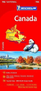
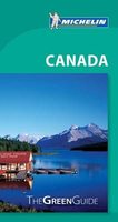
Canada Michelin Green Guide

Canada in the Green Guide series from Michelin presents information while drawing on a long publishing history. Michelin guides are renowned for their individual ‘star rating’, ranking restaurants, sights and attractions. Listings in each guide are organised alphabetically, allowing readers to access information quickly as well as being designed for practical use on the road. With an emphasis on cultural activities and history, each sight is graded and has extensive background information. Practical visitor information is clearly highlighted with symbols. The Green Guides also cover international destinations. An extensive introductory section on planning your trip provides information on when and where to go, useful pre-trip information, getting there, where to stay and eat and
what to do and see. There are also individual sections on Nature, History and Art ad Culture and a selection of driving tours of the area. Fold-out maps at the front and back of the book give an overview of the area covered by the guide.The structure of each guide varies depending on the type of destination. National and regional guides cover regions alphabetically, each with their own accommodation, sights and food and drink listings, while City guides cover sights alphabetically with one city-wide section for listings. Accommodation and food & drink listings are both concise and comprehensive, aiming to cater for all budgets and tastes. Both sights and listings often include information specific to travelling with kids. Each of the places covered in the guide is listed
alphabetically and three Michelin star ratings - highly recommended, recommended and interesting, which have been used for more than 100 years - help readers identify places of interest, restaurants and notable local attractions. Individual listings include principal sights for each city or town, local walking and driving tours in addition to tips on local excursions. There is also an ‘address book’ information box in each section including recommendations for the best restaurants and accommodation in the area, as well as any relevant leisure activities. A series of overview regional and city plans also helps navigation and orientation for each region.
RIP - This product is no longer available on our network. It was last seen on 25.09.2019

This page now acts as a permanent archive for this product. Add more information using the comments box below to ensure it can still be found by future generations.

Use our search facility to see if it is available from an alternative contributor.
  • Availability: Out Of Stock
  • Supplier: Stanfords
  • SKU: 9782067197329
Availability: In Stock
£14.99

Product Description

Canada in the Green Guide series from Michelin presents information while drawing on a long publishing history. Michelin guides are renowned for their individual ‘star rating’, ranking restaurants, sights & attractions. Listings in each guide are organised alphabetically, allowing readers to access information quickly as well as being designed for practical use on the road. With an emphasis on cultural activities & history, each sight is graded & has extensive background information. Practical visitor information is clearly highlighted with symbols. The Green Guides also cover international destinations. An extensive introductory section on planning your trip provides information on when & where to go, useful pre-trip information, getting there, where to stay & eat & what to do & see. There are also individual sections on Nature, History & Art ad Culture & a selection of driving tours of the area. Fold-out maps at the front & back of the book give an overview of the area covered by the guide. The structure of each guide varies depending on the type of destination. National & regional guides cover regions alphabetically, each with their own accommodation, sights & food & drink listings, while City guides cover sights alphabetically with one city-wide section for listings. Accommodation & food & drink listings are both concise & comprehensive, aiming to cater for all budgets & tastes. Both sights & listings often include information specific to travelling with kids. Each of the places covered in the guide is listed alphabetically & three Michelin star ratings
- highly recommended, recommended & interesting, which have been used for more than 100 years
- help readers identify places of interest, restaurants & notable local attractions. Individual listings include principal sights for each city or town, local walking & driving tours in addition to tips on local excursions. There is also an ‘address book’ information box in each section including recommendations for the best restaurants & accommodation in the area, as well as any relevant leisure activities. A series of overview regional & city plans also helps navigation & orientation for each region.

Reviews/Comments

Add New

Intelligent Comparison

Oooops!
We couldn't find anything!
Perhaps this product's unique.... Or perhaps we are still looking for comparisons!
Click to bump this page and we'll hurry up.

Price History

Vouchers

No voucher codes found.
Do you know a voucher code for this product or supplier? Add it to Insights for others to use.

Facebook

Jargon Buster

star - A giant ball of plasma held together by gravity.
History - Anything that happens in the past. An acedemic subject.
Road - a manmade lane or a path that is used to speed up travel.
Wide - Something with a large width.
Accommodation - A room in which someone can live in, for example in a hotel
Practical - Weather a task is easy to carry out and realistically succeed.
Regional - An adjective to describe a set geographic area.
Individual - A single separate item or person.
Kids - A young child.

Supplier Information

Stanfords
Stanfords was established in 1853 and opened their iconic Covent Garden flagship store in 1901. They have become the top retailer of maps, travel books and accessories in the UK and arguably offer the largest selection of maps and travel books worldwide. Famous names such as Captain Robert Falcon Scott, Ranulph Fiennes and Michael Palin have purchased from Stanfords. They now have a shop in Bristol and both stores together with other venues operate a calendar of events including talks, book signings and exhibitions. As a specialist map retailer, the map selection is comprehensive and includes road maps, street maps and walking maps from worldwide destinations, as well as a selection of world atlases and wall maps. Books include travel guides and travel literature. Stanfords also stock globes, from miniatures made of blue marble to magnificent floor-standing globes. The website features a selection of interesting articles on travel topics.
Page Updated: 2023-11-12 20:15:36

Community Generated Product Tags

Oh No! The productWIKI community hasn't generated any tags for this product yet!
Menu